 Environment
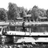 Recreation and Sports
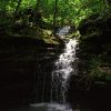 River Designations
 Tourism
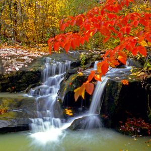 Cossatot River State Park
 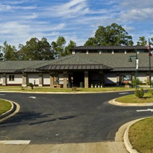 Cossatot Visitors Center
 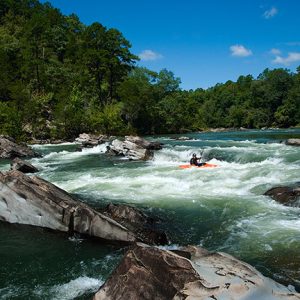 Cossatot River
 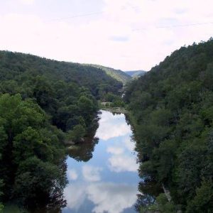 Cossatot River State Park - Natural Area
 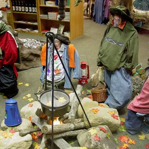 Cossatot River State Park
 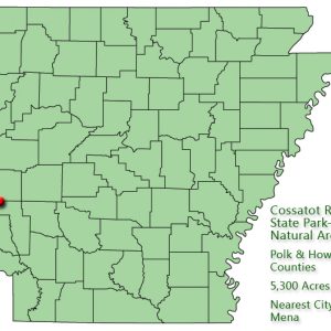 Cossatot River State Park-Natural Area: Park Location
501-918-3025
calsfoundation@cals.org
calsfoundation@cals.org
| Location: | Polk and Howard counties |
| Size: | 5,300 acres |
The Cossatot River State Park–Natural Area conserves a twelve-and-one-half-mile stretch of the Cossatot River, a southwest Arkansas stream included by the legislature in the state’s Natural and Scenic Rivers System. The National Park Service has designated the Cossatot’s upper reaches as a National Wild and Scenic River. The upper Cossatot is free of impoundments, and its shoreline is largely primitive and undeveloped. Within the park, there are over thirty rare plant and animal species, many of which are endemic to the Ouachita Mountains.
The idea of establishing a natural area along the upper Cossatot surfaced in 1974, shortly after the Arkansas Environmental Preservation Commission was created. The panel was subsequently renamed the Arkansas Natural Heritage Commission. In October 1975, its staff contacted the Weyerhaeuser Company, a forestry products firm that owned the land, to discuss acquiring the Cossatot Falls area and other portions of the Cossatot’s corridor. In January 1976, the commission presented a written proposal to Weyerhaeuser. While generally positive, the company’s response was tempered by concerns over the commission’s ability to oversee such an intensively used public recreation area, one that was used by floaters, campers, hikers, and swimmers. The Cossatot River is famous for its Class IV and V rapids.
By 1984, the Arkansas Department of Parks and Tourism had joined the effort, and the heritage and parks agencies prepared a joint proposal that addressed Weyerhaeuser’s concerns about the state’s ability to manage the property. Once a tentative sale agreement was reached, the heritage agency asked the Arkansas field office of The Nature Conservancy to assist with negotiations and acquisition. The conservancy agreed to acquire and hold in trust the acreage identified for the proposed park/natural area until funding was available for state purchase of the land.
Negotiations culminated on November 19, 1987—at a joint meeting of the State Parks, Recreation, and Travel Commission and the Heritage Commission—with Governor Bill Clinton’s announcement that the state, in cooperation with The Nature Conservancy, would acquire an eleven-mile segment of the upper Cossatot. On December 23, 1987, The Nature Conservancy acquired title to 4,144.46 acres. Final approval of state park designation was granted by the Legislative Council, by Act 512 of 1975, on February 19, 1988.
The Nature Conservancy transferred management responsibility for the area to the state in July 1988. The parks and heritage agencies agreed on a cooperative management plan.
In 1990, Arkla Gas Company acquired from private individuals 160 acres in the Brushy Creek area and donated it to the park/natural area in compensation for crossing the Cossatot park with a thirty-six-inch gas pipeline. Additional land acquisitions enlarged the park/natural area to 5,299.65 acres.
On October 21, 2004, a 16,304-square-foot park visitors and education center was dedicated. The center features a gallery of interpretive exhibits, two classrooms with laboratory facilities, an elevated wildlife viewing area, gift shop, restrooms, and park administrative offices. It is located in Howard County off U.S. 278 approximately eight miles east of Wickes (Polk County).
The park/natural area is home to two fishes—the Ouachita Mountain shiner and the leopard darter—that are found only in streams of the Ouachita Mountains. Several rare plant species are found within the park/natural area’s five major plant communities.
For additional information:
Arkansas Natural Heritage Commission. http://www.naturalheritage.org/ (accessed August 6, 2021).
Arkansas State Parks–Cossatot River State Park-Natural Area. http://www.arkansasstateparks.com/cossatotriver/ (accessed August 6, 2021).
Gough, Buddy. “Rest Your Head.” Arkansas Democrat-Gazette, May 16, 2011, pp. 1E, 6E.
Staff of the Arkansas Department of Parks and Tourism


Comments
No comments on this entry yet.