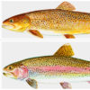
 Salmonids
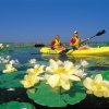 State Parks Division
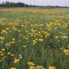 Wildflowers
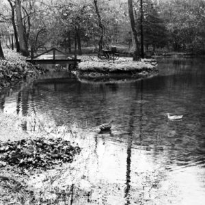 Withrow Springs State Park
 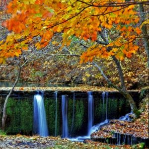 Withrow Springs State Park
 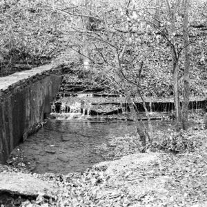 Withrow Springs Dam
 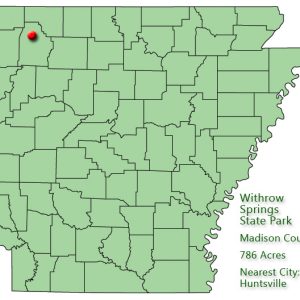 Withrow Springs State Park: Park Location
501-918-3025
calsfoundation@cals.org
calsfoundation@cals.org
| Location: | Madison County |
| Size: | 786 acres |
Withrow Springs State Park is located approximately five miles north of Huntsville (Madison County) in the Ozark Mountains of northwest Arkansas. The park was created among scenic mountains and valleys in a wilderness that surrounds the site’s key feature, Withrow Spring. At first, the park was also called Withrow Spring State Park—that name appears in literature from the Arkansas Department of Parks and Tourism as late as the mid-1970s—but common usage has made the name Withrow Springs State Park.
The spring, which has a constant temperature of fifty-four degrees, served as a common watering place for area settlers and travelers in the 1800s. No archaeological information reveals whether the spring was used prior to this time. It is named for Richard Withrow, an early settler who traveled west in 1831 from Tennessee and established one of the first gristmills in the area. He, along with his sons and their families, homesteaded land over much of the area. The water from the spring emerges from a cliff side, flows for several hundred feet, and then disappears underground, reemerging inside the War Eagle Cave to flow into War Eagle Creek.
The land for the park, which began with just 320 acres, including the spring, was given to the state by Roscoe V. Hobbs on January 29, 1962, at the urging of his good friend Governor Orval Faubus, a Madison County native. Withrow Springs State Park opened in 1965 with a swimming pool, visitor center, rough trails, and modern campsites. In 1974, Madison County built three baseball fields and two tennis courts on park land (11.73 acres) leased to the county.
Over the years, the park has upgraded its visitor center, gift shop, swimming pool, and playground. Other amenities include two pavilion sites, volleyball and horseshoe pits, three trails, picnic sites, and a crossbow range. In spring, canoes and kayaks are available for rent for float trips on War Eagle Creek. Fishing is also popular in the creek and in a small pond in the center of the park.
Withrow Spring gushes from a small cave at the foot of a bluff, spills into a pond, cascades over a ledge, and makes its way through the hardwood forests of the park before joining War Eagle Creek. Hikers can venture about 175 feet into the small War Eagle Cave. Bats frequent the cave, including the gray bat, the little brown bat, and the eastern pipistrelle. In April 2010, however, the cave closed to visitors in an effort to protect the cave from contamination from white-nose syndrome, a fungus that has killed millions of hibernating bats in New England and the mid-Atlantic states. The closure is temporary, but it is unknown when the cave will reopen.
Withrow Springs State Park’s environment consists of rugged oak-hickory forest bordering War Eagle Creek. (Many local residents and even some official maps call this stream War Eagle River.) The park’s plant life includes white trillium orchids, which are an endangered flower in Arkansas. Roaming the park are deer, foxes, wild turkeys, groundhogs, bobcats, and river otters. Eagles can be seen along the creek in the winter.
Interpretive programs are presented daily in the park during the summer and on demand throughout the rest of the year. The park hosts special events, including stargazing parties and a War Eagle Creek Celebration.
For additional information:
Arkansas State Parks–Withrow Springs. http://www.arkansasstateparks.com/withrowsprings/default.aspx (accessed September 14, 2022).
Russell, Joy. “History of Withrow Springs.” Madison County Musings 21 (Summer 2002): 57–79.
Staff of the Arkansas Department of Parks and Tourism
Staff of the CALS Encyclopedia of Arkansas


Comments
No comments on this entry yet.