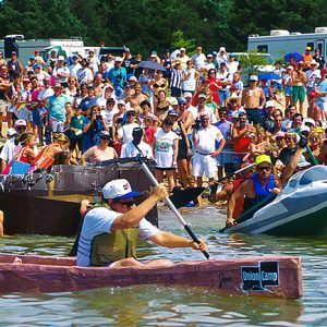
 Cardboard Boat Race
 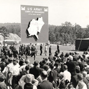 Corps of Engineers Sign
 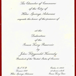 Greers Ferry Reservoir Dedication Invitation
 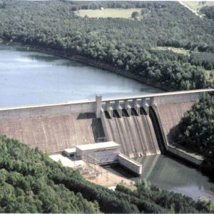 Greers Ferry Dam
 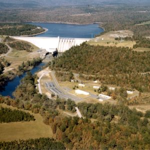 Greers Ferry Dam
 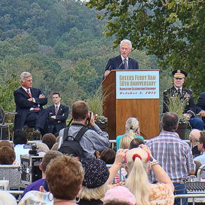 Bill Clinton at Greers Ferry
 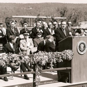 Faubus Speech at Greers Ferry
 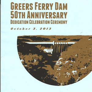 Greers Ferry Dam 50th Anniversary Brochure
 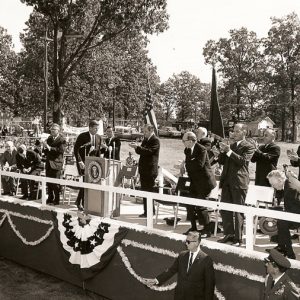 Kennedy Speech at Greers Ferry
 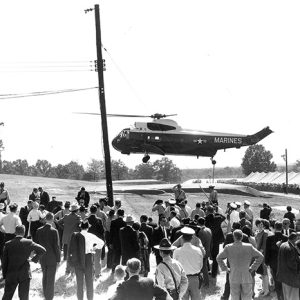 President Kennedy's Arrival at Greers Ferry
 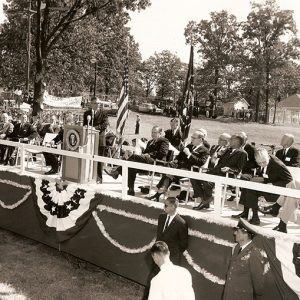 Wilbur Mills at Greers Ferry Dam
 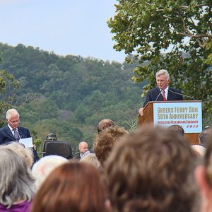 Mike Beebe at Greers Ferry
 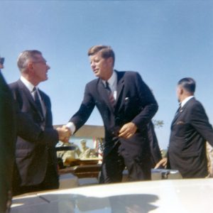 Greers Ferry Dam Dedication
 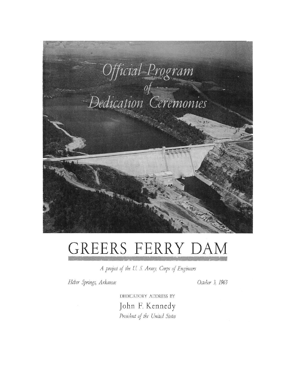 Greers Ferry Dam Dedication Program
 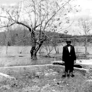 Greers Ferry Lake Filling
 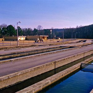 Greers Ferry National Fish Hatchery
 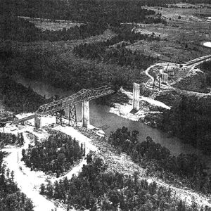 Narrows Bridge
501-918-3025
calsfoundation@cals.org
calsfoundation@cals.org
Greers Ferry Dam on the Little Red River, approximately three miles north of Heber Springs (Cleburne County), is a concrete dam built between 1959 and 1962. The dam’s primary function is flood control, but it also serves as a hydroelectric power plant. Greers Ferry Lake, created as a result of the dam, is a popular recreational destination.
The flow of the Little Red River was uncontrolled during the first half of the twentieth century, resulting in almost yearly flooding downstream; high water levels in the Little Red River could compound flooding problems further downstream along the White River. In 1938, Congress passed the Flood Control Act, which authorized the U.S. Army Corps of Engineers to build dams on most of the country’s major free-flowing river systems. North Arkansas’s White River basin, which includes the Little Red River, was among the chosen waterways.
Shortly after the passage of the Flood Control Act, engineers began surveying the White River and its tributaries for locations to build a series of high, concrete dams. Several locations were selected, and in 1944, the first of five dams that would eventually be built in the White River basin was completed at Norfork (Baxter County). The Norfork Dam was followed by the Bull Shoals Dam in 1951 and Table Rock Dam in 1959. In 1960, construction began simultaneously on the Beaver and Greers Ferry dams. Greers Ferry Dam, named after a ferry operated on the Little Red River near where the dam was built, was completed in 1962 and was dedicated on October 3, 1963, by President John F. Kennedy, in what would be one of his last major public appearances before his assassination. The dam measures 1,704 feet in length and stands 243 feet above the streambed of the Little Red River. It cost $46.5 million and created a reservoir of between 30,000 and 40,000 acres, depending on water level, and over 340 miles of shoreline in Cleburne and Van Buren counties.
The construction of the dam required the relocation of families living on the bottomland along the river, and upon the dam’s completion, a number of communities were submerged, including Miller, Higden, Shiloh, and Edgemont. While there were many who were opposed to the construction of the dam, at the time the dam was constructed, no citizen protest had ever successfully halted plans for a Corps of Engineers Reservoir, and most viewed opposition as futile. Despite the inundation of the majority of the county’s most productive farmland, the positive economic impact of the dam and lake was immediate. Cleburne County’s population grew from 9,000 in 1960 to over 24,000 in 2000. The Corps of Engineers estimated that over 5.5 million people visited the lake and surrounding area by 2000, generating over $130 million in revenue. Popular tourist destinations associated with the lake include the William Carl Garner Visitor Center, eighteen recreational areas offering camping, swimming, and boat access, and three nature trails. The Greers Ferry National Fish Hatchery, located below the dam, is another popular destination. The hatchery, operated by the U.S. Fish and Wildlife Service, primarily raises rainbow trout, which thrive in the colder water.
In 1970, a group of volunteers met the weekend following Labor Day and cleaned the lake’s shoreline. The cleanup has become a yearly event, and the success of the program inspired the first Great Arkansas Cleanup in 1979. In 1984, the Greers Ferry program was used as a model for Keep America Beautiful’s first National Public Lands Day.
For additional information:
Berry, Evalena. Time and the River: A History of Cleburne County. Heber Springs, AR: Cleburne County Historical Society, 1982.
Greers Ferry Lake and Little Red River Tourism Association. http://visitgreersferrylake.org/ (accessed March 30, 2020).
U.S. Army Corps of Engineers. http://www.swl.usace.army.mil/Missions/Recreation/Lakes/GreersFerryLake.aspx (accessed March 30, 2020).
Zackery A. Cothren
Arkansas Historic Preservation Program


Comments
No comments on this entry yet.