 Big Island
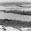 Geography and Geology
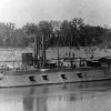 Steamboats (Civil War)
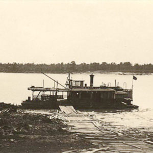 Arkansas City Ferry
 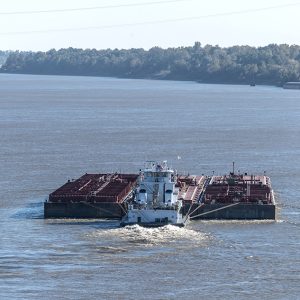 Barge
Barge 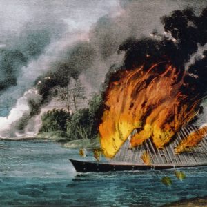 CSS Arkansas
 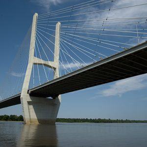 Greenville Bridge
 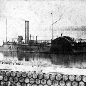 Gunboat Eastport
 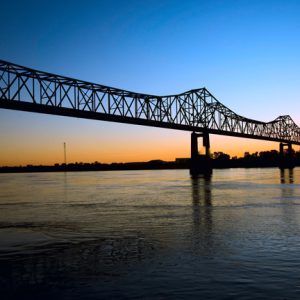 Helena-West Helena Bridge
 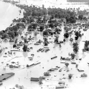 Lake Village Flood
 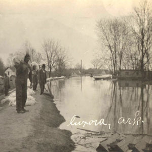 Luxora Flood
 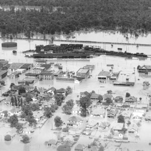 McGehee Flood
 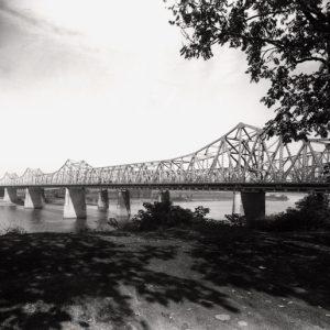 Memphis-Arkansas Memorial Bridge
 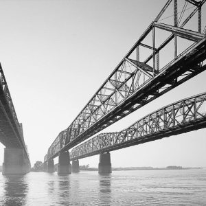 Memphis-Arkansas Memorial Bridge
 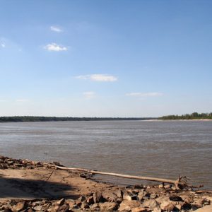 Mississippi River
  Osceola Levee
 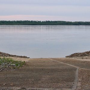 Sans Souci Landing
 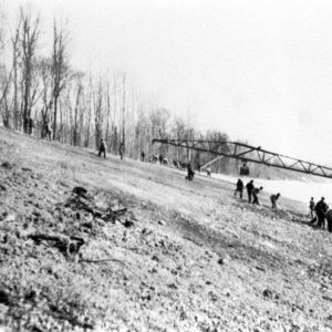 West Memphis
 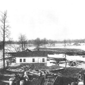 West Memphis Flood
501-918-3025
calsfoundation@cals.org
calsfoundation@cals.org
The Mississippi River is the largest and most important river in North America. This great river, often referred to as the “Mighty Mississippi,” originates as a small brook flowing out of Lake Itasca in Minnesota and, 2,340 miles later, empties into the Gulf of Mexico. It is truly one of the nation’s most important assets. Covering forty-one percent of the forty-eight contiguous United States, its watershed stretches across the heart of the nation. This vast river system, which includes several large tributaries, drains 1,260,000 square miles, making it the largest drainage basin in terms of area in North America and the third largest in the world.
Significance to Arkansas
The Mississippi River is a dominant physical feature of many states in the middle United States, including Arkansas. It flows along almost the entire eastern border of Arkansas. The river created what is often referred to as the “Delta” of eastern Arkansas, which is part of the nation’s largest alluvial plain. This vast and vital habitat supports a wide variety of flora, fauna, and aquatic species. The alluvial plain has remnant wetlands and several large oxbow lakes including Lake Chicot, Arkansas’s largest natural lake.
The river’s impact on human history is evidenced in historic river ports such as Osceola (Mississippi County) and Helena (Phillips County). The Delta Cultural Center in Helena explores the Mississippi’s natural and historical legacies and its influence on regional culture, especially blues music.
The alluvial plain in Arkansas has some of the richest and most productive agricultural land in the nation. Arkansas is the leading rice producer in the United States and ranks high in the production of cotton and soybeans. Eastern Arkansas is also part of the Mississippi Flyway and provides important waterfowl habitat for a large number of birds, including a wide variety of ducks. Stuttgart (Arkansas County), for example, located near the confluence of the Arkansas, White, and Mississippi rivers, is known as the “Duck and Rice Capital of the World.”
Physical Characteristics
Of all the processes functioning to alter the surface of the earth, none is more important than the work of streams. This was the case with the Mississippi River Valley more than 8,000 years ago when glacial meltwater carved channels through the glacial debris. These channels served as the flow-path for the Mississippi River and its tributaries. This large watershed has been divided into several smaller basins for convenience of study. The Upper Mississippi Basin, for example, extends from its point of origin at Lake Itasca to the confluence of the Ohio and Mississippi rivers at Cairo, Illinois. The Missouri River is the largest tributary in the upper basin and furnishes approximately fifteen percent of the total discharge and constitutes more than forty percent of the Mississippi system drainage area.
The Lower Mississippi Valley extends from the confluence of the Ohio and Mississippi rivers at Cairo to the mouth of the Mississippi River in the Gulf of Mexico. The watersheds of the Arkansas, Red, and White rivers are among the most important tributaries of the lower basin. The Arkansas River, at 1,469 miles in length, is one of the most significant tributaries of the entire Mississippi River drainage network and is particularly important to Arkansas. This relatively large river flows east-southeast across the entire state. It enters Arkansas at Fort Smith (Sebastian County) and passes through Little Rock (Pulaski County), Pine Bluff (Jefferson County), and other cities before terminating at its confluence with the Mississippi River east of Dumas (Desha County).
The lower Mississippi River meanders in great loops across a broad alluvial plain (also known as the Mississippi River Delta). It is a classic example of a stream in equilibrium, in which stream erosion and deposition have combined to produce a gradient that allows the stream to carry a sediment load that is in balance with the load that is delivered to the stream by its tributaries. As with all graded streams, the Mississippi River walks a fine line between temporarily picking up sediment load and then depositing it again. Natural levees, built up from sediment carried and deposited in times of flood, border the river for much of its length. Sediment has also been deposited on the riverbed. As a result, the surface of the river is above that of the surrounding plain in some places.
The flow (discharge) of the river is usually greatest in the spring, when heavy rainfall and melting snow fill the watersheds of the tributaries, especially the Missouri and Ohio. This increase in flow frequently causes the river to overflow its banks and levees and inundate the adjacent floodplain. Arkansas has experienced numerous disastrous floods. One of the worst was the Flood of 1927. It covered much of the eastern third of the state, killed almost 100 people, and left thousands homeless. This disastrous flood prompted the construction of dams on the upper Mississippi and its tributaries to regulate flow. In addition, more than 1,600 miles of levees were built below Cape Girardeau, Missouri, to help contain the swollen river. Floodways were established to divert water at critical points, cutoffs were constructed to eliminate some of the more dangerous winding channels, and improvements were made to the main channel to increase the river’s flood-carrying capacity. Despite these efforts, the river continues to experience problems with flooding. Very serious floods occurred in 1973, during the summer of 1993, and as recently as the spring of 2008. It is important to note that flooding along a large river like the Mississippi cannot be eliminated. At best, one can limit its effects and try to protect the most valued land.
Historical and Economic Significance
Several Native American groups lived along the banks of the Mississippi River, including the Quapaw in what is now eastern Arkansas. They exchanged goods, fished, farmed the fertile floodplains, and gave the river its name. The Ojibway Indians of northern Minnesota called it “Messipi” or “Big River,” and it was also known as the “mee-zee-see-bee” or “Father of Waters” in the Algonquian language. Some of the first Europeans to travel on the river were Spanish explorers such as Hernando de Soto in 1541, and French Jesuit missionaries and explorers Louis Jolliet and Jacques Marquette in 1673. The French were the first Europeans to establish settlements in the valley. They founded New Orleans, Louisiana; St. Louis, Missouri; and several other sites in the early eighteenth century, including Arkansas Post.
Navigation became a very important activity on the river during the early 1800s when steamboats were used to usher in the era of powered shipping. It soon became cheaper to ship cargo by river through New Orleans than to ship goods by land over the Appalachian Mountains. The golden era of steamboats on the Mississippi continued until the 1870s, when railroads began to surpass the river as the major commercial transportation mode for the central United States. After an extended lull in the use of the river, barge traffic began to increase in the early twentieth century. Waterborne commerce on the Mississippi rose substantially with the shipment of such products as grains, coal and coke, petroleum products, sand and gravel, and more. Dredging and other channel improvements made the river navigable as far north as St. Paul and Minneapolis in Minnesota. St. Paul became an important grain-shipping port. St. Louis, located at the confluence of the Missouri and Mississippi rivers, is known as the “Gateway to the West.” It grew as a port linking the Mississippi with the Great Plains. Along the lower reaches of the river, oceangoing vessel navigation is possible as far upstream as Baton Rouge, Louisiana. Consequently, New Orleans and Baton Rouge have become vital ports as well as major cities along the river.
For additional information:
Cech, Thomas V. Principles of Water Resources: History, Development, Management, and Policy. 2nd ed. Hoboken, NJ: John Wiley & Sons, Inc., 2005.
Corbet, John. Physical Geography Manual. 6th ed. Dubuque, IA: Kendall/Hunt Publishing Company, 2006.
“Mississippi River Facts.” National Park Service. https://www.nps.gov/miss/riverfacts.htm (accessed April 20, 2022).
“Mississippi River Navigation.” U.S. Army Corps of Engineers. http://www.mvn.usace.army.mil/Portals/56/docs/PAO/Brochures/Navigation.pdf (accessed April 20, 2022).
Morris, Christopher. The Big Muddy:An Environmental History of the Mississippi and Its Peoples, from Hernando de Soto to Hurricane Katrina. New York: Oxford University Press, 2012.
Owens, Jeffrey Alan. “Holding Back the Waters: Land Development and the Origins of Levees on the Mississippi, 1720–1845.” PhD diss., Louisiana State University, 1999. Online at https://digitalcommons.lsu.edu/gradschool_disstheses/6922/ (accessed July 6, 2022).
Schneider, Paul. Old Man River: The Mississippi River in North American History. New York: Henry Holt, 2013.
Hubert B. Stroud
Arkansas State University


Comments
No comments on this entry yet.