 Big Lake National Wildlife Refuge
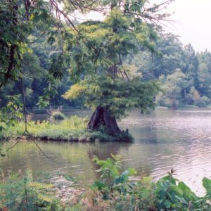 Big Lake National Wildlife Refuge
 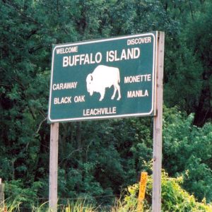 Buffalo Island
501-918-3025
calsfoundation@cals.org
calsfoundation@cals.org
Buffalo Island is a local name given to western Mississippi County and eastern Craighead County. It consists of the land south of Big Lake between the Little River (not to be confused with a stream of the same name in southwestern Arkansas) and the St. Francis River, containing the communities of Manila (Mississippi County), Monette (Craighead County), Leachville (Mississippi County), Black Oak (Craighead County), and Caraway (Craighead County).
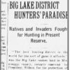
The first written mention of the area was by Hernando de Soto, who passed through the area in 1541. De Soto’s party described Big Lake as existing on a high, dry area near the Mississippi River and feeding a moat around a large village believed to be in the area of contemporary Gosnell (Mississippi County). Father Jacques Marquette also indicated the lake on a map; he said it was near the St. Francis River. By the time of the Louisiana Purchase, the area was used as hunting land by the Osage, who lived farther north in what is now Missouri.
The area was then sparsely inhabited. Massive earthquakes along the New Madrid Fault struck in 1811 and 1812, changing the landscape of Buffalo Island and adjacent areas. Witnesses said the Mississippi River ran backward for a time. What had been a haven for game sank in a spray of sand that left dunes dozens of feet high as the plateau continued to shrink. Parts of the Little River shifted or were dammed, causing the land around the lake to fill with even more water and creating the swampy hardwood forest that exists today. After the quake, the area became the Big Lake swamp and the St. Francis Sunken Lands. For about fifty years, although active trade routes developed on the St. Francis and Little rivers by way of Pemiscot Bayou out of Missouri, no one considered settling in the sunken lands area, fearing another earthquake would cause the ground to sink even lower.
In 1833, Mississippi County was established. Its original boundaries were the St. Francis River on the west and the Mississippi River on the east, taking in all of Buffalo Island. In 1859, Craighead County was formed, taking in land from Greene, Poinsett, and Mississippi counties and placing the county line almost dead center through Buffalo Island. Sometime after Mississippi County was formed, trappers and commercial fishermen began setting up camps and temporary settlements on the shores and islands of Big Lake. Reportedly, the forest also sheltered outlaws and other people seeking to hide from encroaching civilization.
Before the Civil War, steamboats began to ply Big Lake and the St. Francis and Little rivers, up the Pemiscot to the Mississippi, bringing settlers and supplies and taking pelts, fish, and game to the north. Valuable timber, including red oak, cypress, gum, and walnut trees, drew the Chicago Mill and Lumber Company into Buffalo Island. In spite of the difficult terrain, many loggers worked to harvest these trees in the nineteenth century. Sawmills and stave mills were established throughout the region. In 1859, the area that had been unofficially called Big Lake Island was granted a post office and named Cinda. The town that grew from it was later incorporated as Manila, the first community to be founded on Buffalo Island. Shortly after the Civil War, although the exact date was never recorded, William Stotts bought forty acres and cleared the first farm on Buffalo Island.
Several local and regional attempts to drain the swampland proved largely ineffective until the St. Francis District for levees and drainage was established in 1893. Roughly ninety percent of Mississippi County, including the Buffalo Island area, was mosquito-infested swampland until levees and drainage ditches opened rich new land suitable for farming cotton and corn. Soybeans and rice were later introduced as well. The Jonesboro, Lake City, and Eastern Railroad Company crossed Big Lake to connect western Mississippi County to points farther west; the railroad reached Manila in December 1900.
As early as 1880, more settlers had moved to the area and established a new community. The city and its post office were officially named Monette in 1898. Leachville was founded in 1890, Black Oak in 1899, and Caraway, the last of the Buffalo Island incorporated cities, in 1916. Meanwhile, flooding continued to be a problem—especially the historic floods of 1927 and 1937. Higher land contained valuable timber, drawing workers into the area after the improved drainage had made transportation possible.
In 2000, Buffalo Island became the first cross-county region to be awarded Arkansas Community of Excellence status by the Arkansas Economic Development Commission. Buffalo Island holds an American Cancer Society Relay for Life, a chili cook-off, and a Youth Fishing Rodeo each year. All of the Buffalo Island communities are consolidated into the Buffalo Island Central school district except Manila, which has its own public school system, and Caraway, which consolidated with Lake City (Craighead County) to make the Riverside School District.
For additional information:
“Buffalo Island: Drainage District No. 16 of Mississippi County, Arkansas… Then and Now!” N.p.: Drainage District No. 16, 1987.
Buffalo, W. T. “Timber Days on Buffalo Island.” Craighead County Historical Quarterly 2 (Autumn 1964): 17–24.
Buffaloe, Tom. “Buffalo Island Essays.” Craighead County Historical Quarterly 29 (Winter 1990–1991): 18–27.
Edrington, Mabel Flannigan. History of Mississippi County. Ocala, FL: Ocala Star-Banner, 1962.
Stuck, Charles A. The Story of Craighead County: A Narrative of People and Events in Northeast Arkansas. Jonesboro, AR: The Hurley Company, 1960.
Pat Lendennie
Blytheville, Arkansas
Staff of the CALS Encyclopedia of Arkansas


Comments
No comments on this entry yet.