 Arkansas Geological Survey (AGS)
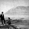 Big Rock
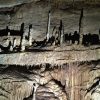 Blanchard Springs Caverns
 Hot Springs (Garland County)
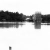 Karst Topography
 Kings River
 Miser, Hugh Dinsmore
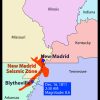 New Madrid Fault
 Public Land Surveys
 Waterfalls
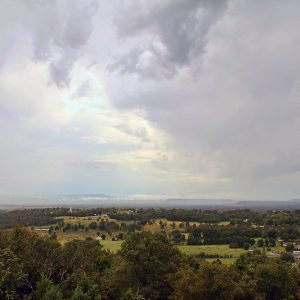 Arkansas River Valley
 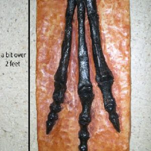 "Arkansaurus fridayi"
 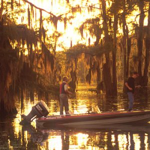 Bayou Bartholomew
  Big Lake National Wildlife Refuge
 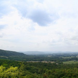 Boston Mountains
 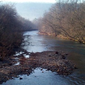 Caddo River
 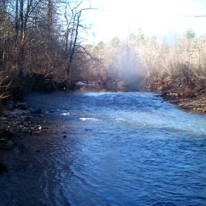 Caddo River
 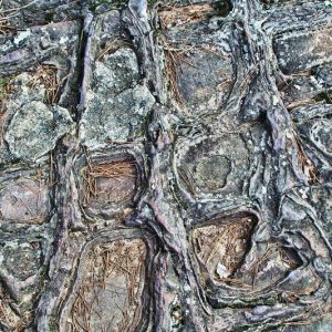 Carpet Rock
 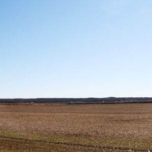 Crowley's Ridge
  Crowley's Ridge State Park
  Daisy State Park
  Delta Heritage Trail
 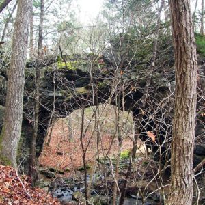 Dolph Natural Bridge
 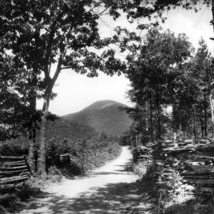 Eagle Mountain
 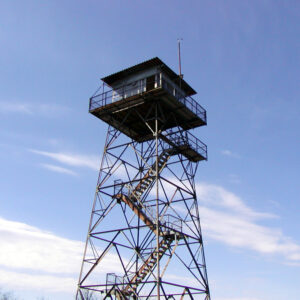 Fire Tower
 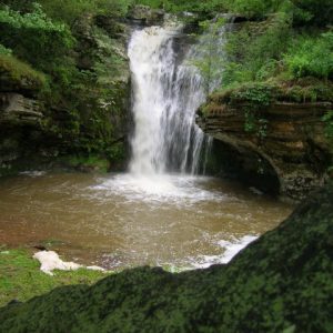 Gid Waterfall
 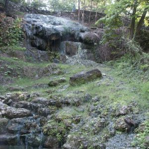 Hot Springs National Park
 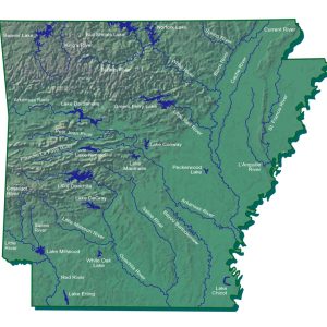 Hydrography Map
 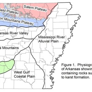 Karst Topography Map
  Magazine Street Scene
 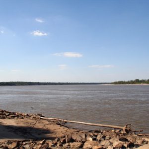 Mississippi River
 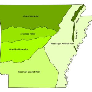 Natural Divisions Map
  New Madrid/St. Francis River Swamp
 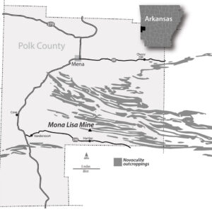 Novaculite Outcroppings
 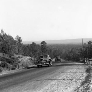 Ouachita Mountains Road
  Ozark Plateau Map
 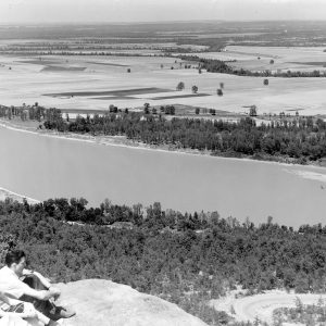 Petit Jean State Park
 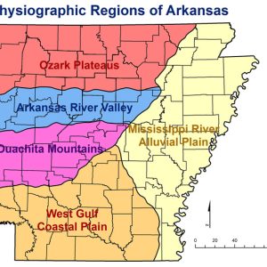 Physiographic Regions
 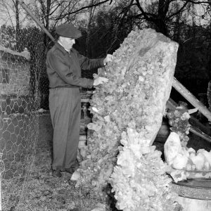 Quartz Crystal Formation
 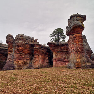 Rock Formations
  Syllamo Mountain Bike Trail
  Toad Suck Ferry
  White Hall: Lock & Dam No. 5
501-918-3025
calsfoundation@cals.org
calsfoundation@cals.org
Geography has played an important and continuing role in the history and culture of Arkansas. From settlement patterns to Civil War battlefields to centers of economic development and political party affiliation, geographic patterns are obvious. These are often related to the distinct physical/biological landscapes of the state, each one of which has a unique combination of limitations and potentials for human use. These landscapes often occur in regions where the character is set by the underlying geology, which in turn influences soil and vegetation. Also, climate varies across the state as a result of changes in latitude, elevation, and local topography. All of these factors combine in varied ways to make Arkansas surprisingly diverse.
One approach to understanding the patterns of natural diversity of Arkansas is to examine its major regions, which have been referred to as natural divisions or ecoregions. One can begin with more general regions and then divide them into smaller and more uniform areas, providing more detail when needed. Early descriptions recognized five or fewer regions, but six or more have been recognized more recently. The first regions were the physiographic provinces defined by geologists, but later regions were defined based on broader ecological characteristics that affect people and other living things. The major regions are relatively consistent among recent maps, although each varies slightly from the others, combining two regions or splitting one. The emphasis here will be the six natural divisions: the Ozark Mountains (a.k.a. the Ozark Plateau or Plateaus), the Ouachita Mountains, the Arkansas River Valley, the Coastal Plain, the Mississippi Alluvial Plain (a.k.a. the Arkansas Delta), and Crowley’s Ridge.
The relationships among geology, soil, climate, and vegetation in the natural divisions are most easily understood by reconstructing the history of landscape change and development.
GEOLOGIC HISTORY: ARKANSAS IN THE PALEOZOIC ERA
The story of the geology of Arkansas that is visible at the surface begins about 500 million years ago, during the time geologists refer to as the Paleozoic era, or time of “early life.” Today, most rocks that are northwest of a diagonal line running across the state northeast to southwest date from that time.
During the Paleozoic, all of Arkansas was covered by the ocean. In the northern part, the ocean was relatively shallow, and marine organisms were abundant, while farther south the water was much deeper. Occasionally, areas would rise above the water level and then subside again or be eroded away. Whether microscopic or larger, many marine plants and animals have shells composed of calcium compounds. As they die, their shells can accumulate on the bottom, as they often did in what is today northern Arkansas. Farther south, in what is now central and southern Arkansas, the ocean was deeper, and sand and clay were the primary materials deposited. Under pressure and the appropriate chemical conditions, calcium shells and skeletons became limestone, sand became sandstone, silt became siltstone, and clay became shale. These are the predominant rocks in northwestern Arkansas today.
Formation of the Ozark Mountains Natural Division
Throughout the Paleozoic era the continents drew close together and eventually joined into a single “super continent” that has been called Pangaea. As individual continents approached each other, collisions caused mountains to rise. For instance, as the North American plate collided with the European plate, the Appalachians were formed, and a similar collision with the super continent of Gondwana (comprising the present continents of South America, Africa, Antarctica, and other land masses) provided the forces that caused the area of north Arkansas to be uplifted, with limestone and related calcareous rocks such as dolostone (the rock formed from the mineral dolomite) common, along with other rocks such as sandstone and chert (a flint-like rock formed from silica). Erosion lowered the land surface until thick, erosion-resistant layers were reached, creating a series of level uplands, or plateaus—from highest to lowest, these are the Boston Plateau, the Springfield Plateau, and the Salem Plateau. Rivers cut valleys into these plateaus, and in some cases, the plateau surface only remains as the tops of the hills or mountains, all at similar elevations. In other places, though, the plateau surface is extensive and only intermittently cut into by streams.
This region in northwestern Arkansas characterized by eroded plateaus is the Ozark Mountains Natural Division. It includes such cities as the Fayetteville–Springdale–Rogers metropolitan area (Washington and Benton counties), Harrison (Boone County), Mountain Home (Baxter County), Batesville (Independence County), and Clinton (Van Buren County). Most of these developed where the plateau surfaces are extensive, providing ample opportunity for urban and agricultural development, along with reasonable transportation routes. These areas remain some of the fastest-growing urban areas of Arkansas. The more rugged areas, such as the Boston Plateau area, which is usually referred to as the Boston Mountains because of its rugged topography, offered none of these advantages to development. There, people were isolated with few opportunities to make a living and poor transportation, factors that contributed to development of the mountaineer or hillbilly lifestyle so often associated with this area. The Ozark Mountains Natural Division continues into portions of eastern Oklahoma and southern Missouri.
Formation of the Ouachita Mountains Natural Division
Farther south, collision with Gondwana squeezed together a belt of seafloor into a series of folds and faults in the earth’s crust. In contrast to the Ozarks, where the layers or strata (layers) of rock are fairly level, the strata of the Ouachitas are tilted and even twisted into tight folds. The folds have been eroded into ridges, usually sharp-pointed and running in an east-west direction, since the direction of continental collision was north-south. Typical rocks are those created from the sediments that had accumulated on the bottom of the former abyss: sandstone and shale. Special rocks of this area include quartz crystal and novaculite, a hard, silica-based rock which is sold as “Arkansas stone,” the whetstone that is unique to the Ouachita Mountains. In this natural division, streams typically follow along the broad folds created during the formation of the mountains, creating a trellis pattern where the main stream follows the structural valley, and tributaries enter at more or less right angles. This contrasts with the pattern of stream valleys in the Ozarks, where streams tend to radiate out from high points and the resulting pattern is often dendritic, like tree branches. Rainwater that follows folds far below the surface emerges as hot springs in Hot Springs National Park and elsewhere in the Ouachitas. This natural division extends from eastern Oklahoma to the western parts of Little Rock (Pulaski County) and includes Mena (Polk County) and Mount Ida (Montgomery County). The Arkansas River cuts through the eastern Ouachitas, and the ridges of the Ouachitas continue eastward to near Beebe (White County) and Searcy (White County).
Formation of the Arkansas River Valley Natural Division
Between the two mountainous natural divisions is one that shares some of the characteristics of both and has some that are unique: the Arkansas River Valley Natural Division. During the Paleozoic era, rivers carried sediment into the ocean margin that was to become the Arkansas River Valley. As the rock that would become the Ouachita Mountains was folded up into an anticlinorium, or complex “hump” made up of many folds, the sediment of the Arkansas River Valley was warped downward into a trough that was filled in and eroded again. Swamps of river deltas accumulated clay and plant remains that were buried under later sediments. The remains of ferns and other plants gradually were transformed into coal or natural gas that are valuable economic products of the valley today.
The topography of the Arkansas River Valley is varied. There are narrow ridges (anticlines) like those of the Ouachitas and flat-topped mountains (broad synclines) similar to those of the Ozarks. In more recent geological times, steep-sided, flat-topped mesas formed, similar in general appearance to those of the arid southwestern states. The most typical character of the valley is broad, gently rolling, or hilly plains with interspersed mountains, split by the wide alluvial bottomlands of the Arkansas River. This helped to make it an important transportation corridor through the mountains, for highways (including Interstate 40), river transportation on the McClellan-Kerr Arkansas River Navigation System, and rail lines. It also provided opportunities for agricultural and urban development. It extends from Oklahoma eastward to near Batesville (Independence County) and includes cities such as Fort Smith (Sebastian County), Clarksville (Johnson County), Russellville (Pope County), Morrilton (Conway County), and part of Conway (Faulkner County).
GEOLOGIC HISTORY: ARKANSAS IN THE MESOZOIC AND CENOZOIC ERAS
As the land continued gradually rising relative to sea level, southern and eastern Arkansas emerged from the southern ocean, the Gulf of Mexico. Changes in living things following a mass extinction at the end of the Paleozoic era, along with other changes such as climate, have caused geologists to call this time the Mesozoic era, the time of “middle life.”
Formation of the Coastal Plain Natural Division
Offshore reefs protected a wide lagoon in what is now southern Arkansas. Its northern boundary, and therefore the boundary between Mesozoic and Paleozoic rocks, ran east-west from Arkadelphia (Clark County) to north of Murfreesboro (Pike County) to north of De Queen (Sevier County). The water was shallow and productive, with beds of mollusks such as oysters. Their limey shells, along with skeletons of micro-organisms, created deposits of chalk and calcareous clay or marl. These sediments were laid down during the Cretaceous period, the final chapter of the Mesozoic, which, along with the preceding Jurassic period, has come to be known as the age of dinosaurs. Consequently, fossilized dinosaur bones, and even tracks, have been found in southwestern Arkansas along with fossils of marine organisms. Like the earlier mass extinction that ended the Paleozoic era, the Mesozoic era ended in a wave of extinction. It is now known that this one was caused or aided by the cataclysmic impact of an asteroid or comet with earth, killing many of the living things on the earth in a geological instant and making way for the evolution of new species.
That impact marked the end of the Mesozoic Era and ushered in a new interval of geologic time that has been termed the Cenozoic Era, the time of “new life” that continues today.
The shoreline of the Gulf of Mexico at the time of the impact, and therefore the boundary between rocks of the Mesozoic or Paleozoic eras and those of the Cenozoic, runs through southwestern Arkansas, near the present route of Interstate 30 from Hope (Hempstead County) to Arkadelphia and on to Little Rock (Pulaski County), Newport (Jackson County), and beyond, along a huge bay extending northward to southern Missouri. During the first part of the Cenozoic era known as the Tertiary period, the Gulf receded to the south, leaving behind the sands and gravels that made up its bottom and beaches as well as the deltas of rivers that emptied into it. These deposits, as well as most Mesozoic deposits in southwestern Arkansas, were not subsequently compressed and cemented into hard rock, like those in the northwestern half of the state. Therefore, the surface geology of this area that is now called the Coastal Plain Natural Division is characterized by unconsolidated deposits of sand, gravel, silt, and clay from the ocean bottom, beaches, and estuaries that have eroded into rolling, sandy hills that were covered with forests characterized by loblolly and shortleaf pine, which have become an important economic resource for this region. As exceptions to the typical piney hills, those areas underlain by Mesozoic chalk and marl were covered with grasslands and woodlands of the blackland prairies. These areas are generally pasture today.
Because streams in this natural division are easily able to remove these unconsolidated materials, they have much wider alluvial bottomlands than are typical in the regions underlain by hard Paleozoic rocks. There are extensive bottomland forests in these bottoms except for some areas, particularly along the Red River, that have been converted to productive agricultural land. During glacial advances and retreats (the Pleistocene epoch), rivers became swollen relative to today and covered much larger areas, creating extensive alluvial terraces along the larger rivers and sometimes blanketing large areas between today’s rivers. Sometimes these terraces have been converted to productive farmland or pasture.
The Coastal Plain Natural Division includes surface deposits from the Cretaceous period of the Mesozoic era (uplands of southwestern Arkansas), the Tertiary period of the Cenozoic era (uplands of south-central Arkansas), and the Quaternary period of the Cenozoic era (alluvial terraces and bottomlands throughout the natural division). The natural division as a whole is referred to as the West Gulf Coastal Plain (that part of the Gulf Coastal Plain west of the Mississippi River) and extends from Oklahoma, Texas, and Louisiana across southern Arkansas northward to the Ouachita Mountains and reaches southern Little Rock (Pulaski County). Other cities within it include Magnolia (Columbia County), Camden (Ouachita County), Monticello (Drew County), El Dorado (Union County), and part of Pine Bluff (Jefferson County).
Formation of the Mississippi Alluvial Plain (a.k.a. the Arkansas Delta) Natural Division
Eastern Arkansas was originally part of the northward-extending bay of the Gulf of Mexico already mentioned, created by subsidence of the underlying rocks. However, as this bay was filled and emerged from the sea, it was dramatically altered by rivers, primarily the Mississippi, Ohio, and Arkansas. The older Tertiary deposits were carved away, and rivers replaced the upper several hundred feet of marine deposits with the sand, silt, and clay that they carried from the north, east, and west. The courses of the rivers constantly changed over thousands of years, reshaping virtually all of the eastern third of Arkansas along with parts of six other states, including large parts of Louisiana and Mississippi. The region they created is the Mississippi Alluvial Plain Natural Division, often referred to as the Delta. The Delta vividly demonstrates that geologic processes are still operating today, as rivers carve away older sediments and simultaneously lay down new deposits. Much of the surface of this region has been created within the last several thousand years.
However, some areas are older. They are outwash deposits laid down by the rivers swollen with meltwater from the Pleistocene glaciers. These deposits often form terraces that are higher than modern river floodplains. The oldest is the Prairie Terrace—the largest unit of which underlies the Grand Prairie, extending over a half million acres—deposited by the Arkansas River over 100,000 years ago. That terrace extends from Searcy southward past Lonoke (Lonoke County), Des Arc (Prairie County), Stuttgart (Arkansas County), and Dewitt (Arkansas County) to near the Arkansas River. Other younger and lower Pleistocene terraces cover most of the Delta north of the Arkansas River, and some of the land south of the Arkansas River is occupied by these terraces as well. Almost all the Delta is extremely flat, with local elevation differences of only a few feet. The Grand Prairie terrace is even flatter than most, without even the abandoned river features, such as oxbow lakes, that add variety to much of the region.
The deep alluvial soil of the Delta has made it the most important agricultural region of Arkansas. Soils and crops often reflect the character of the river that shaped the local landscape. Cotton is most important in the sandy soils along the Mississippi and Arkansas Rivers, while rice is most extensive on the Pleistocene terraces that often are underlain by a clay subsoil or “pan” that provides a watertight bottom for irrigated fields.
The subsidence that created the Mississippi Alluvial Plain actually began as a rift in the North American continent starting in the late pre-Cambrian (about 700 million years ago). If that rift had continued, it would have split the ancestral North American continent in two and created a new ocean. Although it did not accomplish that, there is still geologic activity today in a different form. Opening of the Atlantic Ocean along the Mid-Atlantic Spreading Center is pushing North America westward and causing compressive forces in the middle of the plate. In 1811–12, this force field caused the New Madrid Earthquakes, among the most powerful earthquakes ever recorded in North America.
The Mississippi Alluvial Plain in Arkansas reaches from Missouri to Louisiana and is bounded by the Mississippi River on the east, while on the west it intersects each of the other natural divisions. Major cities include Blytheville (Mississippi County), West Memphis (Crittenden County), Newport, Brinkley (Monroe County), Dumas (Desha County), and Lake Village (Chicot County). Pine Bluff lies on the boundary with the Coastal Plain, and Little Rock and North Little Rock (Pulaski County) lie on the boundary with the Coastal Plain and the Ouachita Mountains. Overall, the Mississippi Alluvial Plain extends from Illinois through Missouri and Kentucky, Arkansas, Tennessee, Mississippi, and Louisiana to the Gulf of Mexico.
Formation of the Crowley’s Ridge Natural Division
During the most recent glacial advance, the Mississippi River flowed west of its modern course, nearer to the Ozark Mountains, while the Ohio followed a route parallel to it near where the Mississippi is now, and the two did not join each other or the Arkansas River until all three were south of today’s Arkansas. As they reworked eastern Arkansas, they left untouched a narrow strip of land typically from half a mile to twenty miles wide and over 150 miles long, reaching from Missouri to Helena-West Helena (Phillips County), except for one break just north of Marianna (Lee County). Although this low ridge was primarily composed of the Tertiary marine deposits that originally covered all of eastern and southern Arkansas, it was capped with river-deposited sand and gravel. Today, shark’s teeth can be found in the marine deposits, and the gravel deposits are the most valuable in this part of the state. This low ridge became the core of the Crowley’s Ridge Natural Division, which was completed by the addition of wind-blown dust, or loess, up to fifty feet thick at the southern end. The loess originated as glacial ground silt that was spread out as thin sheets over the adjacent Mississippi Alluvial Plain about 20,000 to 30,000 years ago. When it was picked up by the winds, the low ridge of ocean-bottom materials disturbed wind flow and allowed silt to accumulate, primarily from Jonesboro (Craighead County) south, building the ridge up to its present height. The bulk of the wind-borne silt was transported on to the uplands along the eastern side of the alluvial plain, creating a line of loess hills from north of Memphis, Tennessee, southward through Vicksburg and Natchez, Mississippi. Although it is generally less than 200 feet higher than the surrounding Delta, Crowley’s Ridge has been dissected by streams into very steep valleys. Because of the chemical and physical properties of loess, landslides are common where it is thick. Upland hardwood forests on the ridge contrast with bottomland hardwood forests of the adjacent delta. Thus, although Crowley’s Ridge is completely surrounded by the Delta, the geologic histories of the two are very different, and even though Crowley’s Ridge is small, it is a distinctly different upland ecosystem. The largest city is Jonesboro, and others include Wynne (Cross County) and Forrest City (St. Francis County).
CLIMATE
Climate is the other basic physical feature, along with geology, controlling natural systems of Arkansas and other places. The term climate generally refers to long-term (decades to centuries) averages of annual and seasonal temperature and precipitation. Extreme climatic events such as droughts or ice storms, often considered by people to be “disturbances,” are simply extreme variations in overall climatic patterns. Arkansas has a humid subtropical climate, with typical monthly high temperature averages ranging from about forty to over ninety degrees Fahrenheit and average annual precipitation ranging from about forty-five to fifty-five inches. However, climate can be modified by local landforms and vegetation. Flat sites impact plants, animals, and people differently than sites that are rolling, hilly, or mountainous. For instance, south-facing slopes are drier and warmer than those that face north. Because the ridges of the Ouachita Mountains Natural Division are generally oriented in an east-west direction, they have prominent north and south facing slopes. South slopes are warmer and drier and support woodlands dominated by shortleaf pine, while upland hardwoods dominate north-facing slopes.
A site within a forest will have a different temperature range than one that is totally exposed. Elevation exerts an important influence on climate. In Arkansas, a mountaintop in Newton County may be 200 miles north of the Louisiana state line and over 2,500 feet higher. This results in an average temperature difference of more than eight degrees. Of course, climate also affects geology and landforms, for example, as rainfall and wind wear away mountains.
At the same time the geologic events described here were taking place, the climate was undergoing equally dramatic changes. In earlier eras, one can only infer climate from such evidence as rock type and fossils. These reveal that the Mesozoic era was generally warmer than the Paleozoic. There is more detailed evidence of recent times. Pollen studies have shown that 40,000 years ago Arkansas was covered mostly by oak savanna (wide-spaced trees with a ground layer of prairie grasses and flowers) and oak-hickory-pine forest in the middle and western part of the state, with mixed hardwoods bordering cypress and tupelo along the Mississippi River. Approximately 18,000 years ago, at the peak of the most recent glacial advance, the climate was cooler, and much of western and central Arkansas was dominated by a spruce and jack pine forest in the Ouachita and Ozark mountains. Spruce forest with associated northern hardwoods covered the Mississippi Alluvial Plain.
Between 14,000 and 10,000 years ago, the climate became warmer, the spruce forest declined, and most of Arkansas became dominated by vegetation much like that of today, with oak-hickory woodland to the north and oak-hickory mixed with southern pine in the south. The Mississippi Alluvial Plain was covered by cypress-tupelo with mixed hardwoods.
However, major vegetation changes occurred between 8,000 and 5,000 years ago when the climate became warmer and drier. Vegetation of the arid southwest of North America shifted eastward, including prairies dominated by grasses and flowers, as well as oak woodlands with scattered trees over prairie-like ground vegetation. Very dry sites were desert-like, with bare ground interrupted by scattered shrubs or trees. This period has been referred to under several names, such as the mid-Holocene dry interval, the Altithermal interval, or the Hypsithermal interval. After that period, the climate became more moist, eventually developing into the climate of today, although it has constantly fluctuated.
As the climate moistened, the desert, woodland, and prairie vegetation moved back westward. Upland areas in Arkansas again were covered with oak-hickory or oak-hickory-pine forests and woodlands, and low areas of the Delta were covered with bottomland hardwood forests and cypress-tupelo swamp. However, prairie left from the past dry periods persisted even to the present on drier, frequently burned areas. Prairie grasses and flowers use water more efficiently than most woody plants. Therefore, areas with about twenty inches of precipitation per year tend to be dominated by grasslands, whereas areas with more rainfall, like Arkansas today, may be covered with forest, and drier areas with desert. In Arkansas, droughty sites with thin soils helped to maintain prairies in spite of rainfall that today is much higher than twenty inches per year. Frequent fire, set by both lightning and people, has played a vital role in maintaining them as well, since fire may kill woody plants that grow from buds at the tips of branches but does not damage grasses that grow from the base of the plant. In the absence of fire, these droughty sites would have long since changed to dry forests. Instead, large areas of prairie or woodland remained in all the natural divisions of Arkansas until modern fire suppression efforts became effective, in addition to the clearing and farming upon of many areas.
In contrast to the prairies and woodlands of drier sites, relict stands of sugar maple and beech forests similar to those found in New England are present in moist coves and protected places in the Ozarks and Ouachitas. These are remnants of the more northern, cooler forests that once covered much of Arkansas and retreated to these sites during drier times. The substantial number of endemic species—that is, those that occur only in Arkansas and those parts of its natural divisions that extend to other states—demonstrates that the cool coves of the mountains provided refuge to species with high moisture requirements even during past dry intervals and may be expected to do so during future such conditions as well.
SOIL
Soils develop along with vegetation in relationship to geology and climate. Soil comprises weathered geologic parent material, along with organic (primarily plant) remains.
The Mississippi Alluvial Plain has by far the deepest and most productive soils of the natural divisions, and as a result, the original bottomland hardwood forest has usually been cleared for row-crop agriculture. The forests of the bottomlands are sensitively related to flooding. Different forest communities occur on sites only one or two feet different in elevation, as the species occupy sites with the precise duration and frequency of flooding to which they are adapted. However, the high terraces of the Delta were seldom or never flooded and were often covered by prairie or woodland, including the largest prairie in the state, the Grand Prairie. Almost all of these higher, drier sites have been cleared for agricultural use.
Crowley’s Ridge has deep, well-drained, loessial soils that support upland hardwood forest. The forests of that natural division are related to those east of the Mississippi River and have some eastern species that are found nowhere else in Arkansas.
The Coastal Plain often has sandy soils derived from the ocean-bottom sands and gravels that are typically not productive enough for row-crop agriculture but are prime lands for supporting pine timber production. Along the large rivers in the Coastal Plain, however, are deep, productive soils that can support row-crop agriculture or may support distinctive bottomland hardwood and pine forests. Distinctive “blackland” prairies and woodlands occur in the dry soils derived from Cretaceous chalk and marl (limey clay).
In the Ozarks, fairly deep soils have formed on the flat tops of hills and mountains and on the more extensive plateau surfaces, and the original hardwood forests, prairies, and woodlands of these sites have often been cleared for pasture. Hillside soils are shallow except at the toes of slopes, where soil has collected due to gravity, and these sites still usually support hardwood or pine forest.
In the Ouachitas, soils of ridges are shallow while those in the wide valleys are relatively deep and productive. The native upland hardwood forests and woodlands continue to thrive on the ridges but have often been converted to pasture in the valleys.
Soils and vegetation of the Arkansas Valley are like those of the Ozarks or Ouachitas where the valley is similar in character to either of those natural divisions. However, along the Arkansas River are deep, productive bottomland soils that originally supported bottomland hardwood forests but often today are in row-crop agriculture.
CONCLUSION
These geologic and climatologic processes have contributed to the geographic variation of Arkansas that underlies the six natural divisions described here. Each is distinctly different from the others, but within a given natural division, the physical factors and the resulting vegetation are relatively consistent and predictable.
These natural divisions can be divided into finer geographic units or subdivisions, and each is part of a larger region. Thus, the first three of these natural divisions are part of the Interior Highlands physiographic region, and the latter three are part of the Gulf Coastal Plain.
The Interior Highlands is generally characterized as hilly to mountainous topography on Paleozoic rock substrates dominated by upland hardwood and upland pine-hardwood forests, with extensive prairies in the north. It includes portions of Missouri, Arkansas, Oklahoma, and Kansas, and a disjunct area occurs in southern Illinois.
The Gulf Coastal Plain is a belt of land up to about 600 miles wide extending from Texas to Florida. It has been inundated by the Gulf of Mexico at some time since the Jurassic period, generally during the Tertiary period or more recently. The surface geology includes areas of hard rocks such as sandstone, limestone, or chalk but is more typically unconsolidated sand, gravel, or clay, sloping gently from its northern, inland boundary to the gulf. Typical plant cover is pine forest on sandy hills and bottomland hardwood forest along streams and rivers.
The physical and biological factors that characterize each natural division have given them different potentials and limitations and consequently affected the course of history and development of the state.
For additional information:
Arkansas Geological Survey. https://www.geology.arkansas.gov/ (accessed October 3, 2022).
Arkansas Natural Heritage Commission. “Ecoregions/Natural Divisions of Arkansas.” http://www.naturalheritage.org/Default.aspx?PageID=15481793&A=SearchResult&SearchID=10985867&ObjectID=15481793&ObjectType=1 (accessed October 3, 2022).
Blevins, Brooks. A History of the Ozarks. 3 vols. Champaign: University of Illinois Press, 2018–2020.
Collins, Janelle, ed. Defining the Delta: Multidisciplinary Perspectives on the Lower Mississippi River Delta. Fayetteville: University of Arkansas Press, 2015.
Croneis, C. Geology of the Arkansas Paleozoic Area. Little Rock: Arkansas Geological Survey, Bulletin 3, 1930.
Dale, Edward E., Jr. “The Vegetation of Arkansas.” Arkansas Naturalist 4 (September–October 1986): 7–27.
Delcourt, P. A., H. R. Delcourt, R. C. Brister, and L. E. Lackey. “Quaternary Vegetation History of the Mississippi Embayment.” Quaternary Research 13 (1980): 111–132.
Fenneman, N. M. Physiography of Eastern United States. New York: McGraw-Hill, 1938.
Foti, Thomas L. Arkansas, Its Land and People. Little Rock: Arkansas Department of Education, 1976.
———. “Natural Divisions of Arkansas.” In Arkansas Natural Area Plan. Little Rock: Arkansas Department of Planning, 1974.
Foti, Thomas, and Gerald Hanson. Arkansas and the Land. Fayetteville: University of Arkansas Press, 1992.
Haley, Boyd R., Ernest E. Glick, Benjamin F. Clardy, Charles G. Stone, Mac B. Woodward, and Doy L. Zachry. “Geologic Map of Arkansas.” Map scale 1:500,000. Rev. ed. Little Rock: Arkansas Geological Commission and U.S. Geological Survey, 1993.
Milson, Andrew J. Arkansas Travelers: Geographies of Exploration and Perception, 1804–1834. Fayetteville: University of Arkansas Press, 2019.
Pell, W. F. “The Natural Divisions of Arkansas: A Revised Classification and Description.” Natural Areas Journal 3.2 (1983): 12–23.
Saucier, R. T. Geomorphology and Quaternary Geologic History of the Lower Mississippi Valley. 2 vols. Vicksburg, MS: U.S. Army Engineer Waterways Experiment Station, 1994.
Stroud, Hubert B., and Gerald T. Hanson. Arkansas Geography. Little Rock: Rose Publishing Company, 1981.
Thornbury, W. D. Regional Geomorphology of the United States. New York: John Wiley and Sons, 1965.
Whayne, Jeannie, and Willard B. Gatewood, eds. The Arkansas Delta: Land of Paradox. Fayetteville: University of Arkansas Press, 1993.
Woods, A. J., et al. “Ecoregions of Arkansas.” Map scale 1:1,000,000. Reston, VA: U.S. Geological Survey, 2004.
Thomas Foti
Department of Arkansas Heritage


Comments
No comments on this entry yet.