 Cossatot River State Park-Natural Area
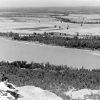 Geography and Geology
 Little River (Northeastern Arkansas)
 Maumelle and Little Maumelle Rivers
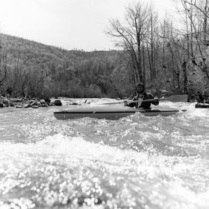 Buffalo River Kayaking
 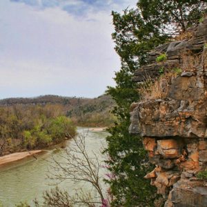 Buffalo River
 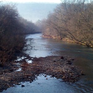 Caddo River
 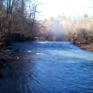 Caddo River
 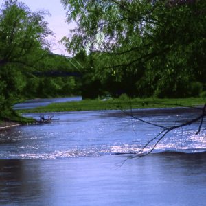 Eleven Point River
 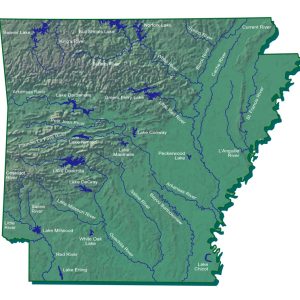 Hydrography Map
 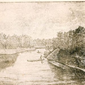 Little Red River
 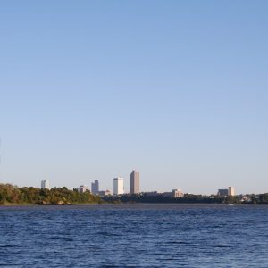 Little Rock Skyline
 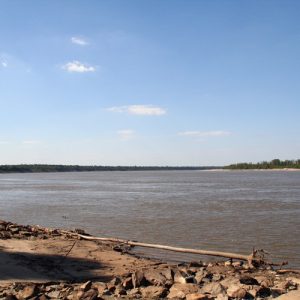 Mississippi River
 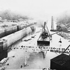 Ouachita River
 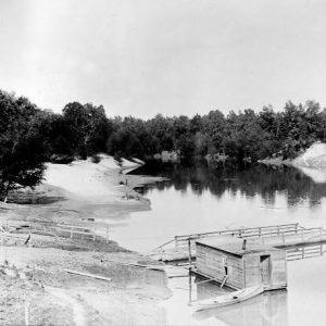 Ouachita River Ferry
 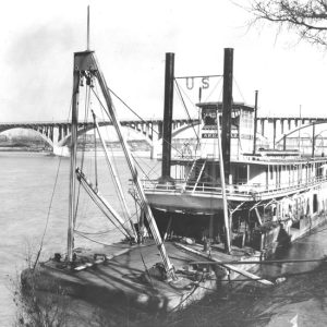 Snag Boat Arkansas
 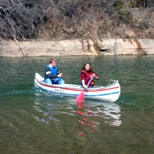 Sylamore Creek
 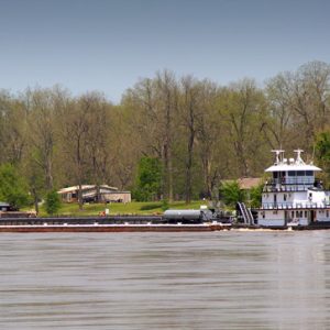 Tug and Barges on the Arkansas River
 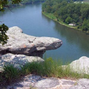 White River
 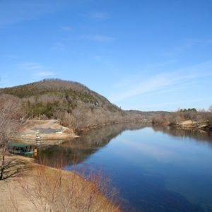 White River
 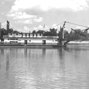 White River Dredge
501-918-3025
calsfoundation@cals.org
calsfoundation@cals.org
Arkansas has approximately 90,000 miles of rivers and streams. Thirty-three rivers are generally recognized as passing through Arkansas or along one of its borders; more than half of Arkansas’s rivers also enter or run along the borders of other states. While river travel has many hazards—including rapids and hidden snags—until the second half of the nineteenth century, the rivers of Arkansas often provided the best means of transportation for residents and visitors, and many cities and towns were established because of their proximity to rivers.
A river is a narrow body of water with land on two sides, generally flowing downhill until it empties into another river or into a lake, sea, or ocean. All rivers are streams, but smaller streams are often called creeks or brooks. Bayous are also small streams, usually offshoots of a river or a lake, found in lowland and swampy areas; bayous are generally more sluggish and stagnant than rivers and creeks. No official definition clearly distinguishes rivers from creeks, and often the same body of water will be designated by both names.
Rivers are always changing, shaping and being shaped by the environment. Flood-producing storms, droughts, and even earthquakes can change the course of a river. Former river beds become lakes, and formerly attached lands become islands as rivers move over time. The use of rivers as boundaries between nations, states, or counties can be inconvenient because of such changes; for example, small parts of Arkansas lie east of the present-day Mississippi River, and parts of Tennessee and Mississippi are found on Arkansas’s side of the same river.
Because rivers are always changing, measuring rivers is an inexact science. Any river meanders to a certain extent, and river miles often are double the straight-line distance between two points on that river. Some rivers widen into lakes, especially where they have been dammed deliberately to create lakes, control flooding, or generate hydroelectric power. In 1972, federal laws were enacted to protect the Buffalo River from such dams; since that time, state action has given similar protection to portions of the Cossatot, Little Missouri, Saline, and Strawberry rivers.
When Arkansas was settled by French explorers and American colonists, most of their early settlements were built along rivers. Greenock (Crittenden County), Helena (Phillips County), Napoleon (Desha County), and Columbia (Chicot County) were built along the Mississippi River. Arkansas Post (Arkansas County), Pine Bluff (Jefferson County), Little Rock (Pulaski County), Cadron (Faulkner County), Dardanelle (Yell County), and Fort Smith (Sebastian County) were built along the Arkansas River. Batesville (Independence County) was built along the White River. Some of these settlements flourished (especially Little Rock, Fort Smith, and Helena), but others declined, often because of problems due to the rivers. Pine Bluff and Helena both lost major sections of their cities to river erosion, and Napoleon was entirely swallowed by the Mississippi River. River floods also frequently devastated agricultural areas, most markedly in 1927 and 1937. Major projects such as the McClellan-Kerr Arkansas River Navigation System (including sixteen dams and eighteen locks) have reduced but not eliminated the problem of flooding in Arkansas; in March and April of 2008, flooding impacted many towns and farms in Arkansas, and ten counties were declared federal disaster areas because of flooding.
With the improvement of roads and the emergence of railroads and air travel, rivers are less important for transportation than before, although shipping along major waterways such as the Arkansas River remains highly significant. The McClellan-Kerr Arkansas River Navigation System, dedicated in 1971, is responsible for $1 billion to $2 billion in trade transportation for Arkansas each year. In contemporary times, rivers offer recreational activities such as whitewater rafting, boating, canoeing, and fishing. Sylamore Creek, in the Blanchard Springs Recreation Area, and the Little Missouri River, at the Albert Pike Recreation Area, have popular swimming areas. The Buffalo River, Mulberry River, and Arkansas River are especially noted for rafting and boating opportunities. Among the many popular fishing spots in Arkansas are locations on the Mississippi River, Arkansas River, Buffalo River, Little Red River, White River, North Fork River, and Spring River, as well as many streams in the Ouachita and Ozark mountains. Trout and bass are the most popular fish found in Arkansas rivers.
| Name of River | Total Miles | Miles in Arkansas |
| Antoine | 35 | 35 |
| Arkansas | 1,460 | 445 |
| Black | 300 | 200 |
| Boeuf | 230 | 45 |
| Buffalo | 150 | 150 |
| Cache | 213 | 164 |
| Caddo | 80 | 80 |
| Cossatot | 120 | 120 |
| Current | 225 | 40 |
| Eleven Point | 115 | 50 |
| Fourche | 20 | 20 |
| Fourche La Fave | 140 | 140 |
| Illinois | 140 | 56 |
| Kings | 115 | 100 |
| L’Anguille | 110 | 110 |
| Little | 220 | 92 |
| Little Black | 32 | 12 |
| Little Missouri | 145 | 145 |
| Little Red | 105 | 105 |
| Mississippi | 2,350 | 480 |
| Moro | 105 | 105 |
| Mulberry | 70 | 70 |
| North Fork | 110 | 25 |
| Ouachita | 600 | 500 |
| Petit Jean | 113 | 113 |
| Poteau | 128 | 72 |
| Red | 1,290 | 180 |
| St. Francis | 470 | 350 |
| Saline | 300 | 300 |
| Spring | 100 | 75 |
| Strawberry | 90 | 90 |
| Sulphur | 110 | 36 |
| White | 722 | 690 |
For additional information:
Columbia Gazetteer of North America. New York: Columbia University Press, 2000.
Foti, Thomas, and Gerald Hanson. Arkansas and the Land. Fayetteville: University of Arkansas Press, 1992.
Haley, Boyd R., Ernest E. Glick, Benjamin F. Clardy, Charles G. Stone, Mac B. Woodward, and Doy L. Zachry. “Geologic Map of Arkansas.” Map scale 1:500,000. Rev. ed. Little Rock: Arkansas Geological Commission and U.S. Geological Survey, 1993.
Moffatt, Walter. “Transportation in Arkansas, 1819–1840.” Arkansas Historical Quarterly 15 (Autumn 1956): 187–201.
Stroud, Hubert B., and Gerald T. Hanson. Arkansas Geography. Little Rock: Rose Publishing Company, 1981.
Staff of the CALS Encyclopedia of Arkansas


Comments
No comments on this entry yet.