 Crittenden County Map
501-918-3025
calsfoundation@cals.org
calsfoundation@cals.org
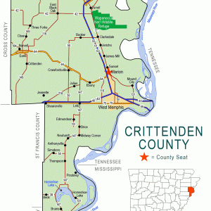
Hopefield was a small town on the Mississippi River in eastern Crittenden County near present-day West Memphis (Crittenden County) and across from present-day Mud Island in Memphis, Tennessee. As a railroad terminal and river landing, the town was pivotal in the development of transportation and commerce between Tennessee and Arkansas during the nineteenth century, but devastation from war, disease, commercial setbacks, and the geological power of the Mississippi itself ultimately destroyed Hopefield in the early twentieth century.
Hopefield traces its origin to a Dutch immigrant named Benjamin Fooy (also spelled “Foy”), who established a Spanish encampment (Foy’s Point) in 1795, which was built to regulate river traffic and discourage American encroachment past the Mississippi River. He had been appointed by the Spanish governor of Louisiana as an agent to the local Native Americans and was also in charge of tariff collections from adjacent river traffic. Fooy and several family members had also received generous land grants from the Spanish. The settlement was renamed Campo de la Esperanza (“Camp of Hope” or “Field of Hope”) in 1797, which in turn was renamed Hopefield in 1803 after what is now Arkansas was acquired with the Louisiana Purchase. Fooy remained at Hopefield after the land acquisition and served as a justice of the peace and U.S. magistrate; he was well respected as a businessman and judge, and this reputation boosted the status of Hopefield as a “healthful, moral and intelligent community” until Fooy’s death in 1823. Afterward, Hopefield gained some repute as a location for dueling and a rendezvous for gamblers seeking refuge from prosecution across the river in Memphis.
In 1824, Congress made appropriations to construct a road from Memphis to Little Rock (Pulaski County), and westward to what is now Oklahoma, for military use and in order to promote the opening of Arkansas Territory to immigration. This Military Road was complete enough in 1831 to allow mail delivery between Little Rock and Hopefield, but perennial threats from flooding occasionally made the road impassible. Flooding also prevented a railroad line connecting Hopefield to Little Rock from being fully completed until after the Civil War.
Before large-scale construction of railroads in Arkansas began, factions within the state argued about the geographical distribution of the lines and fought for federal dollars and land grants to implement their visions. In 1853, the Cairo and Fulton Railroad Company received a federal land grant to develop a railroad that ran northeast to southwest across Arkansas, terminating at the Red River near Fulton (Hempstead County). Implementation of this new railroad eventually shifted more trade toward Memphis and St. Louis, Missouri, which in turn greatly benefited Hopefield. Endeavors to build a connecting line (the Memphis and Little Rock) to the Cairo and Fulton line began in 1854, but work was slow due to the economic infeasibility (at the time) of constructing rail on embankments that would be safe from threatening flood waters. A machine shop, a rail depot, and railroad support services boosted employment and growth, which led to establishment of a Hopefield post office in 1858.
During the Civil War, the rail shops at Hopefield were converted to use as a Confederate armory, though outright use of the railroad and its facilities was abandoned when Union forces seized Memphis in June 1862. Confederate guerillas went on to sabotage the partially completed Memphis and Little Rock line and harassed Union operations in the area. By February 1863, even the ferry service between Memphis and Hopefield was disrupted, which prompted the Union commander stationed at Memphis, Major General Stephen Hurlburt, to give orders commanding that Hopefield be burned to counteract the insurgency. The town was peacefully evacuated on February 19, and Hopefield was burned to the ground.
Following the Civil War, Hopefield was rebuilt to accommodate renewed construction on the railroad, and ferry operations across the river to Memphis flourished. The Memphis and Little Rock line was fully completed in 1871, but growth at Hopefield was stunted with an outbreak of yellow fever that ravaged Memphis beginning in 1873. Quarantine in Hopefield was effective at first, but another epidemic in 1878 decimated the town’s population, which was reduced to 150 by 1880. Continuous erosion from the flooding Mississippi did little to help matters; in 1887 and 1888, several hundred feet of Hopefield shoreline were swallowed by the river, which necessitated the relocation of buildings and railroad tracks.
Hopefield was still used as a ferry landing during this time, but when the Kansas City, Fort Scott and Memphis (KCFS&M), and later the Iron Mountain, St. Louis and Southern Railroad, constructed their lines in the area, their terminals and ferry inclines were not built at Hopefield but were established about a half-mile downriver. In 1892, the KCFS&M opened Memphis’s first railroad bridge (the Frisco Bridge), but its high usage tolls compelled other rail lines to continue using the Hopefield ferry until another railroad bridge (the Harahan Bridge) was completed in 1916.
Large-scale levee construction in eastern Arkansas had been ongoing for several decades and was largely completed by the twentieth century, but protective levees in Crittenden County had been erected some ways back from the Mississippi, which left Hopefield defenseless against floods. The town was eradicated by a severe flood in 1912. After this flood, all railroad freight was transferred over the Frisco Bridge, and the opening of the Harahan Bridge in 1916 eliminated demand for ferry services altogether. Consequently, Hopefield remained abandoned. Today, the supporting piers of the Interstate 40 bridge rest atop the old location of Hopefield. Several historical markers placed by a Boy Scout troop once detailed significant events and locations in town history, but years of neglect took their toll, and the markers no longer remain. Some building foundations and the railroad embankment partially remain, and at times when the Mississippi is low, the submerged vessels then visible attest to the traffic that once flowed through the town. Ox-bow Hopefield Chute (also called Dacus Lake) and Hopefield Lake just to its south are the only other extant reminders of the community long ago inundated by the river.
For additional information:
Bragg, Marion. Historic Names and Places on the Lower Mississippi River. Vicksburg, MS: Mississippi River Commission, 1977.
Demuth, David O. “The Burning of Hopefield.” Arkansas Historical Quarterly 36 (Spring 1977): 123–130.
Fair, James R. “Hopefield, Arkansas: Important River-Rail Terminal.” Arkansas Historical Quarterly 57 (Summer 1998): 191–204.
Phillips, Bianca. “A World Away.” Memphis Flyer. August 29, 2003. Online at https://www.memphisflyer.com/a-world-away (accessed March 1, 2022).
Thompson, George H. Arkansas & Reconstruction. Port Washington, NY: Kennikat Press, 1976.
Woolfolk, Margaret Elizabeth. A History of Crittenden County, Arkansas. Greenville, SC: Southern Historical Press, 1993.
Adam Miller
Searcy, Arkansas


Thanks for such an informative article about Hopefield. I have often thought about doing research on the town I was born in, but never took the time to do so. Yes, you are so right, the town was abandoned by industry, but not the farmers. I was born on my grandfather’s place, along with my five brothers, cousins, aunts, and uncle. My grandfather farmed this land until his health became an issue. We live in Hopefield until the river forced us out for the last time in 1962.
Living in Hopefield was a challenge for myself and brothers. In order for us to get an education, we walked across the TN/AR bridge every day for years. It was the greatest challenge a child could face, but our folks insisted that we get an education. It was truly our passport to success. I thank God for His protection during those many trips across that bridge, and the wisdom of my family. I am a retired teacher now, but still active in the educational system.
I am trying to get my brothers to go back to The Bottom, that’s what we called Hopefield, and make that pilgrimage one more time. A couple of them think that is crazy, and one says there are too many bad memories. I must admit, walking in the mud on rainy days and being laughed at by the city kids after getting to school was horrible. But you know what? I am laughing.