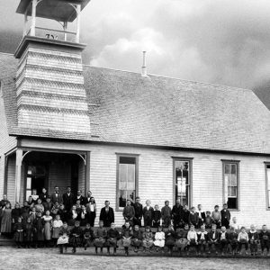
 Aydelotte School
 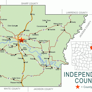 Independence County Map
  Independence Steam Electric Station
 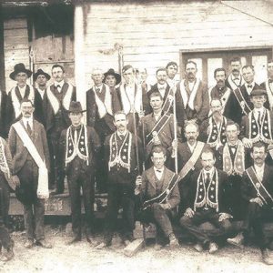 Moore Dry Goods
 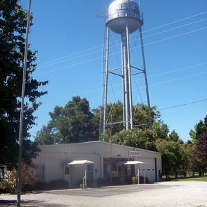 Oil Trough
 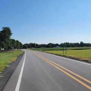 Entering Oil Trough
 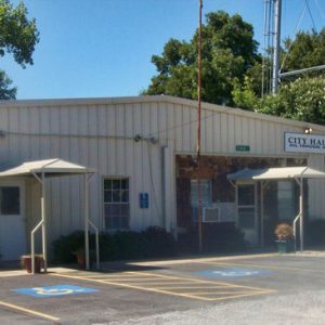 Oil Trough City Hall
 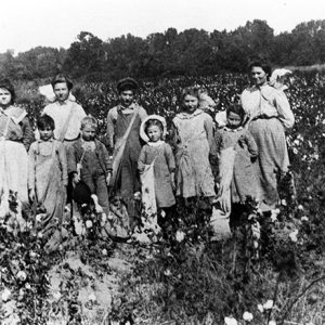 Oil Trough Cotton Pickers
 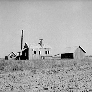 Oil Trough Cotton Gin
 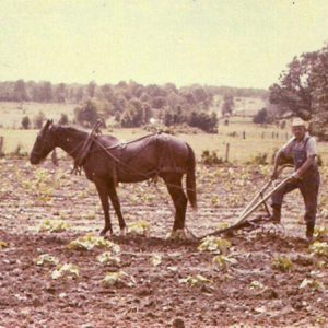 Oil Trough Bottoms
 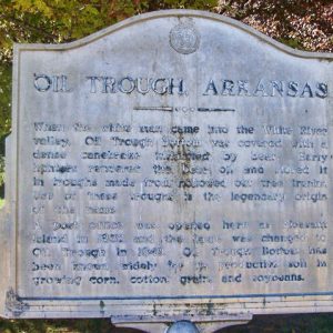 Oil Trough Sign
 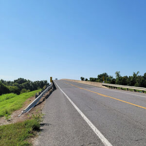 Oil Trough Bridge
 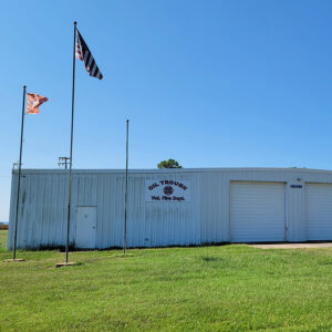 Oil Trough Fire Department
 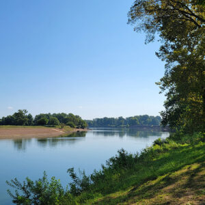 Oil Trough Park
 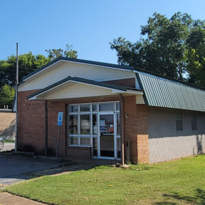 Oil Trough Post Office
 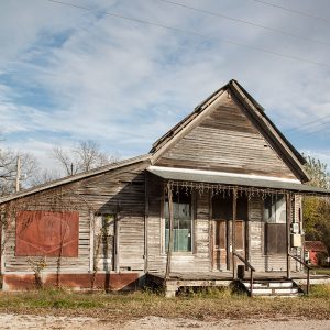 Oil Trough Store
 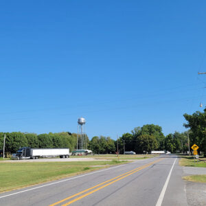 Oil Trough Street Scene
 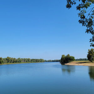 White River
 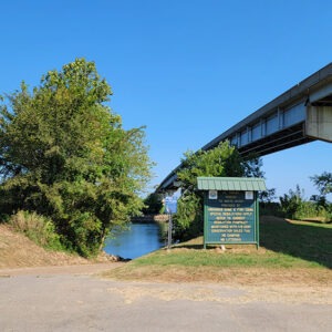 White River Access
501-918-3025
calsfoundation@cals.org
calsfoundation@cals.org
| Latitude and Longitude: | 35°37’51″N 091°27’37″W |
| Elevation: | 233 feet |
| Area: | 0.23 square miles (2020 Census) |
| Population: | 226 (2020 Census) |
| Incorporated: | July 22, 1959 |
Historical Population as per the U.S. Census:
|
1810 |
1820 |
1830 |
1840 |
1850 |
1860 |
1870 |
1880 |
1890 |
1900 |
|
– |
– |
– |
– |
– |
– |
– |
– |
– |
– |
|
1910 |
1920 |
1930 |
1940 |
1950 |
1960 |
1970 |
1980 |
1990 |
2000 |
|
– |
– |
– |
– |
– |
237 |
524 |
280 |
208 |
218 |
|
2010 |
2020 |
|
|
|
|
|
|
|
|
|
260 |
226 |
|
|
|
|
|
|
|
|
The town of Oil Trough is located twelve miles southeast of Batesville (Independence County) in the southeastern part of Independence County. It is located southwest of the White River, in a rich area of bottomlands known as the Oil Trough Bottoms. Above the bottoms is the Oil Trough Ridge, composed of black limestone that the Goodspeed history of the area (1889) described as “capable of a superior polish.”
Beginning around 1800, the area was a favorite hunting ground for French frontiersmen. The large stands of cane along the river were a perfect hiding place for game, including bear; the limestone cliffs nearby provided the bears with a perfect place for their dens. Indeed, legend has it that the area was named for the wooden troughs used by hunters to store their bear oil. Some accounts indicate that the bear oil was placed in the troughs and then floated downstream as far as New Orleans, Louisiana, for use in cooking, cosmetics, hair dressing, and tanning leather.
The Oil Trough Bottoms were settled as early as 1817, when Hardin Hulsey arrived. Others who arrived soon after included Charles Kelley, William Reed, Townsend Dickinson, William Dudley, James Miller, and John Safford (or Saffold). The first post office in the area, named Pleasant Island, was established on May 2, 1832. The name was changed to Oil Trough on June 22, 1849.
When German hunter Friedrich Gerstäcker traveled through the Oil Trough Bottoms in 1838, he marveled over the fertile land and the enormous trees, some measuring five to six feet in diameter. According to his account, the land was so fertile that it could produce “sixty to seventy bushels of maize to the acre and pumpkins larger than a man can lift.” There was at the time a large number of paw-paw trees, whose fruit a farmer named Magness (probably either Morgan or Perry Magness) was using to make liquor. Gerstäcker actually referred to the area as “Oil Trove Bottom.” In 1852, the Arkansas legislature approved the incorporation of the Oil Trough Academy, a co-educational school whose trustees were Edwin R. McGuire, James F. Saffold, and Daniel J. Chapman.
In July 1861, Captain Thomas J. Morgan’s Company (CSA) was organized in Oil Trough. During May 1863, Confederate general John S. Marmaduke had his equipment in the Oil Trough Bottoms while his troops were camped along the Black River. In March of the following year, Major Lewis C. Pace of the Eleventh Missouri Cavalry (US) moved down the White River to Camp Livingston in the Oil Trough Bottoms. Later that month, on March 25, there was a skirmish at Oil Trough Bottom when twenty-five men of the Second Arkansas Cavalry routed forty Confederates under the command of Captain George Rutherford, killing Captain McGuffin and three others. There was another skirmish nearby on March 27 involving the Eleventh Missouri Cavalry.
In the early 1870s, the St. Louis, Iron Mountain and Southern Railroad was completed as far as the White River, which facilitated the shipment of abundant crops of cotton and grain. In 1887, the town was being served by the Oil Trough and Batesville Telephone Company. There were two churches in town, one of them Methodist. At one time, there was a chapter of the Masonic lodge, named for local farmer Edwin R. McGuire, who was one of the original founders of the Oil Trough Academy. It was later moved to Thida (Independence County). The Hulsey Bend School, near the junction of Highways 122 and 14, was built around 1900 and is now listed on the National Register of Historic Places.
Although the Oil Trough Bottoms area was flat, and the Goodspeed history of the area described it as “not subject to overflow,” this would not prove to be the case. It has been susceptible to frequent flooding, most notably in 1867, 1882, and 1915, when an August tropical storm stalled in the area and caused evacuations and the loss of all of the year’s crops.
There had long been a ferry across the White River at Oil Trough. In 1897, the stern-wheel paddler J. A. Woodson was plying the waters. According to the Works Progress Administration’s Arkansas, a Guide to the State, published in 1941, the “Oil Trough Barge” carried passenger traffic from State Highway 14 across the river. It was described as a “flat bottomed, engine-propelled scow, held on its course by trolleys riding a steel cable.” On January 12, 1973, the ferry sank while attempting to carry a tractor-trailer of soybeans across the river and was out of service for five days. It was ultimately discontinued in 1975 when a bridge was built between Oil Trough and Newark (Independence County).
At the time of the 2010 census, the population of Oil Trough was 260. As of 2011, there are three churches: Methodist, Baptist, and Church of Christ. The downtown area also has a small grocery store, which includes a dining area. The local schools closed due to school consolidation—the high school after the graduating class of 1990 and the elementary school not long after.
For additional information:
Hicks, John C. “The Legend of Oil Trough.” Arkansas Democrat Magazine, January 26, 1964, p. 2.
Mahnkey, Douglas. “Curiosity Leads to Oil Trough.” Ozarks Mountaineer 34 (March/April 1986): 40–41.
McGinnis, A. C. “Farming in Oil Trough, 1904–1960.” Independence County Chronicle 13 (July 1972): 27–39.
Nancy Griffith
Presbyterian College


Comments
No comments on this entry yet.