 Big Indian Creek, Skirmish at
 Fly-fishing
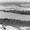 Geography and Geology
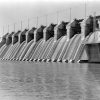 Hydroelectricity
 Salmonids
 Speckled Pocketbook
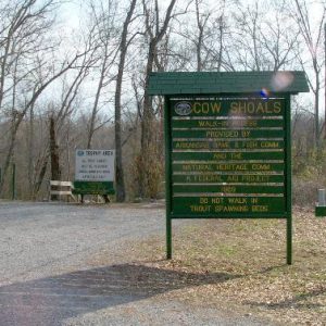 Cow Shoals Riverfront Forest Natural Area
 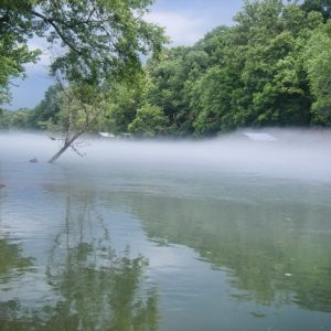 Little Red River
 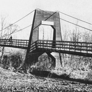 Pangburn Suspension Bridge
 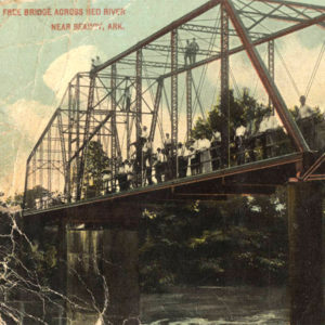 Red River Bridge
 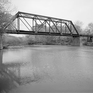 Shirley Bridge
 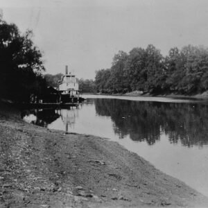 West Point Landing
 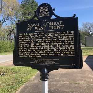 West Point Memorial
 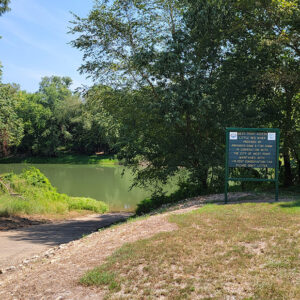 West Point River Access
 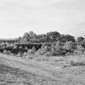 Winkley Bridge
 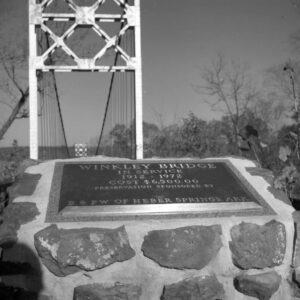 Winkley Bridge
501-918-3025
calsfoundation@cals.org
calsfoundation@cals.org
The Little Red River runs through north-central Arkansas, arising from several different forks in the Ozark Mountains. Major towns situated along the course of the river are Clinton (Van Buren County), Fairfield Bay (Van Buren County), Heber Springs (Cleburne County), and Searcy (White County), though the river also flows north of the old settlement of Georgetown (White County), where it empties into the White River. The Little Red River is dammed just east of Heber Springs, creating the reservoir of Greers Ferry Lake, which is a major regional tourist destination.
The Little Red River passes through three different natural divisions of Arkansas: the Ozark Mountains, the Arkansas River Valley, and the Mississippi Alluvial Plain (the Delta). The forks of the river arise in loblolly shortleaf pine forest and oak-hickory forest in the Ozarks. Archeologists have uncovered a number of prehistoric Native American settlements in the river valley area, mostly consisting of small, late Mississippian Period hamlets up and down the river, as well as several Indian mounds. It is likely that the expedition of Hernando de Soto passed through the river valley. The first archaeologist to conduct research in the area was Edward Palmer in 1883. The area now covered by Greers Ferry Lake was excavated by the Arkansas Archeological Survey in 1958 and yielded a number of burial sites and artifacts.
Though the river provided water and food to early American settlers, living along the river could be troublesome, as it tended to flood after rains; this meant that there were few fords where one could cross. The first ferry on the river was operated by John Standlee in 1818. Greers Ferry—from which the Cleburne County community, dam, and lake all take their name—was operated by William V. “Bud” Greer in the 1880s, just above the area then known as Tumbling Shoals. In 1885, the Cleburne County Court designated certain ferries as public ferries and regulated them. In 1912, work began on three bridges over the river, located at Miller, Tumbling Shoals, and Turney’s Ferry. The last one, called Winkley Bridge, was known locally as “Swinging Bridge” and became something of a tourist attraction after it was closed to vehicular traffic in 1972. It collapsed on October 28, 1989, however, killing five people.
The federal Flood Control Act of 1938 authorized the U.S. Army Corps of Engineers to build dams on a number of the nation’s rivers for purposes of flood control. One of the rivers designated by the act was the White River in Arkansas. Because almost yearly flooding on the Little Red River could compound flooding on the White River, the Corps chose to dam the Little Red near the town of Heber Springs. Construction on Greers Ferry Dam began in 1959 and was completed in 1962. The project was not without controversy, however, for not only did the new reservoir inundate a great deal of local farmland, but the change in water temperature below the dam killed off many native fish species. As a consequence, engineers working on DeGray Dam in southwestern Arkansas installed measures to allow for the regulation of the water released through the dam, so as to preserve fish populations downstream. On the Little Red River, the U.S. Fish and Wildlife Service established a fish hatchery to raise trout, which thrive in the colder water. This has made the river a local and national fishing destination.
In 1982, a massive flood on the Little Red River hit Clinton. In response, the U.S. Army Corps of Engineers channelized a portion of the river that runs through Clinton. However, this straightening of the river led to erosion that expanded the channel from 200 to 800 feet wide, threatening landowners, as well as the local airport. In 2012, the Nature Conservancy of Arkansas, in cooperation with several other public and private organizations, began work on restoring that section of the river.
For additional information:
Akridge, Glen, and Scott Akridge. “Late Mississippian and Protohistoric Occupation in the Little Red River Valley.” Arkansas Archeologist 39 (1998): 1–18.
Berry, Evalena. Time and the River: A History of Cleburne County. Heber Springs, AR: Cleburne County Historical Society, 1982.
Little, Charlsie B. “Ferries, Fords and Fishing Holes on the Little Red River.” Cleburne County Historical Journal 10 (Fall 1984): 93–100.
Staff of the CALS Encyclopedia of Arkansas


Comments
No comments on this entry yet.