 Bull Shoals (Marion County)
 Fly-fishing
 Salmonids
 Tourism
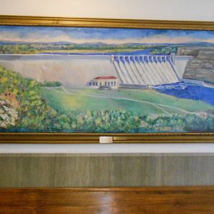 Bull Shoals Dam Painting
 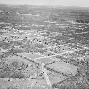 Bull Shoals Aerial View
 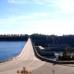 Bull Shoals Dam
 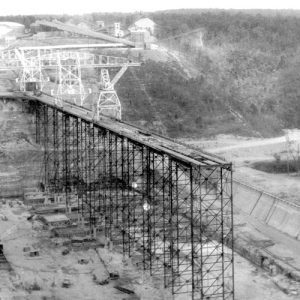 Bull Shoals Dam
 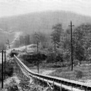 Bull Shoals Dam Conveyer Belt
 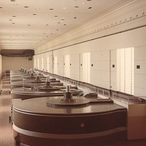 Bull Shoals Dam Power Plants
 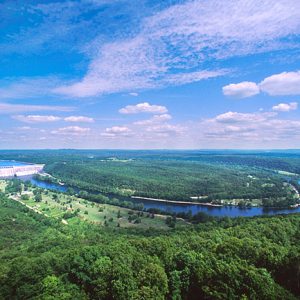 Bull Shoals-White River State Park
 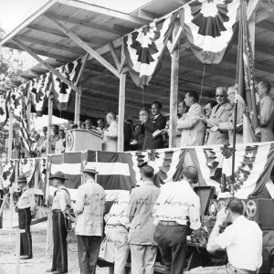 President Truman at Bull Shoals
 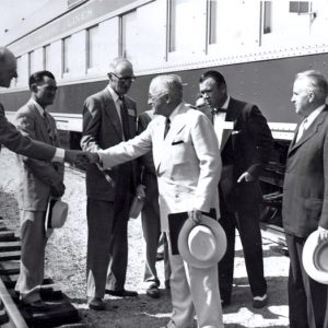 President Truman at Cotter
501-918-3025
calsfoundation@cals.org
calsfoundation@cals.org
Bull Shoals Dam site is located on the White River about ten miles west of Mountain Home (Baxter County), where the river divides Baxter and Marion counties. The site is named after its location at a shoal (a shallow and swift reach of river), borrowing from the French “Boill,” meaning a large spring.
Private power companies had explored the possibility of building a dam at Wildcat Shoals above Cotter (Baxter County) as early as 1902 but never began any work toward it. Congress approved the construction of six reservoirs in the White River Basin in the Flood Control Act of 1938. A U.S. Army Corps of Engineers report in 1930 had recommended the Wildcat Shoals site along with seven others as being the most effective of thirteen investigated. However, in a 1940 report, the Corps presented the Bull Shoals site as an alternative to the Wildcat Shoals, where unsuitable foundation conditions had been found. This report recommended the construction of Table Rock and Bull Shoals as multi-purpose reservoirs for flood control, hydropower generation, and “other beneficial purposes,” concluding the reservoir projects to be economically justifiable.
After the wartime construction of Norfork Dam by the Corps of Engineers on the tributary North Fork River in southern Baxter County from 1941 to 1945, the construction of the Bull Shoals dam began in 1947. The dam length is 2,256 feet with a maximum height of 256 feet above the stream bed. The spillway length is 808 feet. The dam contains 2.1 million cubic yards of concrete. At the time of its construction, Bull Shoals dam was the fifth largest in the country, and its powerhouse was the largest building in Arkansas. Along with its seventeen spillway gates, which are forty feet by twenty-nine feet, there are also sixteen outlet conduits that can each discharge 3,375 cubic feet per second. The flow of one of these conduits is roughly equivalent to one of the powerhouse’s eight generators running at full capacity.
When the lake is at the top of the conservation pool, there are about 740 miles of shoreline. This is increased to 1,050 miles at the top of the flood control pool. Total potential storage of the reservoir is 5.76 million acre feet. The Corps of Engineers’ reservoir controls 6,036 square miles of drainage area.
Powerhouse construction began in September 1950, and generation started in September 1952. The powerhouse and switch yard were completed in 1953, with the final two generating units installed in 1963. The powerhouse contains eight generating units. The original four generators and turbines were built by the Allis-Chalmers Company of Milwaukee, Wisconsin, and produce 42,750 kilowatts an hour. Four additional units that produce 47,500 kilowatts were added later and were built by the Newport News Shipbuilding and Drydock Company of Newport News, Virginia. The total installed plant capacity is 361,000 kilowatts. At completion, the project cost an estimated $86 million.
President Harry S. Truman spoke at the dedication of the project on July 2, 1952. The completion of the dam and reservoir immediately began to affect the local economy. Media coverage attracted attention to the region and resulted in the quick growth of the tourist industry. In 1940, there were only thirteen businesses that provided overnight accommodations. By 1970, 300 such establishments could be found. Assessed taxable real estate values, per capita income, and manufacturing payroll rose dramatically in the following decades. The area also now supports a retirement community.
The dam put an end to long, multiday fishing floats from Branson, Missouri, to Cotter. Jim Owen of the Owen Boat Line had operated a float trip business on the river for many years. Largely through Owen’s promotion, the White River garnered a reputation for excellent smallmouth bass fishing. But the new reservoir soon offered equally excellent lake fishing for a number of warm water species, as well as stocked trout below the dam. Marinas, boat businesses, and fishing guide services sprang up rapidly to handle the influx of anglers.
Public tours of the dam, which were halted after September 11, 2001, resumed in 2009 during the summer months. The James A. Gaston Visitor Center at the Bull Shoals-White River State Park overlooks the dam and organized the tours. However, the tours ended again in May 2015 for security reasons.
The Corps estimates Bull Shoals Dam to have prevented an estimated $225.5 million in flood losses through fiscal year 2009. The six-lake White River system (consisting of Bull Shoals, Norfork, Beaver, and Greers Ferry dams in Arkansas, along with Table Rock and Clearwater dams in Missouri), together with the White River Basin levees, prevented an estimated $959.9 million in flood losses through fiscal year 2009.
For additional information:
Clay, Floyd M. A History of the Little Rock District, U.S. Army Corps of Engineers, 1881–1979. 2nd ed. Little Rock: U.S. Army Corps of Engineers, Little Rock District, 1979.
U.S. Army Corps of Engineers. Bull Shoals Dam and Reservoir Project, Arkansas and Missouri, White River Watershed. Little Rock: U.S. Army Corps of Engineers, Little Rock District, 1947.
U.S. Army Corps of Engineers. Water Resources Development in Arkansas. Dallas: U.S. Army Engineer Division, Southwestern, 1995.
Scott Branyan
Rogers, Arkansas


Comments
No comments on this entry yet.