501-918-3025
calsfoundation@cals.org
calsfoundation@cals.org
| Latitude and Longitude: | 35°18’20″N 093°57’13″W |
| Elevation: | 466 feet |
| Area: | 3.12 square miles (2020 Census) |
| Population: | 296 (2020 Census) |
| Incorporation Date: | July 3, 1909 |
Historical Population as per the U.S. Census:
|
1810 |
1820 |
1830 |
1840 |
1850 |
1860 |
1870 |
1880 |
1890 |
1900 |
|
– |
– |
– |
– |
– |
– |
– |
– |
– |
– |
|
1910 |
1920 |
1930 |
1940 |
1950 |
1960 |
1970 |
1980 |
1990 |
2000 |
|
271 |
370 |
318 |
390 |
308 |
258 |
325 |
353 |
299 |
357 |
|
2010 |
2020 |
|
|
|
|
|
|
|
|
|
367 |
296 |
|
|
|
|
|
|
|
|
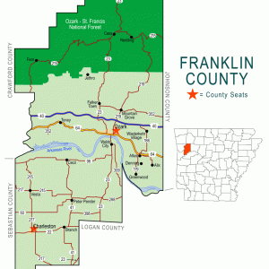
The city of Branch developed in southern Franklin County around the beginning of the twentieth century as coal mining was being conducted in the area. Located on the rail line, the city began to decline when the railroad ceased operation, but it has since become an educational hub for the region.
What is now Franklin County was hunting and fishing land for the Osage when the United States first acquired the land in the Louisiana Purchase of 1803. For a decade, the area was granted by treaty to the Cherokee, but after the Osage and the Cherokee had both been moved farther west, the land opened for settlement. Land claims were slow to develop in the area, but brothers Samuel and Thomas McFerran registered land grants in 1845 north of present-day Branch. They were joined by Thomas Aldridge in 1855 and by James Hunter and Albert Moffet in 1860. Elijah Morrison claimed land immediately east of what would become Branch in 1882.
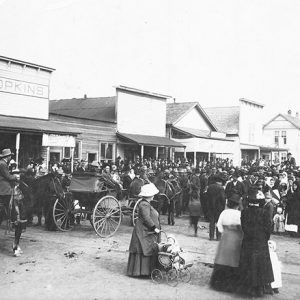
Coal was recognized and used locally, but attempts to mine it extensively for sale outside the region did not begin until the 1880s. At that time, the Arkansas Central Railroad was planned to run from Fort Smith (Sebastian County) east to the coal fields near Charleston (Franklin County) and Paris (Logan County). Construction was slow, and the rails did not reach Charleston until 1898. Building farther east, the railroad reached a site on which three men—William Bradbury, Richard Turner, and John Branch—founded the community of Branch. They originally planned to name their community Turner, since Richard Turner was appointed the first postmaster, but that name had been claimed by a post office in Phillips County in 1875. Therefore, they chose the name Branch. John Branch had built cotton and grist mills in the area, but the railroad and the coal mines brought more settlers than did agriculture. A large strip mine operated at Grand Prairie, about five miles northwest of Branch, and many of the miners lived in the city, which was incorporated in 1909. A brick high school was built around 1914. A branch railroad from the Central Arkansas (which, by 1910, had been renamed the Fort Smith, Subiaco, and Eastern Railway) was built to Grand Prairie in 1919, with a headquarters for the line located in Branch.
Some historians claim that as many as 900 people lived in Branch during the peak mining years, although census figures show fewer than 400 residents for any given census year. Coal mining in Franklin County was never as successful as that of Sebastian County, and the Fort Smith, Subiaco, and Eastern Railway eventually went out of business, running its last train in 1949.
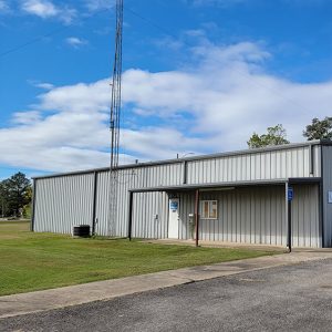
School consolidation brought new students into Branch, as the school district in Ratcliff (Logan County) was closed in 1950. Branch High School was moved to the present-day site of County Line High School three miles east of Branch in 1951. Three schools—Branch, Cecil, and Ratcliff—consolidated and the new school was built on the Franklin and Logan county line (thus the name County Line). Branch’s two-story brick grade school was in use through 1961, when a new elementary school was completed. Eventually, the County Line School District, headquartered in Branch, became one of the largest in the area. Enrollment figures in the twenty-first century report roughly 450 students, from kindergarten through high school. The offices of the West Arkansas Education Service Cooperative are also in Branch. The school district and the cooperative are the two largest employers in the city.
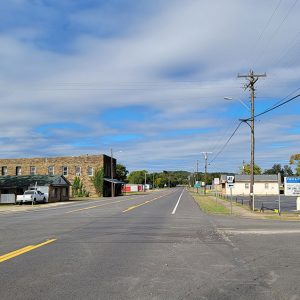
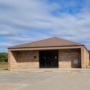
During the 1950s and ’60s, Branch had five churches: Methodist, Baptist, Free Will Baptist, Assembly of God, and Church of Christ. There were five gas stations, three grocery stores, two barber shops, two welding shops, and a post office. By the twenty-first century, businesses in the city included construction firms, an auto repair shop, a feed mill, a farmers’ cooperative, a nursery, and a convenience store, and there were at least two churches: an Assembly of God and a Baptist church. The population in 2010 was 367, predominately white; it was down to 296 by 2020.
For additional information:
Franklin County, Arkansas, Genealogy and History. http://www.rootsweb.com/~arfrankl/ (accessed June 28, 2025).
Hull, Clifton E. Shortline Railroads of Arkansas. Hart, MO: Wadsworth Publishing Company, 1997.
Steven Teske
Butler Center for Arkansas Studies


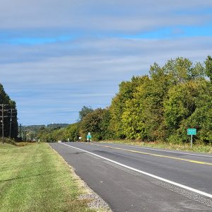
Highway 22 was the straight route for vehicles going east. That is why many of the small towns from Fort Smith to Dardanelle had several gas stations. Branch and every town on Highway 22 had two bus lines: Trailways and Greyhound. This all changed with the completion of I-40 in the late 1960s. With the interstate travel switching from the state highways like 22 to the federal highway I-40, the need for gasoline decreased. In 1962, the Norge company built the Borg Warner division and brought thousands of new jobs to Fort Smith reaching a peak of 4,500 at Whirlpool by 2005. Many people moved to Fort Smith to be closer to work. In mid-2012 the Whirlpool plant closed.