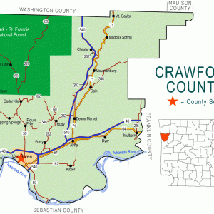
 Crawford County Map
501-918-3025
calsfoundation@cals.org
calsfoundation@cals.org
| Latitude and Longitude: | 35º25’49″N 094º13’54″W |
| Elevation: | 436 feet |
| Area: | 5.00 square miles (2020 Census) |
| Population: | 1,005 (2020 Census) |
| Incorporation Date: | December 6, 1963 |
Historical Population as per the U.S. Census:
| 1810 | 1820 | 1830 | 1840 | 1850 | 1860 | 1870 | 1880 | 1890 | 1900 |
| – | – | – | – | – | – | – | – | – | – |
| 1910 | 1920 | 1930 | 1940 | 1950 | 1960 | 1970 | 1980 | 1990 | 2000 |
| – | – | – | – | – | – | 611 | 798 | 931 | 969 |
| 2010 | 2020 | ||||||||
| 961 | 1,005 |
East of Van Buren (Crawford County) and south of Alma (Crawford County), the city of Kibler is about halfway between Interstate 40 and the Arkansas River. Although Kibler was not incorporated until 1963, its roots go back to a nineteenth-century settlement originally known as Prairie Grove. Early in the twentieth century, the community (like several others in Crawford County) benefited from the discovery of natural gas deposits in the region.
The Arkansas River was a natural transportation route for Native Americans and for early European explorers, but the hilly region of Kibler did not draw the attention of settlers until late in the nineteenth century. John Kibler is said to have arrived from Germany in the 1840s, but the earliest land record bearing the family name credits Mary Kibler as the landowner; her claim dates to December 1882. Fred Bushmiaer and Thomas Miles Garner were among the other early landowners in the area. A Methodist church met in the home of George Brunk starting around 1886, and a Landmark Missionary Baptist church was established in the area around 1899. A one-room schoolhouse was also established before the beginning of the twentieth century.
Tom Kibler started a store at the crossroads of the small community around 1900. G. T. Cazort opened a competing store with a cotton gin in 1903. Around this time, the community began to call itself Kibler Crossroads, or simply Kibler. The Methodists erected a new church building in 1903, and the Baptists added a structure of their own in 1908. By this time, the settlement also included a grist mill and a blacksmith shop.
Wells for natural gas were dug in 1914 on the Binks Kibler farm, followed by similar wells the next year on the Dave Cox farm. A sawmill was built to harvest trees in order to clear land for gas wells and for cotton farms. The first shallow wells were soon exhausted, but deeper wells were drilled, and mining continued. The community grew slowly, and the school district was consolidated with Cross Lanes, Newtown, and Yoestown, all in Crawford County. Eventually, these schools all became part of the Van Buren School District.
Kibler was incorporated in December 1963, with Thell Nelson serving as the first mayor. By the 1970s, the city had incorporated four and a half acres and held a population of 611. An Assembly of God joined the Methodist and Baptist churches, and two nursery businesses were established: Bryant Green House and Parks Nursery. Highway 162, which runs through Kibler, is called Kibler Highway in Crawford County. In 2013, the Arkansas Oil and Gas Commission reported seven active natural gas wells in the Kibler area.
For additional information:
Eno, Clara B. History of Crawford County, Arkansas. Van Buren, AR: Press-Argus, n.d.
Garner, T. J. “Early Recollections of Kibler.” The Heritage 10 (April 1967): 15–16.
History of Crawford County, Arkansas. Van Buren, AR: Historical Preservation Association of Crawford County, Arkansas, 2001.
Steven Teske
Butler Center for Arkansas Studies


I wonder why Kibler doesn’t have its own address.