501-918-3025
calsfoundation@cals.org
calsfoundation@cals.org
| Latitude and Longitude: | 36°27’12″N 090°08’43″W |
| Elevation: | 299 feet |
| Area: | 0.35 square miles (2020 Census) |
| Population: | 218 (2020 Census) |
| Incorporation Date: | August 4, 1888 |
Historical Population as per the U.S. Census:
|
1810 |
1820 |
1830 |
1840 |
1850 |
1860 |
1870 |
1880 |
1890 |
1900 |
|
– |
– |
– |
– |
– |
– |
– |
– |
356 |
420 |
|
1910 |
1920 |
1930 |
1940 |
1950 |
1960 |
1970 |
1980 |
1990 |
2000 |
|
459 |
501 |
294 |
266 |
292 |
224 |
297 |
266 |
201 |
250 |
|
2010 |
2020 |
|
|
|
|
|
|
|
|
|
250 |
218 |
|
|
|
|
|
|
|
|
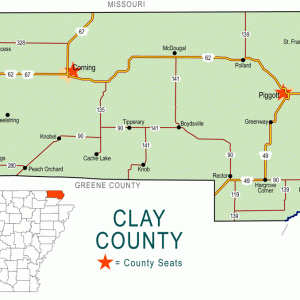
The city of St. Francis in northeastern Arkansas was a prosperous community relying on the timber industry in the late nineteenth and early twentieth centuries. Since that time, it has remained a quiet community adjacent to the Missouri bootheel.
North of St. Francis lies Chalk Bluff, the name of the white clay outcroppings that constitute the northern face of Crowley’s Ridge. A military road crossed the St. Francis River at this location, and a ferry served travelers using the road. Around 1840, the first permanent settlers arrived. They included Abraham, Jacob, David, and George Seitz, who raised horses and cattle, operated the ferry, and ran a small store to provision travelers. In 1850, a post office with the name of Chalk Bluff was established in the Seitz store, and by 1860, the community had three churches, three merchants, two doctors, a brick mason, a gunsmith, a blacksmith, a cabinet maker, and a surveyor.
The bluff was a strategic point for controlling transportation between Missouri and Arkansas, so it saw considerable military action during the course of the Civil War. In May 1862, Federal forces attacked the community, successfully destroying Confederate supplies. In March 1863, Federal forces struck again, destroying the ferry and burning several buildings. Confederate forces attacked a Federal force in Missouri from Chalk Bluff in April 1863. The largest skirmish, though, was fought on May 1 and 2, 1863, when General John S. Marmaduke attempted to capture Federal supplies in Missouri. The Confederate raid failed because of the strength of Federal forces, and Marmaduke’s retreat from Missouri led him to cross the river at Chalk Bluff, using a floating log bridge, while resisting pursuers. The number of soldiers wounded and killed during this skirmish is unknown.
A Masonic lodge was organized in the area with thirty charter members in 1867. They met first in a Presbyterian church and later in a one-room schoolhouse. However, in 1868, the post office at Chalk Bluff closed. In 1882, the St. Louis Southwestern Railroad (commonly called the Cotton Belt) constructed a narrow gauge railway across southern Missouri and northeastern Arkansas with a wooden bridge spanning the St. Francis River less than two miles from the community of Chalk Bluff. Racial tension accompanied the railroad construction, as African-American construction workers were threatened by anonymous citizens of the area and reportedly refused to enter Clay County. Residents and businesses of Chalk Bluff relocated to a spot adjacent to the tracks, and the new community took the name St. Francis from the river, which had been named for Francis of Assisi, an ascetic Christian mystic of thirteenth-century Italy. A post office was opened at St. Francis in 1882.
The railroad gave life to the timber industry of northeastern Arkansas, and the timber industry gave life to the city of St. Francis. Methodist and Baptist churches were organized, along with the older Presbyterian congregation, which completed its new building in St. Francis in 1890. By 1892, the city had five two-story hotels, a bank, and a school, as well as a dozen mills and factories. Hunting and fishing also drew travelers into the area, and a group of wealthy men from St. Louis, Missouri, established a sportsmen’s clubhouse in St. Francis. A saloon was built on the Missouri end of the bridge. Called “Last Chance,” it was frequented by the workers of St. Francis every Saturday night after they had received their week’s wages.
By 1915, much of the timber had been removed, and the cleared land was being farmed by local landowners. As a result, the population of St. Francis declined from its reported peak population of 1,500. Empty homes and businesses often were destroyed by fire. In 1928, the railroad bridge was replaced by a steel draw span.
By 1947, St. Francis had four stores, a schoolhouse, two churches, one cotton gin, and several other small businesses, including a gas station. Clay County Air Conditioning built a plant on the west side of St. Francis, offering some jobs to the dwindling population. School consolidation put the children of St. Francis into the Piggott (Clay County) school district, and no school buildings of that district are located in St. Francis. The town’s St. Francis Baptist Church shares its surprising name with at least two other congregations in the United States. Every June, the “Battle of Chalk Bluff” is reenacted, drawing tourists and historians to the area.
Writer Clyde Crosley was born in St. Francis.
For additional information:
Gillespie, J. Lewis. “The Boom and ‘the Bust’ of St. Francis.” Arkansas Democrat Sunday Magazine, October 19, 1947, p. 10.
Ponder, Jerry. The Battle of Chalk Bluff: An Account of General John S. Marmaduke’s Second Missouri Raid. Doniphan, MO: Ponder Books, 1994.
Steven Teske
Butler Center for Arkansas Studies


I enjoyed reading about the little community where I have been living for the past nine years. I moved up here with my husband from Louisiana but my husband is originally from here.