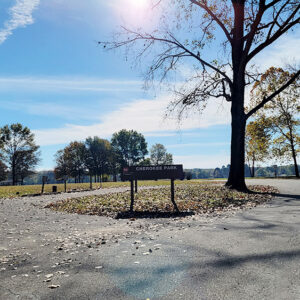
 Cherokee Park
 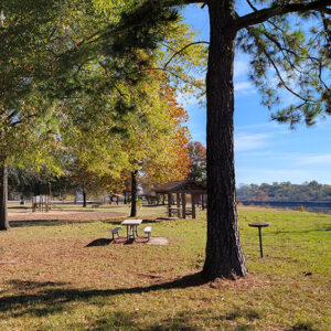 Cherokee Park
 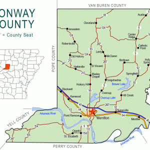 Conway County Map
 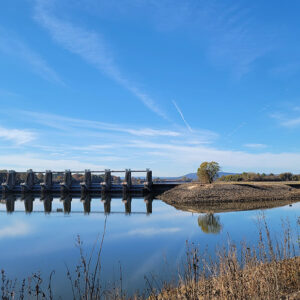 Lock & Dam No. 9
 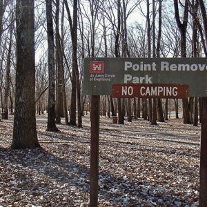 Point Remove Park
 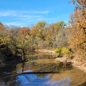 Point Remove Creek
 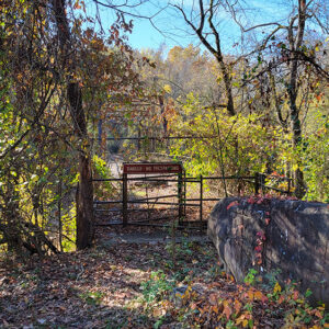 Point Remove Creek
501-918-3025
calsfoundation@cals.org
calsfoundation@cals.org
The designation of “Point Remove,” popularly employed to describe the confluence of Point Remove Creek in Conway County with the Arkansas River, is almost certainly derived from the French word remous, meaning “eddy” or “whirlpool.” Most instances of the term in early nineteenth-century documents follow this usage. However, the name “Point Remove” was later mistakenly connected to Indian Removal in Arkansas, supposedly marking the principal geographic point in the description of the boundary of Cherokee land in Arkansas, prior to the Cherokee population’s later relocation to Indian Territory (present-day Oklahoma).
William Lovely used the term “point remove byo,” the abbreviation “byo” meaning “bayou” and thus designating the creek, in a public document in 1813. In his book Journal of Travels into the Arkansas Territory during the year 1819, naturalist Thomas Nuttall identified the location as “Point Remu,” perhaps indicating that the name was a corruption of the French remous. Likewise, an account of the 1819–1820 expedition of Major Stephen Long named the site “Point Remove, or Eddy Point creek,” also demonstrating a linkage with the French meaning of the term. The term “remove” thus predates the formal policy of Indian Removal.
The Treaty of the Cherokee Agency set aside land for the Cherokee in Arkansas, drawing a boundary line from “Budwells Old Place” at the mouth of Point Remove Creek in a northeasterly direction to the White River at Shields Ferry near Batesville (Independence County), about seventy-one miles away. The remainder of the reservation was designed to provide the sufficient acreage to replace the lands that were to be abandoned east of the Mississippi River, but the western boundary line was not firmly established, as many of the Western Cherokee disputed the amount of land involved. The newly created line became the western boundary of the Arkansas Territory and the eastern line of the Cherokee reservation. Describing this boundary line in 1828, the year the Cherokee were forced to give up their land in Arkansas, Governor George Izard noted that it began at “Pointe au Remou,” again pointing to the French derivation of the term.
However, over the years, the term “Point Remove” became conflated with the policy of Indian Removal. Probably the first to make this error was U.S. senator Sam Houston of Texas in 1854. Houston had lived among the Cherokee in Arkansas from 1829 to 1832, after they had formally ceded their lands in the state, and may have been unaware of the original meaning of the term “Point Remove.” Later historians likewise misinterpreted the origin of the name.
Any sort of permanent community failed to develop at Point Remove because of various factors, including the transitional population, distance from authorities, and low-lying terrain. By the time of the 1820 federal census, only a handful of families had settled in the vicinity of the mouth of Point Remove Creek on both sides of the Arkansas River. In 1827, one of the important duels in Arkansas history took place in the area. The duel involved two factional leaders of the territory: Ambrose Sevier and Thomas Newton (the challenger). Neither duelist was injured, their “honor” was preserved, and both eventually had Arkansas counties named for them. However, the duel, combined with the border status of the area, fed into the area’s reputation for lawlessness.
The name Point Remove continued to be applied to developments in the area. The Point Remove Bridge was built around 1893 and remains a historic site, representing bridge construction techniques of the era. A post office called Arthur was established in the area in 1880; it underwent a number of name changes, including to Point Remove, before being closed in 1915, with mail routed to Solgohachia (Conway County).
With the Arkansas highway bridge constructed in 1917–1919 as a permanent crossing of the Arkansas River near Lewisburg (Conway County), the area was abandoned completely. Because the area was isolated but with a decent roadway, it was destined to become a dumping ground. During the period from the early 1930s to the late 1960s, it became the Morrilton (Conway County) city dump. Environmental laws and the development of the McClellan-Kerr Arkansas River Navigational System forced the clean-up of the dumping area.
A small, relatively unmarked park with a few picnic tables is the modern-day setting for this early settlement. A much more active and well-developed park and campsite called Cherokee Park now exists along the river a short distance downstream. The Old Cherokee Boundary Line continues to be an important land demarcation point, referenced in deed and title issues.
For additional information:
Conway County, Arkansas: Our Home, Our Land, Our People. Little Rock: Historical Publications of Arkansas, 1992.
Higgins, Donald. “Point Remove Creek and the Cherokees, Part 1: Prehistoric and Historic Native Americans in the Petit Jean Country.” Petit Jean Country Headlight, No. 32, October 9, 2019, pp. 1–2.
———. “Point Remove Creek and the Cherokees, Part 2: The Point Remove Creek Landmark.” Petit Jean Country Headlight, October 16, 2019, pp. 1–2.
———. “Point Remove Creek and the Cherokees, Part 3: The Cherokee Reservation in Arkansas.” Petit Jean Country Headlight, October 23, 2019, pp. 1–2.
———. “Point Remove Creek and the Cherokees, Part 4: The Trail of Tears.” Petit Jean Country Headlight, October 30, 2019, pp. 1–2.
Treaty of the Cherokee Agency, July 8, 1871. GeorgiaInfo. http://georgiainfo.galileo.usg.edu/cheragen.htm (accessed February 22, 2022).
Larry Taylor
Springfield, Arkansas


Comments
No comments on this entry yet.