 Carden Bottom
 Petit Jean, Skirmish at
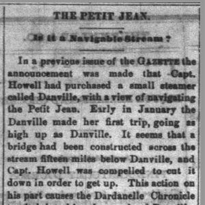 Danville Article
 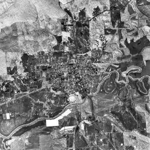 Danville Aerial View
 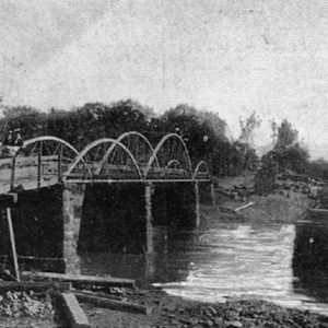 Ola Bridge
 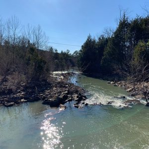 Petit Jean River
 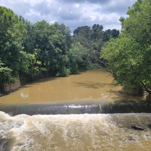 Petit Jean River
 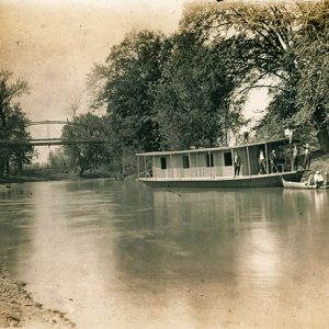 Petit Jean River at Danville
 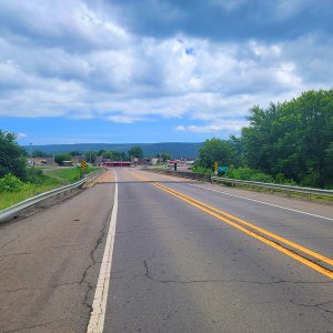 Petit Jean River Bridge
501-918-3025
calsfoundation@cals.org
calsfoundation@cals.org
The Petit Jean River rises from the confluence of several streams in the northern Ouachita Mountains of western Arkansas near Waldron (Scott County). From there, it flows primarily eastward for 113 miles before emptying into the Arkansas River just north of Petit Jean State Park. Many ascribe the name of the river, and of Petit Jean Mountain, to the legend of a young French woman who disguised herself as a man to follow her lover to the New World, though others believe the original French name of the river to have been Petit Jaune, or “little yellow,” possibly in reference to the river’s color. The river is dammed just west of Havana (Yell County), creating Blue Mountain Lake. It is the largest river to flow entirely within the Arkansas Valley natural division.
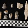
Like the rest of Arkansas, the Petit Jean River valley has been the site of human habitation since approximately 10,000 BC. Local histories record the presence of numerous Indian mounds in the area, and Native American rock art (pictographs and petroglyphs) has been found in caves along the river. The 1541–1542 expedition of Hernando de Soto likely touched upon the Petit Jean River, and the French later explored the area, giving place names not only to the river but also to other local features. Some Cherokee settled in the area in the late 1790s and early 1800s, though they later accepted land north of the Arkansas River in exchange for their ancestral holdings back east. Early American settlers established farms along the river’s bottomlands and grew cotton.
The Petit Jean River has never developed into a major transportation corridor. Local histories assert that the steamship Danville did progress up the river in 1840, lending its name to the city of Danville (Yell County), which was laid out the following year. However, this seems to be in error. The steamboat Ben Coursin ascended the Petit Jean to Danville in 1861, leading the Arkansas General Assembly to designated the river as being navigable. It was not until 1872 that a Captain Howell brought his steamboat Danville to the town and began a regular trade before that the river was considered viable for riverine commerce.
Danville remains the largest community established along the river. In 1879, a 100-foot bridge over the Petit Jean River was constructed at Danville. During the 1890s, the Choctaw Railroad constructed a line linking Little Rock (Pulaski County) with the town of Howe in Indian Territory (present-day Oklahoma). This line crossed the Petit Jean River at Danville. The development of the railroad led to the growth of the timber industry along the river.
In the early twentieth century, state and federal officials sought to control flooding in the Petit Jean River valley. Many of the feeder streams that emptied into the Petit Jean were dammed, and work began in 1940 on damming the river itself. However, work halted in 1942 as World War II drew government resources away from civilian projects. Work picked up again after the war, and the dam was completed in June 1947. The resulting reservoir is known as Blue Mountain Lake and is a popular local attraction. The Blue Mountain Wildlife Management Area (WMA) surrounds the lake, providing hunting and fishing opportunities.
The Petit Jean River remains a well-known attraction in the state and is popular with canoeists. Aside from the Blue Mountain WMA, the river also flows through the Petit Jean WMA. The stretch of river from approximately Booneville (Logan County) in the west to Danville in the east flows between the Ouachita National Forest and a section of the Ozark National Forest. Holla Bend National Wildlife Refuge is situated east of the river’s mouth. However, the most popular site along the river is likely Petit Jean State Park.
For additional information:
Blue Mountain Lake. U.S. Army Corps of Engineers, Little Rock District. https://www.swl.usace.army.mil/Missions/Recreation/Lakes/Blue-Mountain-Lake/ (accessed February 9, 2022).
Yell County Historical and Genealogical Association. Yell County Heritage: A History of Yell County, Arkansas. Bedford, TX: Curtis Media, Inc., 1997.
Staff of the CALS Encyclopedia of Arkansas


Comments
No comments on this entry yet.