 Central Arkansas Water
 Early Twentieth Century, 1901 through 1940
 Environment
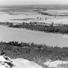 Geography and Geology
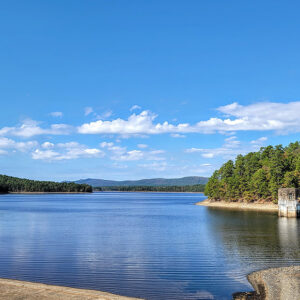 Lake Winona
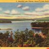
 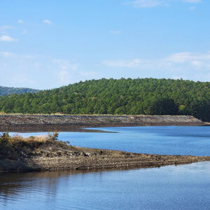 Lake Winona Dam
 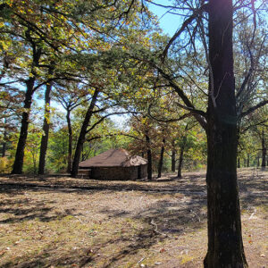 Lake Winona Picnic Area
 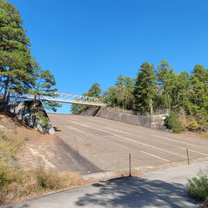 Lake Winona Spillway
 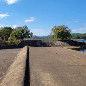 Lake Winona Spillway
 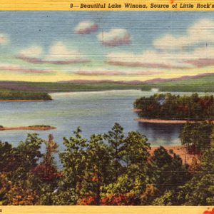 Lake Winona
 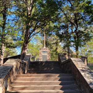 Water Works Monument
 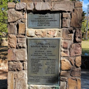 Water Works Monument
 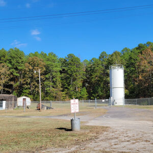 Waterworks
501-918-3025
calsfoundation@cals.org
calsfoundation@cals.org
Lake Winona is a manmade lake located thirty-five miles west of Little Rock (Pulaski County) in the Ouachita National Forest near the community of Paron (Saline County). Winona has a surface area of 1,240 acres and a watershed of forty-three square miles. In 1968, Lake Winona, Lake Sylvia, and Bear Creek Lake became part of the 174,782-acre Winona Wildlife Management Area overseen by the Arkansas Game and Fish Commission. The land is owned by the U.S. Department of Agriculture and Green Bay Packaging, Inc. Lake Winona supplies thirty-five percent of the area’s fresh drinking water in the twenty-first century.
Before Lake Winona was built, the land was home to the Saline County community of Walnut Bottom. In addition to subsistence farming, lumber was the largest industry in early Saline County. The Cedar Valley Lumber and Tie Company and the Neimeyer Lumber Company operated in Walnut Bottom before the Great Depression. The two companies utilized temporary rail lines and steam-powered mills. Teams of men would clear an area and then lay more track and repeat the process as they moved along. In the early 1930s, the Civilian Conservation Corps (CCC), a New Deal–era program formed by President Franklin D. Roosevelt, established a camp at Walnut Bottom north of where Lake Winona is now located. The former campground is now under water, but when the water is low, many bridges and other structures built by the CCC can be seen above the lake’s surface.
In 1934, Little Rock’s Chamber of Commerce Water Committee decided to find a new water source. In 1935, the City of Little Rock applied to the Public Works Administration (PWA) for funds to develop a new water supply system. Previously, the Arkansas River was the area’s main water source, but by then its waters were considered unsafe for drinking. Newly elected Little Rock mayor Richard E. Overman promised to secure a new water source for the area. The City of Little Rock’s proposal to build a new reservoir on the Alum Fork of the Saline River was denied because the city did not own its water distribution system. The application was revised on the basis that the city would purchase the Arkansas Water Company’s properties in Saline County, thereby creating a municipal water system that would service Little Rock and North Little Rock (Pulaski County).
In 1936, the City of Little Rock sold $6.59 million in four-percent, forty-year, non-callable bonds (bonds that cannot be redeemed early). It then purchased a plant and distribution system on the south side of the Arkansas River from the Arkansas Water Company for $3.85 million and started construction of a dam on the Alum Fork of the Saline River. After the city took ownership of the utility on April 1, 1935, construction began on what was then called the Alum Fork Reservoir. Many residents were relocated and landmarks uprooted in the process, including a cemetery and a church that were moved to the nearby Reform (Saline County) community. The WPA purchased rocks from residents at $5.00 per truck load. The rocks were then used to construct buildings, walls, and walkways, and some were placed on the Alum Fork Dam for riprap (stones thrown together without order to form a wall).
The resulting lake was named Lake Winona, supposedly after a commissioner’s wife. A thirty-nine-inch-diameter, thirty-five-mile-long water line was constructed from Winona to Little Rock. A purification plant at Ozark Point was built to keep the water clean, and a reservoir three miles to the west provided storage. Burns and McDonnell Engineering Company of Kansas City, Missouri, oversaw the project. Construction began in July 1936 and was completed in May 1938.
The first water from the new system flowed into Little Rock on April 17, 1938. In 1941, the WPA’s travel guide listed Lake Winona as the “principal source of Little Rock’s water supply.” Little Rock later had to expand its water supply. Construction of Lake Maumelle began in 1956 and finished in 1958. These two lakes provide clean drinking water to the area in the twenty-first century.
The Lake Winona Dam is 115 feet high and 2,800 feet long. It holds back 14 billion gallons of water, which make up the lake. Central Arkansas Water (CAW) owns both Lake Winona and Lake Maumelle. The reservoir of the public drinking water system provides water to a population of 398,000. Lake Winona itself is used for recreational activities in a restricted area, and guidelines set by the CAW Board and the U.S. Forestry Service help keep people from polluting the lake and its surrounding areas. Lake Winona is classified as “fishing only,” so boating is allowed but not near the dam where water is collected for purification. The lake is stocked with bass, crappie, and catfish. The lake and its grounds are used for outdoor activities like camping, hiking, and picnicking.
For additional information:
Anderson, Joel E., Gary D. Chamberlin, Jeffrey B. Connelly, Michael R. Hemphill, Roby D. Robertson, and Ashvin P. Vibhakar. “Water for Our Future: Overcoming Regional Paralysis.” A report by the Water Study Task Force. University of Arkansas at Little Rock, September 2000.
“Lake Winona.” Arkansas Department of Parks and Tourism. https://www.arkansas.com/lake/lake-winona/76 (accessed November 7, 2022).
“Mountain Water for Little Rock.” Engineering News-Record, November 19, 1936, pp. 718–720.
Works Progress Administration. WPA Guide to 1930s Arkansas. Lawrence: University Press of Kansas, 1987.
Cody Lynn Berry
Benton, Arkansas


The Neimeyer Lumber Company’s railroad (the Little Rock, Maumelle and Western) ran from a connection with the St. Louis, Iron Mountain and Southern railroad just south of Asher out to Lake Winona. That line ran past the Neimeyer Feed Mill on Asher, through UALR’s property, down 12th Street, followed Markham Street, Rock Creek Trail, went through Ferndale and then on to Lake Winona. Michael Hood has an excellent video on YouTube called “In Search of the Little Rock Maumelle and Western Railroad.”