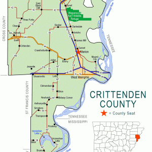
 Crittenden County Map
 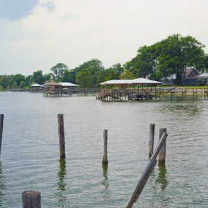 Horseshoe Lake
501-918-3025
calsfoundation@cals.org
calsfoundation@cals.org
| Latitude and Longitude: | 34º54’48″N 090º18’26″W |
| Elevation: | 203 feet |
| Area: | 0.15 square miles (2020 Census) |
| Population: | 264 (2020 Census) |
| Incorporation Date: | September 19, 1983 |
Historical Population as per the U.S. Census:
|
1810 |
1820 |
1830 |
1840 |
1850 |
1860 |
1870 |
1880 |
1890 |
1900 |
|
– |
– |
– |
– |
– |
– |
– |
– |
– |
– |
|
1910 |
1920 |
1930 |
1940 |
1950 |
1960 |
1970 |
1980 |
1990 |
2000 |
|
– |
– |
– |
– |
– |
– |
– |
– |
298 |
321 |
|
2010 |
2020 |
|
|
|
|
|
|
|
|
|
292 |
264 |
|
|
|
|
|
|
|
|
The town of Horseshoe Lake is located on the old Seyppel area in Crittenden County at the east end of the lake from which it takes its name. Horseshoe Lake is predominately a bedroom community, with the surrounding area consisting of farmland where cotton, feed corn, soybeans, and milo are grown. Some cattle are also raised on the high ground of the levee.
The Great River Road encircles the lake. Several legendary blues musicians, including B. B. King, Howlin’ Wolf, and Hurbert Sumlin, once played in juke joints on the plantations.
Pre-European Exploration
The remnants of Native American civilizations surround Horseshoe Lake. The oldest recorded Indian mounds in the area are believed to be pre-Mississippian, as evidenced from artifacts found dating back to around AD 600. However, many mounds have been completely eroded over the years from farming operations, while others have been looted.
Louisiana Purchase through the Gilded Age
Mosquito-borne diseases and frequent flooding deterred early colonization of the area. Soon after the War of 1812, the land was surveyed and given to soldiers who fought in the war for payment for their services. Horseshoe Lake is visible as a large oxbow on the survey maps from this time. In 1825, Crittenden County was carved out of Phillips County, and four township divisions were created in the county. One of these was Lucas Township, which encompassed the Horseshoe Lake community.
To make this rich bottomland more productive and to help prevent the encroachment of the Mississippi River at flood stage, the Swamp Land Act of 1850 gave patents to levee builder Isaac Burgett, who built a lavish home at what is present-day Seyppel. The Burgett house was said to have been used as a hospital for Union soldiers during the Civil War. The home remained standing until the 1930s.
According to historian Margaret Woolfolk, it is believed that the Horseshoe Lake area was the site of a skirmish with Texas Rangers during the Civil War.
Early Twentieth Century
During the early twentieth century, hunters and lumbermen discovered the lake. It was dammed at Lost Lake Bayou, raising the water level by over six feet. This made it possible to float timber directly from the area to the Mississippi River, where a sawmill was built to process the lumber. Russell Gardner of St. Louis, Missouri—maker of the Banner Buggy and Gardner Automobile—purchased 1,200 acres along the river for his private hunting reserve, and it was named Bruin for the many bears in the area. Five Lakes Outing Club was established by Memphis, Tennessee, residents as a hunting club on the land in the middle of the horseshoe of the lake. They purchased land from Gardner and the Fritz family, among others, and established an immense hunting and fishing reserve for the club’s forty-five members; it is still in operation in the twenty-first century. The Horseshoe Recreation Club was established around the same time and is also still in existence.
J. O. E. Beck purchased land on the western side of the lake, stretching to Hughes (St. Francis County). He cleared the land of trees and drained the swampland, putting in over 9,000 feet of drainage tiles some ten feet deep. Bob Snowden purchased 1,000 acres on the northwestern side of the lake and established a commissary known as Baugh Store, which had the first frozen food lockers in the area. Gus Zanone purchased land on the northeastern side of the lake on which to build cabins, and E. H. Clarke Sr. purchase farm land east of the lake.
The depth of the lake has been the subject of numerous court cases. The first case was when Five Lakes Outing Club wanted to reclaim land that was flooded after the levee was completed in 1905, increasing the depth of that lake as much as seven feet. The club was allowed to pump water out of the lake and did this for a number of years until the pump broke. The last break in the levee that affected the area was in 1912 and occurred at what is now known as Blue Lake. The floods of 1927 and 1937 also inundated the lake area. Beck and Snowden dug a canal to drain the lake to prevent flooding after the Flood of 1937, but the draining of the lake was opposed, and the lake’s water level remained the same.
World War II through the Faubus Era
During World War II, the farms in the area were desperate for help, as many of the farmers and field hands were serving in the military. The government assisted by establishing a German prisoner-of-war camp about six miles from Horseshoe Lake, in an area now known as Anthonyville.
Roads and bridges were soon built over the Mississippi River, and transportation to the lake moved on wheels instead of water. Many of the river landing post offices moved inland off the levee during this period, with the Seyppel post office being one of the last to close, in 1948.
Jack Rich, a developer, created the Horseshoe Lake Estates subdivision in 1965 and sold more than 400 plots of land. All homeowners in the subdivision automatically became members of the Surf Club, which provided the area with water, a club house, a pier, a boat ramp, a canal, a common greenway on the south side of the canal, and a marina to dock boats. The Surf Club is still in existence in the twenty-first century.
Modern Era
Mechanized farming reduced the need for a large work force to maintain the farms. Tenant houses that once lined the farm roads were torn down, and the population of the area went into a steep decline. The present-day population largely consists of retirees, sportsmen, and a few remaining farmers. The nearest school to the area is in Hughes, about eight miles away.
Residents of the Horseshoe Lake Estates subdivision voted to incorporate in 1983, thus creating the town of Horseshoe Lake. The town provided for a fire department, took over the city’s water supply, and installed a sewer treatment system.
The W. G. Huxtable Pumping Plant near Marianna (Lee County), completed in 1977, stopped the flooding but also prevented runoff, keeping the lake from replenishing itself. Droughts brought the lake to new lows, and canals dried up, diminishing access to the lake. A vote was taken in 2007, and the Horseshoe District was formed, taxing homeowners around the lake in order to fund the installation of ten pumps to maintain the water level. The drainage canal once built by Beck and Snowden was cleared of brush and widened, and a gate was installed across the bayou to keep the water level constant and prevent flooding.
Only one grocery, Bonds Store, remains in the Horseshoe area, serving as a hub of local activity. Summer brings an influx of people from Memphis to the lake. The owners of the property surrounding the lake have sold many lots for summer and retirement homes, renovating or replacing the cabins and tenant houses that once stood there.
Horseshoe Lake has an art gallery, Plantation Gallery, to showcase the works of artists throughout the Delta. Several celebrities were raised in the area, including actor Michael Beck, best known for his role in the 1979 film The Warriors; Memphis musician Lee Baker, guitarist for the bands Electric Blue Watermelon and Mudboy and the Neutrons; and Baker’s son, actor Robert Baker, who has appeared in numerous television shows.
For additional information:
Dye, David H., and Cheryl Anne Cox, eds. Towns and Temples along the Mississippi. Tuscaloosa: University of Alabama Press, 1990.
Phillips, Phillip, James A. Ford, and James B. Griffin, eds. Archaeological Survey in the Lower Mississippi Alluvial Valley, 1940–1947. Tuscaloosa: University of Alabama Press, 2003.
Woolfolk, Margaret. A History of Crittenden County, Arkansas. Marion, AR: 1991.
Nikki Walker
Horseshoe Lake, Arkansas


Comments
No comments on this entry yet.