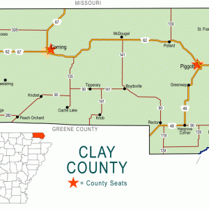
 Clay County Map
 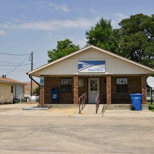 McDougal Post Office
 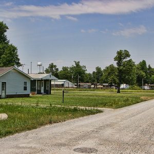 McDougal Street Scene
 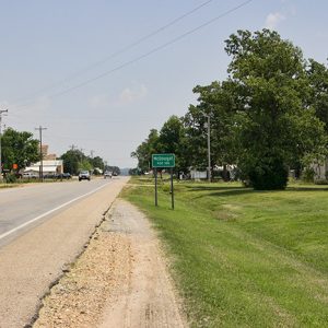 McDougal Street Scene
501-918-3025
calsfoundation@cals.org
calsfoundation@cals.org
| Latitude and Longitude: | 36°26’24″N 090°23’29″W |
| Elevation: | 295 feet |
| Area: | 0.37 square miles (2020 Census) |
| Population: | 134 (2020 Census) |
| Incorporation date: | December 14, 1954 |
Historical Population as per the U.S. Census:
|
1810 |
1820 |
1830 |
1840 |
1850 |
1860 |
1870 |
1880 |
1890 |
1900 |
|
– |
– |
– |
– |
– |
– |
– |
– |
– |
– |
|
1910 |
1920 |
1930 |
1940 |
1950 |
1960 |
1970 |
1980 |
1990 |
2000 |
|
– |
– |
– |
– |
– |
200 |
328 |
239 |
208 |
195 |
|
2010 |
2020 |
|
|
|
|
|
|
|
|
|
186 |
134 |
|
|
|
|
|
|
|
|
McDougal is a city in Clay County on U.S. Highway 62 about halfway between Piggott (Clay County) and Corning (Clay County), the two county seats. Established as a railroad depot early in the twentieth century, McDougal did not incorporate as a city until 1954. Because of its location on the highway, it has survived into the twenty-first century while similar railroad towns have disappeared.
Northeastern Arkansas is part of the Mississippi Alluvial Plain (commonly called the Delta). As such, the land was covered with swamps and hardwood forests when it was acquired by the United States in the Louisiana Purchase of 1803. The New Madrid Earthquakes of 1811–1812 changed the contour of the area, diminishing the interest of settlers in the site that would become McDougal. Throughout the nineteenth century, the land remained unclaimed and remote.
In 1914, the Butler County Railroad of southeastern Missouri extended a branch line connecting Piggott to Poplar Grove, Missouri. The branch line ran deep into the hardwood forests west of Crowley’s Ridge, providing a way to move harvested timber out of the area. Three towns were established along the railroad: McDougal, Hickoria, and Tipperary. While the other two communities were probably named for the local hardwood trees and for a community in Ireland, respectively, it appears that McDougal was named for a railroad worker.
The first two settlers near the McDougal depot were Bill Down and Bob Burton. They were joined in June 1914 by John McCullom and M. V. Murrow. Murrow soon established the only store in McDougal. Tom Russell owned and operated a mill in McDougal into the 1930s. A post office was opened at McDougal in 1916.
Within a dozen years, the timber had been harvested, and the population began to decline in all three communities. In 1927, the St. Louis–San Francisco Railway (commonly called the Frisco) acquired the Butler County Railroad branch and began removing the rails from McDougal to Tipperary. Two building projects allowed McDougal to survive. First, several drainage ditches were dug through the area, part of the drainage system that feeds into the Cache River in southwestern Clay County. Not only did this project provide temporary work, but it also improved farming conditions on the land around McDougal. Second, a national highway, Highway 62 from New Mexico to New York, was established early in the 1930s. Using local roads in areas around Bentonville (Benton County), Harrison (Boone County), and Eureka Springs (Carroll County), this highway also cuts through Clay County, running through the two county seats and reaching St. Francis (Clay County) before briefly cutting through Missouri and Illinois on its route to the Niagara Falls area in New York. McDougal lies just north of this major highway.
McDougal was incorporated in 1954, probably to provide residents with paved streets and local water and sewer services. The city remained quiet through the following decades, with the population remaining above 200 residents through 1990. By 2000, the population had dipped below 200, and it fell to 186 in the 2010 census and 134 in 2020. In 2010, businesses included a farm center, an auto sales business, a convenience store, and a regional center for Clay County Regional Water.
For additional information:
Webb, Robert W. History and Traditions of Clay County. Mountain Home, AR: Shiras Bros. Print Shop, 1933.
Steven Teske
Butler Center for Arkansas Studies


I’m wondering when the movie show was in McDougal, Arkansas? It’s a church now and has been for I know eighty years.