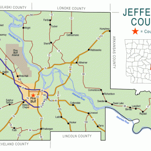
 Jefferson County Map
 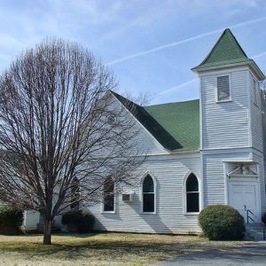 Sherrill United Methodist
501-918-3025
calsfoundation@cals.org
calsfoundation@cals.org
| Latitude and Longitude: | 34°23’07″N 091°57’02″W |
| Elevation: | 217 feet |
| Area: | 0.13 square miles (2020 Census) |
| Population: | 53 (2020 Census) |
| Incorporation Date: | May 25, 1935 |
Historical Population as per the U.S. Census:
|
1810 |
1820 |
1830 |
1840 |
1850 |
1860 |
1870 |
1880 |
1890 |
1900 |
|
– |
– |
– |
– |
– |
– |
– |
– |
– |
– |
|
1910 |
1920 |
1930 |
1940 |
1950 |
1960 |
1970 |
1980 |
1990 |
2000 |
|
– |
– |
– |
258 |
263 |
241 |
208 |
161 |
55 |
126 |
|
2010 |
2020 | ||||||||
|
84 |
53 |
Sherrill is a town in Jefferson County on State Highway 15 between Altheimer (Jefferson County) and England (Lonoke County). Like many Arkansas towns, Sherrill was created by the railroad industry late in the nineteenth century, although it did not incorporate as a town until 1935.
Augustus S. Smith, a native of South Carolina, purchased many acres of land in Jefferson County in 1859; the land featured the rich soil of the Arkansas River Valley. That year, he transported about 200 slaves to his new plantation in Arkansas, where they worked in the cotton fields until their emancipation at the end of the Civil War. Many of these freed slaves remained on the same farmland, working as tenant farmers in the same cotton fields. Louis Mazique established Antioch Baptist Church for these African Americans in 1868, and, by 1870, a school was sponsored by the congregation, with Ash Thatcher teaching the children. The Baptist church established a cemetery which is now on the National Register of Historic Places. By 1920, the congregation had built a schoolhouse, believed to be the first school building for African-American children in Jefferson County.
A neighboring plantation was owned by J. M. Barrett. His parents had come from Mississippi in the 1850s, and he was managing the plantation with the help of tenant farmers by 1880. When the St. Louis Southwestern Railway, known as the Cotton Belt, was surveying a route for a branch line from Argenta—present-day North Little Rock (Pulaski County)—to Altheimer, Barrett donated about sixty acres of land, worth roughly $10,000, to ensure that the rail route would pass through his property. A depot was built and a town surveyed in 1887. It was named Sherrill, evidently to honor physician A. R. Sherrill, who lived in the area. A post office was established in 1890.
Many of the white residents of the new town moved to Sherrill from the communities of Pastoria (Jefferson County) and Raineyville (Jefferson County), which had been bypassed by the railroad. By 1894, these residents had established a Methodist congregation, replacing that of Pastoria, which had been abandoned. The congregation’s first church building was dedicated in 1895. A new, larger church building was completed at the same location in 1910, and it is on the National Register of Historic Places.
Around 1899, when Dr. Sherrill was having a well dug near his house, yellow metal was discovered. Some thought it was gold. Articles were published in the Pine Bluff Semi-Weekly Graphic and the Arkansas Gazette, both on May 10, 1899, but no further discoveries of gold in the area were ever reported.
Arkansas Highway 15, which runs through Sherrill, was part of the state highway system organized in 1926. The town of Sherrill incorporated in 1935. The town has a part-time government and oversees road maintenance and water service for its residents. Children from Sherrill attend school in Altheimer. In 2015, the town had a grocery store and a restaurant, as well as the Methodist church. Two small airports operate near Sherrill.
For additional information:
“Gave $10,000 to Get Railroad.” Jefferson County Historical Quarterly 11, no. 4 (1983): 4–5.
Hall, Wade. “The Sherrill Gold Rush.” Jefferson County Historical Quarterly 28 (December 2000): 32–33.
Rogers, Lillian. “First United Methodist Church of Sherrill.” Jefferson County Historical Quarterly 11, no. 1 (1983): 36–41.
Steven Teske
Butler Center for Arkansas Studies


Comments
No comments on this entry yet.