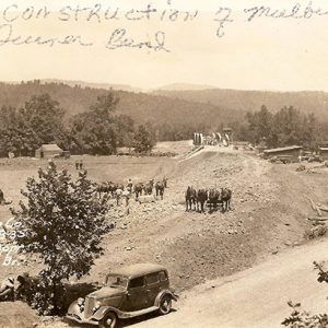
 Highway 23 Bridge
 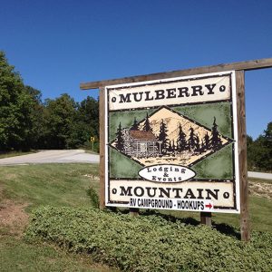 Mulberry Mountain
 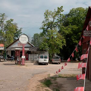 Oark General Store
 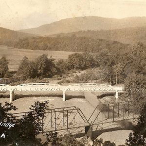 Pig Trail Bridge
 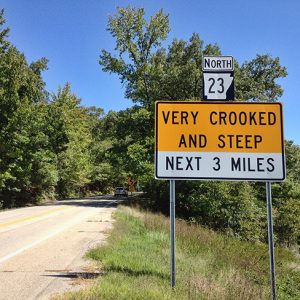 Pig Trail Sign
 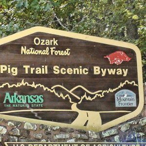 Pig Trail North
 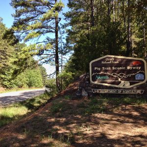 Pig Trail South
 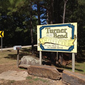 Turner Bend
 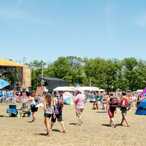 Wakarusa Music Festival
501-918-3025
calsfoundation@cals.org
calsfoundation@cals.org
The “Pig Trail” is the name of a winding, mountainous byway between Fayetteville (Washington County) and Ozark (Franklin County), one used for decades by students from the University of Arkansas (UA) in Fayetteville and sports fans. A driver following the route travels on State Highway 16 southeast from Fayetteville just past Greasy Creek in Madison County to a junction called Brashears Switch, then turns right on the southbound State Highway 23 to Ozark and the intersection with U.S. Highway 64—some fifty-two miles. The Pig Trail Scenic Byway is a nineteen-mile stretch of this road located in the heart of the Boston Mountains, running through Ozark National Forest and over the Mulberry River. Today’s traveler is more likely to use the Pig Trail for leisure and recreation than for point-to-point transportation.
Possible origins of the name “Pig Trail” are many. Near the junction with the Mulberry River, it was not unusual in times past to see roaming pigs, both feral and domesticated, as Ozark farmers once considered the forest as open range for fattening their shoats and hogs. Whether the road was named for these hogs, its resemblance to a curly pig’s tail, UA’s Razorbacks football team, or some combination of the three remains unclear.
UA students declared “Let’s take the Pig Trail!” as they planned a weekend visit to Little Rock (Pulaski County) or elsewhere in central Arkansas, especially before Interstate 40 was fully opened in 1975. The Pig Trail at the time was an alternate route—narrow, tree shrouded, tiny shouldered, curvy, steep in places, and utterly devoid of franchise eateries, liquor stores, or other stops except for widely spaced “mom and pop” gas stations. The standard route of travel between Fayetteville and Little Rock wound down the mountain on U.S. Highway 71 to Alma (Crawford County), whereupon the eastbound traveler engaged U.S. Highway 64 all the way into the capital city. While these U.S. highways were two-lane roads before Interstate 40 and what is now Interstate 49 were completed, they were concrete with wide bridges and roadside amenities. By contrast, Highways 16 and 23 had been paved by 1936, but just barely, with what locals called a “seal job.” That consisted of a gravel bed with bitumen sprayed on top to create a hard surface. “Secondary” was the Arkansas Department of Transportation’s term for such road treatments.
Motorcycle magazines have called attention to the Pig Trail as a fitting excursion for those who want to combine the picturesque and the sublime. Noted Arkansas outdoor photographer Matt Bradley once lay on his stomach in the road, camera ready, awaiting bikers to get the perfect shot of them on the Pig Trail. He succeeded as the motorcycles roared past him, and the photo was published in his book Arkansas: Its Land and People.
The Pig Trail in the twenty-first century has several iconic stops. The Turner Bend has been open since 1911 and offers a wide assortment of aids to motorists, including food and drink, restrooms, canoe rentals, and campgrounds along the beautiful Mulberry River. On a peak day when the river rapids offer whitewater canoeing, 400–500 people can be found on the water. Tens of thousands of people make their way along the Pig Trail each year on their way to Mulberry Mountain, a 650-acre lodge and event center that hosts the music festival Wakarusa in early summer (attracting over 20,000) and Yonder Mountain String Band’s Harvest Music Festival in the fall (attracting 5,000–6,000).
Highway 215 intersects the Pig Trail and provides access to views of mountains and rivers, as well as camping and hiking, at Byrd’s Adventure Center or the Ozark-St. Francis National Forests’ Redding Recreation Area, along with the possibility of a day trip into the small town of Oark (Johnson County). More outdoor recreation is accessible to hikers from the Pig Trail trailhead to the Ozark Highlands Trail. Just a short hike up the ridge to the west of the road, visitors can find remnants of a Works Progress Administration (WPA) cabin. The Federal Highway Administration designated the Pig Trail Scenic Byway a National Forest Scenic Byway in 1989.
In May 2015, a mudslide in Franklin County made that part of the route impassable. After a $1.8 million repair project, both lanes reopened on October 15, 2015.
For additional information:
Bradley, Matt. Arkansas: Its Land and People. Little Rock: Museum of Science and History, 1980.
Schnedler, Jack. “Long and Winding Road.” Arkansas Democrat-Gazette, September 29, 2020, pp. 1E, 6E.
Billy D. Higgins and Daniel R. Maher
University of Arkansas at Fort Smith


Comments
No comments on this entry yet.