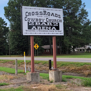
 Crossroads Church Sign
 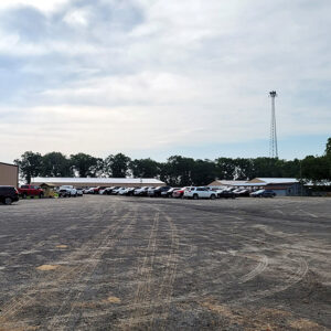 Crossroads Cowboy Church
 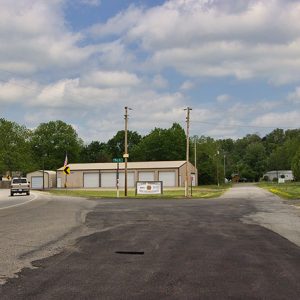 El Paso
 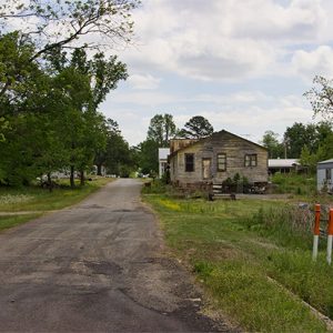 El Paso
 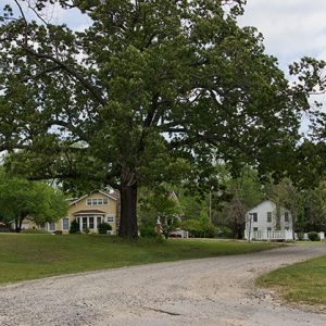 El Paso
 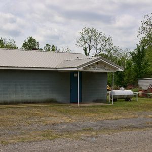 El Paso Masonic Lodge
 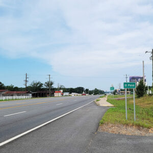 Entering El Paso
 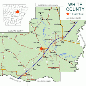 White County Map
501-918-3025
calsfoundation@cals.org
calsfoundation@cals.org
El Paso is a small community located on the southern slope of Cadron Ridge in the southwestern corner of White County near the intersection of U.S. Highway 64 and State Highway 5. It is one of the county’s early settlements and entertained hopes of being chosen as the county seat in 1835.
Settlers began arriving at the valley created by two parallel ridges, Cadron Ridge and Bull Mountain, in the 1830s. Attracted by area springs and fertile lands, they first established themselves on the southern slope of Bull Mountain at a place called Peach Orchard Gap. The name was chosen due to the peach trees growing there. Over time, settlers passed through the gap to the southern slope of Cadron Ridge, the location of the present community. El Paso, meaning “the pass” in Spanish, was selected as the name for the new community.
At the time of its settlement, the area was a part of Pulaski County. With speculation of the creation of a new county, many area citizens hoped that their community would be selected as the seat of government for any such county. The Southwest Trail, the first major pathway for Arkansas settlements, passed near the community, adding to its likely selection. A town was planned with construction of a potential courthouse positioned at its center. However, with the creation of White County on October 23, 1835, present-day Searcy, located near the center of the new county, was designated the seat of government.
A slow growth began. In 1848, five members established a Baptist church. Before constructing a church building in 1867, the congregation met in member homes and brush arbors. The two-story church was constructed south of the town square. By 1880, the church had more than 200 members, making it the largest in the county. A Methodist congregation was founded by 1873. Neither congregation could financially support a preacher every Sunday, so they combined for sermons. The local Masonic lodge met on the second floor of the Baptist church, as did chapters of the Woodmen of the World, Knights of the Maccabees, and the Grange.
During the 1850s, the settlement was home to at least three businesses, one of which was the Peach Orchard Mill owned by James Wright and T. W. Wells. Late in the decade, the settlement was being served by regular stage service. Just before the outbreak of the Civil War, the state legislature incorporated the Des Arc and Dardanelle Railroad Company. There was much excitement when it was determined that the tracks were to be constructed near El Paso. The route had been surveyed and the right-of-way was being cleared, but then came war. All work ceased and was never renewed.
The war hampered the community’s development. A post office named Olive Creek, which had been established in 1850, was renamed El Paso in 1869. Expectations of greater growth came in 1871 with the construction of a road just south of the town that connected Conway (Faulkner County) and Des Arc (Prairie County). Another road connecting Batesville (Independence County) and Little Rock (Pulaski County) intersected with this road. These roads helped contribute to the growth of the town. The community was devastated on April 18, 1880, when a tornado hit the town, destroying nine homes and killing five citizens. The community soon recovered.
In 1884, a degree of political importance was gained when El Paso township was created, making the community an official voting center. Finally, in 1893, a town was officially platted, consisting of six blocks by four blocks with a city government building located in the center. To provide money for further growth, the Bank of El Paso was opened in 1894. The bank building is, as of 2012, being remodeled to house a branch of the White County Regional Library.
El Paso slowly developed into a commercial center for area farmers. Cotton farmers and cattlemen purchased goods from local stores and, with the good roads, were also able to market their products from there. By 1900, the population was reported to be more than 800 citizens. The town soon felt the effects of the Great Depression, with cotton farmers hit especially hard. Farms were foreclosed, and local businesses began to close. People began to move away for better opportunities in the larger nearby towns of Beebe (White County) and Conway.
By the 1950s, little remained of the once prosperous town. There were expectations that the construction of State Highway 5, which practically ran through the town, would stimulate growth. Instead, it gave locals another avenue to leave the area. Even the school, which had been established years before, was consolidated with the Beebe schools by the 1950s.
Today, El Paso is positioned at the intersection of two busy highways, State Highway 5 and U.S. Highway 64. Over the years, any new commercial businesses have developed along these busy highways a few hundred yards from the old town site. Much of the traffic consists of commuters to Conway and those connecting to Interstate 40 there. The town also benefits from the many vacationers traveling to Greers Ferry Lake by way of Highway 5.
An April 27, 2014, tornado killed one person and damaged numerous homes in the area.
The town is home to two National Register of Historic Places properties. Both the David Doyle House and the El Paso Bank were added in 1991. In 1968, one-time resident Virginia Lillian Morris Johnson became the first woman to run for the office of Arkansas governor.
For additional information:
Anderson, Hugh. “El Paso, Arkansas, from Its Beginnings to about 1900.” White County Heritage 4 (July 1966): 2–6.
Petrucelli, Fred. “El Paso Now a Ghost Town.” Arkansas Democrat, March 22, 1959, p. 10A.
Mike Polston
CALS Encyclopedia of Arkansas


Comments
No comments on this entry yet.