 Arkansas County Courthouse
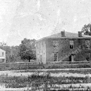
 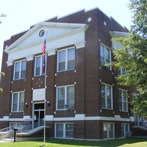 Arkansas County Courthouse, Northern District
 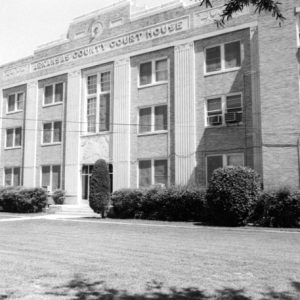 Arkansas County Courthouse, Southern District
  Arkansas County Courthouse, Southern District
 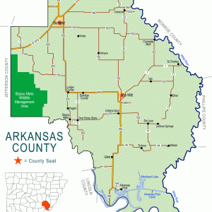 Arkansas County Map
 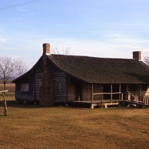 Arkansas County Museum
 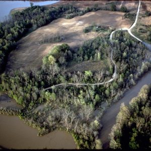 Arkansas Post National Memorial
 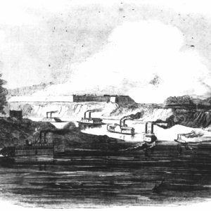 Battle of Arkansas Post
 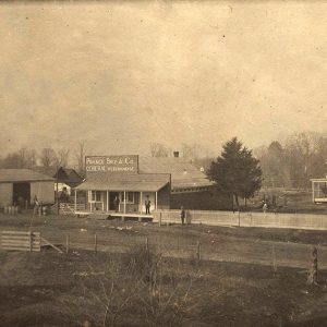 Crockett's Bluff
 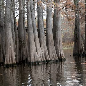 Cypress Trees
 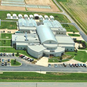 Dale Bumpers National Rice Research Center
 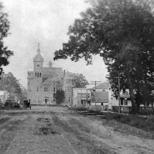 DeWitt Courthouse
 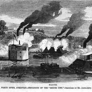 Engagement at St. Charles
 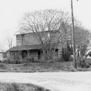 Goldman Home
 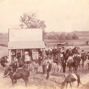 J. R. Chambers's Store
 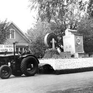 Rice Festival Parade Float
 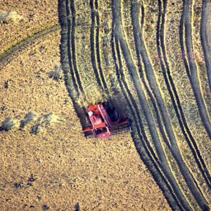 Rice Harvesting
 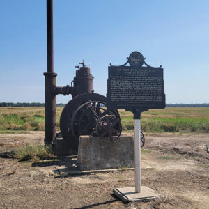 Rice Plantation Pump
 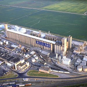 Riceland Foods Facility
 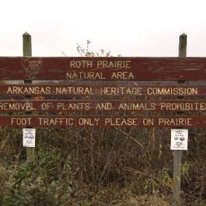 Roth Prairie Natural Area
 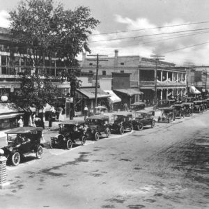 Stuttgart Auto Parade
 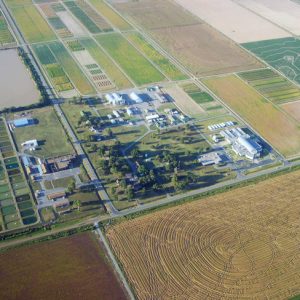 University of Arkansas Rice Research and Extension Center
 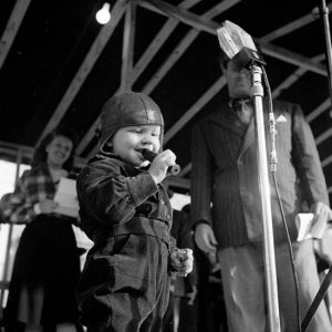 World's Championship Duck Calling Contest
501-918-3025
calsfoundation@cals.org
calsfoundation@cals.org
| Region: | Southeast |
| County Seats: | DeWitt, Stuttgart |
| Established: | December 13, 1813 |
| Parent County: | Original |
| Population: | 17,149 (2020 Census) |
| Area: | 992.14 square miles (2020 Census) |
|
1810 |
1820 |
1830 |
1840 |
1850 |
1860 |
1870 |
1880 |
1890 |
1900 |
|
– |
– |
1,426 |
1,346 |
3,245 |
8,844 |
8,268 |
8,038 |
11,432 |
12,973 |
|
1910 |
1920 |
1930 |
1940 |
1950 |
1960 |
1970 |
1980 |
1990 |
2000 |
|
16,103 |
21,483 |
22,300 |
24,437 |
23,665 |
23,355 |
23,347 |
24,175 |
21,653 |
20,749 |
|
2010 |
2020 |
|
|
|
|
|
|
|
|
|
19,019 |
17,149 |
|
|
|
|
|
|
|
|
| Population Characteristics as per the 2020 U.S. Census: | ||
| White |
11,698 |
68.2% |
| African American |
4,156 |
24.2% |
| American Indian |
44 |
0.3% |
| Asian |
94 |
0.5% |
| Native Hawaiian or Other Pacific Islander |
9 |
0.1% |
| Some Other Race |
405 |
2.4% |
| Two or More Races |
743 |
4.3% |
| Hispanic Origin (may be of any race) |
636 |
3.7% |
| Population Density |
17.3 people per square mile |
|
| Median Household Income (2019) |
$46,696 |
|
| Per Capita Income (2015–2019) |
$26,386 |
|
| Percent of Population below Poverty Line (2019) |
17.3% |
|
Arkansas County, located in southeast Arkansas, has two county seats—DeWitt and Stuttgart. It is one of the state’s original counties and lies in the Delta. Arkansas County is an agricultural county; rice and soybeans are the main crops.
Pre-European Exploration
It is likely that Native Americans of the Tunica tribe resided in what is now Arkansas County before 1700. The Quapaw arrived in the area between 1543 and 1673. Archaeological evidence suggests that the Menard-Hodges Site near Nady was occupied during parts of the Woodland and Mississippian periods, and perhaps later.
European Exploration and Settlement
Spanish explorer Hernando de Soto traveled the Mississippi River from 1541 to 1543. At one point, he and his party reached Anilco, a village on the Arkansas River that may have included the Menard-Hodges Site in the southeast corner of Arkansas County. On the same river were the villages of Cayas and Utiangue.
In 1682, the La Salle expedition reached Kappa, the largest village of the Quapaw Indians; it stood on the west bank of the Mississippi River. The Marquette-Joliet expedition had reached this area nine years earlier but had turned back for fear of the Spanish. In 1686, Henri de Tonti established Arkansas Post at the Quapaw village of Osotouy. It was the first semipermanent French settlement in the lower Mississippi River Valley and the first step in a long struggle between France, Spain, and England over the interior of North America.
Over the years, the post relocated because of flooding from the Arkansas River, but its position was strategic for the French, Spanish, Union, and Confederate military. John Law, a Scottish economist, founded a short-lived colony for France in what is now in the southern part of Arkansas County in the 1720s. Spanish soldiers and British partisans clashed at the post in 1783 in Colbert’s Raid, the only Revolutionary War action that occurred in Arkansas.
Louisiana Purchase through Early Statehood
Created by the Missouri Territory legislature in 1813, Arkansas County comprised about two-thirds of what is now Arkansas and part of eastern Oklahoma. More than half the state’s counties were formed from this original county. In 1819, when Arkansas Territory was created, Arkansas Post became its capital.
On November 20, 1819, at Arkansas Post, native New Yorker William Woodruff printed the first issue of the Arkansas Gazette. On April 1, 1820, the legislature appointed Woodruff public printer. He printed the newspaper at Arkansas Post until November 24, 1821. When the capital was moved to Little Rock (Pulaski County) in 1821, Woodruff moved his office there.
As white settlers steadily moved in, Indians slowly moved out. In 1824, the dwindling remnant of Quapaw Indians at last yielded their lands for $4,000 and an annuity of $1,000 a year for the next eleven years. Thus, a good deal of what is now fine cotton land changed hands at a figure estimated at one dollar per 1,000 acres.
In July 1855, the county clerk was ordered to move the records to DeWitt, the new county seat. The removal of the county seat from Arkansas Post to DeWitt, which was more centrally located, necessitated a new layout of land and new roads throughout the county.
Civil War through Reconstruction
The white residents of Arkansas County relied on slavery to effectively produce crops before the Civil War. The 1860 federal census placed the white population of the county at 3,923, with 4,921 enslaved persons; more than five million dollars of agricultural products were produced in the county that year. Local planter and owner of forty-six enslaved people, James Totten, represented the county at the Secession Convention. Numerous Confederate military companies organized in the county.
St. Charles was the location of a June 17, 1862, Civil War naval and land battle that disabled the Union USS Mound City; the shot that damaged the ship is considered one of the deadliest shots fired in the war.
The most important event in the county during the Civil War was the January 11, 1863, capture of Fort Hindman at Arkansas Post by Union forces under General John McClernand. The number of Union troops in this engagement was around 32,000, not including naval forces. General Thomas J. Churchill commanded the fort with a small but efficient force of Confederates. The surrender of about 5,000 Confederates at the end of the battle was one of the largest mass surrenders in the state.
After the war, towns and villages sprang up across the prairie. Crockett’s Bluff, Casscoe, and St. Charles are on the White River. On the Arkansas River Railroad are Stuttgart, Gillett, and Almyra. On the Cotton Belt is the community of Humphrey. The county also had many smaller post offices.
Crockett’s Bluff, named after William Finley Crockett, son of Davy Crockett, was a flourishing river port town, and one of the state’s first infantry companies was raised there during the war.
Post-Reconstruction through the Gilded Age
In 1877, Reverend Adam Buerkle, a Lutheran minister from Woodville, Ohio, and Stuttgart, Germany, started a colony of Germans to fulfill his dream of establishing a synod. He realized he had found the spot when he was told that the pre-Civil War Gum Pond Plantation was for sale. He bought the 7,749-acre farm for about three dollars per acre. In 1889, Stuttgart was incorporated and named after Buerkle’s German birthplace.
In 1882, W. D. Anthony settled a small cotton farm just off the center of the Grand Prairie. Anthony and an African-American trapper known as Humphrey helped survey the railroad; because the trapper was so helpful and kind, Anthony named the town in his honor.
Early Twentieth Century through Modern Era
There were twenty-two documented lynchings in Arkansas County from 1869 to 1916, with the overwhelming majority directed against African Americans. One of the state’s single deadliest massacres occurred in and around St. Charles in March 1904, resulting in thirteen African Americans killed.
Gillett, a small farming community, was incorporated in 1906. Its residents were largely of German origin, including some who came directly from Prussia, some who came by way of Illinois, and some whose ancestors had lived in Russia.
Growth in the northern part of the county led to the creation of a second county seat in Stuttgart. DeWitt had served as the county seat since 1855 when the county government moved from Arkansas Post. Multiple courthouses served the county over the decades. With explosive growth in the northern part of the county near Stuttgart in the early twentieth century, an effort to create a second county seat emerged. The current Arkansas County Courthouse, Northern District, in Stuttgart was constructed in 1928, with the current Arkansas County Courthouse, Southern District, completed in 1932. Both are listed on the National Register of Historic Places.
Started in 1921, Riceland Foods is a cooperative that markets and mills rice, soybeans, and wheat grown by its more than 9,000 member-owners in Arkansas, Louisiana, Mississippi, Missouri, and Texas. As one of the world’s leading millers of rice, the Stuttgart-based company is a Fortune 500 business that sells long grain, brown, wild, and flavored rice (under the Riceland name, as well as private labels), and oil and shortening products to grocery, food services, and food manufacturing companies throughout the United States and more than seventy-five countries.
In 1942, the army built an airport in Stuttgart for use as a training facility for glider pilots. The airport provided employment for county residents and increased the population of Stuttgart as people from outside the county sought jobs.
Other major employers in Stuttgart include Producers Rice Mill, operated under the guidance of SYSCO Corporation, and Lennox Industries, which produces home heating and cooling units. Phillips Community College of the University of Arkansas has branch campuses in Stuttgart and DeWitt.
Agriculture continues to be a major driver of the local economy in the county. Three agriculture research centers operate in Arkansas: the Harry K. Dupree Stuttgart National Aquaculture Research Center, the Dale Bumpers National Rice Research Center, and the University of Arkansas Rice Research and Extension Center. Part of the Dale Bumpers White River National Wildlife Refuge is located in the eastern part of the county, with the headquarters in St. Charles. Potlatch Cook’s Nature Center focuses upon conservation education.
Duck hunting is an important part of the county’s economy. Stuttgart hosts the annual World’s Championship Duck Calling Contest as part of the Wings over the Prairie Festival each November. Mack’s Prairie Wings in Stuttgart serves as a major retailer for duck hunters.
Arkansas Post National Memorial, operated by the National Park Service, commemorates the first European settlement in what became Arkansas. Located near Gillett, the Menard-Hodges Site is part of the park. The nearby Arkansas Post Museum, operated by Arkansas State Parks, interprets life in the Delta and on the Grand Prairie from 1877 to the present.
For additional information:
Burkett, Bennie Frownfelter. One Hundred Years on the Grand Prairie. Stuttgart, AR: Standard Printing Company, 1980.
Burton, W. H. Halli. A Topographical Description and History of Arkansas County, Arkansas from 1541 to 1875. Greenville, SC: Southern Historical Press, 1978.
Grand Prairie Historical Society Bulletin. Gillett, AR: Grand Prairie Historical Society (1958–).
Bill Shrum
Stuttgart, Arkansas
Revisions, 2022, by David Sesser, Henderson State University


Comments
No comments on this entry yet.