 Advance Store
 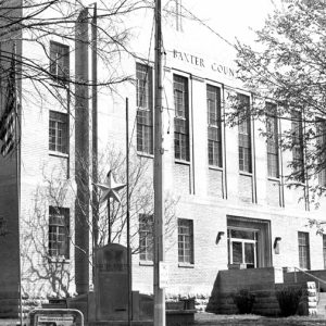 Baxter County Courthouse
 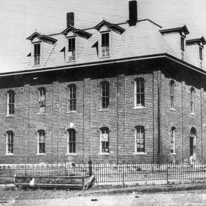 Baxter County Courthouse, with Third Floor
 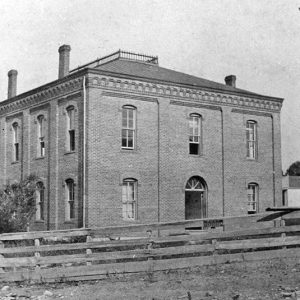 Baxter County Original Courthouse
 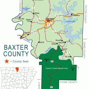 Baxter County Map
 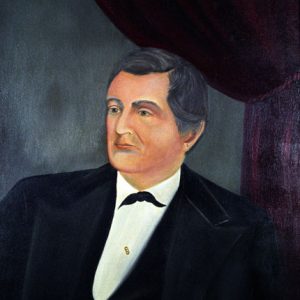 Elisha Baxter
 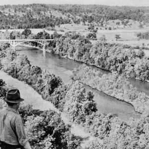 Before Norfork Lake
 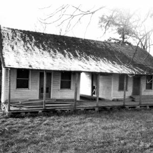 Casey House
 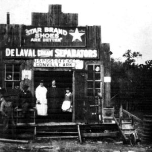 Conville Post Office
 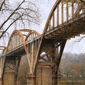 Cotter Bridge
 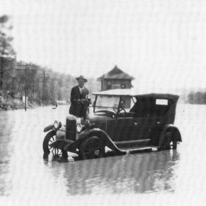 Cotter Flood
 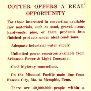 Cotter Pamphlet
 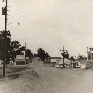 Gamaliel Street Scene
  Gassville Tornado Damage, 2008
 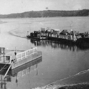 Henderson Ferry
 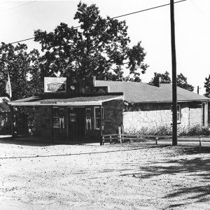 Milligan's Store
 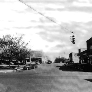 Mountain Home Square
 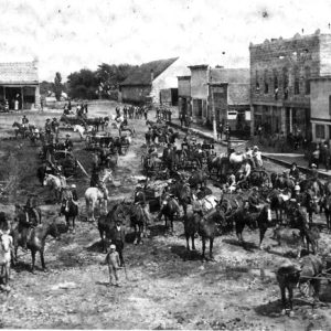 Mountain Home Square
 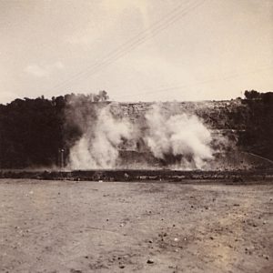 Norfork Dam Construction
 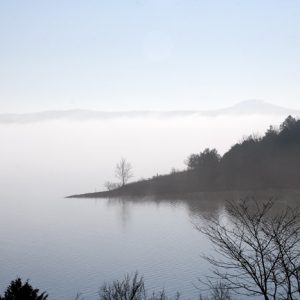 Norfork Lake
 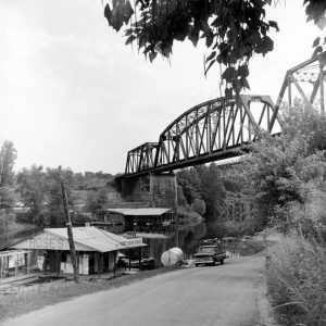 North Fork River Railroad Bridge
 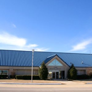 Ozark Regional Airport
 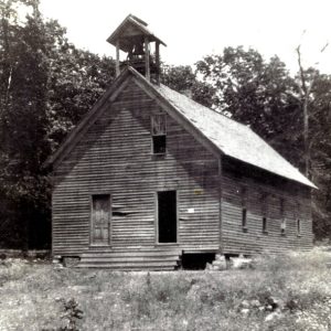 Pilgrim's Rest School
 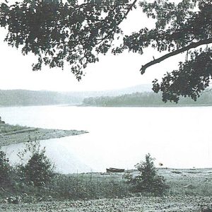 Red Bank Landing
 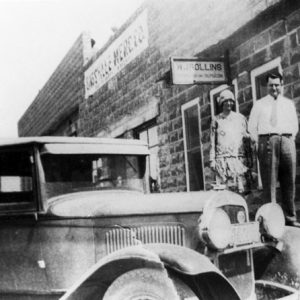 Dr. and Mrs. W. J. Rollins
 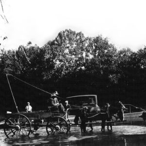 Smith Ferry
 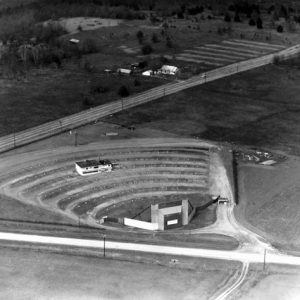 Starlight Drive-in
 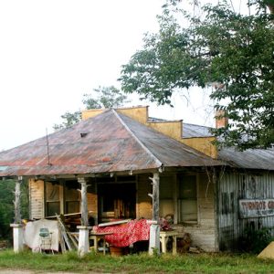 Three Brothers Grocery
  Tracy Ferry School
 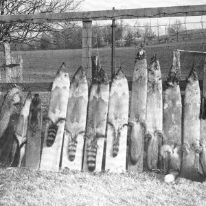 Hiram Wells with Coonskins
 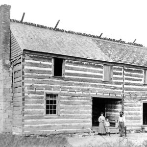 Jacob Wolf House
501-918-3025
calsfoundation@cals.org
calsfoundation@cals.org
| Region: | Northeast |
| County Seat: | Mountain Home |
| Established: | March 24, 1873 |
| Parent Counties: | Fulton, Izard, Marion, Searcy |
| Population: | 41,627 (2020 Census) |
| Area: | 553.93 square miles (2020 Census) |
| Historical Population as per the U.S. Census: | |||||||||
|
1810 |
1820 |
1830 |
1840 |
1850 |
1860 |
1870 |
1880 |
1890 |
1900 |
|
– |
– |
– |
– |
– |
– |
– |
6,004 |
8,527 |
9,298 |
|
1910 |
1920 |
1930 |
1940 |
1950 |
1960 |
1970 |
1980 |
1990 |
2000 |
|
10,389 |
10,216 |
9,519 |
10,281 |
11,683 |
9,943 |
15,319 |
27,409 |
31,186 |
38,386 |
|
2010 |
2020 |
|
|
|
|
|
|
|
|
|
41,513 |
41,627 |
|
|
|
|
|
|
|
|
| Population Characteristics as per the 2020 U.S. Census: | ||
| White |
38,489 |
92.5% |
| African American |
90 |
0.2% |
| American Indian |
255 |
0.6% |
| Asian |
234 |
0.6% |
| Native Hawaiian or Other Pacific Islander |
9 |
0.0% |
| Some Other Race |
327 |
0.8% |
| Two or More Races |
2,223 |
5.3% |
| Hispanic Origin (may be of any race) |
1,058 |
2.5% |
| Population Density |
75.1 people per square mile |
|
| Median Household Income (2019) |
$42,260 |
|
| Per Capita Income (2015–2019) |
$26,863 |
|
| Percent of Population below Poverty Line (2019) |
13.1% |
|
Governor Elisha Baxter formed Baxter County as the sixty-eighth county in Arkansas just prior to the Brooks-Baxter War. It is a county important to Arkansas history because of its flood control projects and its early educational institutions. Most of the land in Baxter County is hilly and rocky, typical of the Ozark Plateau on which it lies.
Pre-European Exploration and Settlement
Hundreds of prehistoric sites, representing various time periods and traditions, are found in Baxter County. The Old Joe site, which includes two prehistoric rock art images, is located near Norfork and is listed on the National Register of Historic Places. By the time of the Louisiana Purchase, the Osage claimed control over the area, but they relinquished their claims in an 1808 treaty with the United States government.
Louisiana Purchase through Early Statehood
The Jacob Wolf House in Liberty (now Norfork) was the territorial seat of government from 1828 to 1836, when Arkansas became a state. The Wolf House, a two-story log structure, is the oldest standing courthouse in Arkansas. The Izard County seat was moved to Mount Olive in 1836, and the Wolf House became a private residence. Baxter County was originally a portion of Izard County and later a part of Marion, Fulton, and Searcy counties.
Most of the pioneers moving into the area before the Civil War were from Alabama, Georgia, North Carolina, South Carolina, and Tennessee. They were mostly of Indian heritage, having been driven out of their homes or looking for more open land. The county’s earliest recorded towns were Big Flat, formed in 1820, and Clarkridge, formed in 1819, and other towns came out of those. Norfork (Liberty) was formed in 1827, and Cotter started as Lake’s Ferry, then Red Bud, and was finally named for a railroad superintendent. Turkey Neck became Gassville in 1878; it was named for the Gass family who owned much of what is now Gassville or for P. A. Cox, who owned an early mercantile store there and was a real storyteller or “gasser.” Gamaliel and Henderson were just small communities until the advent of the Norfork and Bull Shoals dams.
Civil War through Reconstruction
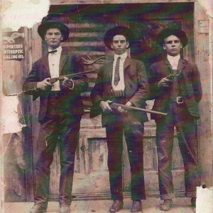
Baxter was not yet a county during the Civil War, and it did not see much direct action. A few small battles (such as the 1862 Skirmish at Mountain Home) took place along the White River at various crossings, and there was a good deal of foraging by both the North and the South by bushwhackers and jayhawkers. Many men from the county who volunteered to fight for the Confederacy joined the Fourteenth Arkansas Infantry and fought many battles far from home. Pro-Union sentiment was carefully hidden, especially after the Peace Society, was so rudely treated, with many of its members being marched to Little Rock and forced to serve in the Confederate army.
Governor Baxter formed Baxter County on March 24, 1873, following an election year when the outcome of the governor‘s race was in doubt, because he wished to leave a lasting legacy. The Arkansas General Assembly passed Act 25 of 1873, creating the county. Baxter County was formed by taking a large part of Marion and Izard counties and smaller parts of Fulton and Searcy counties. The present-day boundary was fixed in 1881.
Gilded Age through Early Twentieth Century
Mountain Home was selected as the county seat at the time Baxter County was formed. Attempts to move the county seat to Cotter or Gassville in the early 1900s failed. An attempt was made again the mid-1940s, but Cotter lost that battle, too. The first attempt in 1910 was foiled by some missing ballot boxes. The city fathers in Mountain Home also found an Arkansas law stating that a courthouse with three floors cannot be moved. Mountain Home immediately added a third floor to its courthouse, though the building was torn down in the early 1940s and a new one was built by the Works Progress Administration (WPA). When there was no longer a three-story courthouse in Mountain Home, another petition drive sought to move the county seat to Cotter, but it failed.
The county supported a college from the late nineteenth to the early twentieth centuries. Mountain Home College, a Baptist-affiliated institution, operated from 1892 until 1933 when it closed in the face of mounting debts.
Zinc mining proved to be an important economic activity in the county in the early twentieth century. Several mines operated in the community of Monkey Run in the western part of the county.
Steamboats traveled up the White River to McBee and Denton ferry landings from the early 1850s until the railroads put them out of business in about 1903 with cheaper shipping rates and year-round service. The railroad bridge at Cotter was made to allow steamboats to pass on the river without hindering their progress. The mechanism on the bridge was tested once to ensure that it worked, but it was never used because the steamboats stopped coming up the river.
Filmed in 1928, Souls Aflame was the first movie to be made in the state. Using locals as both bit part players and extras, the silent film was shot in Norfork.
In 1906, the white residents of Cotter drove off most of the African-American population, transforming Cotter into a “sundown town,” a place where African Americans were forbidden from living, usually through the threat of violence. Twice throughout the whole twentieth century, in 1940 and 1960, Baxter County recorded not a single African American residing there during the census. Racial violence was not new to the area, as a Black man named George Washington was reportedly lynched near Mountain Home in 1871, two years before Baxter County was formed.
World War II through Modern Era
Baxter County started as a series of small subsistence farms and ranch communities. Hunting and fishing in the county have long been popular for sport and food. Cotton was the primary crop before the boll weevil became a nuisance and the lakes engulfed most of the good bottomland. Cotton is no longer a crop in Baxter County; the modern-day crops are mostly hay for sale and grain for a farmer’s own cattle. Turkey- and chicken-growing operations have taken most of the remaining low-quality farm land. The North Fork and Bennett rivers on the north and the east and the White and Buffalo rivers on the west and the south made most of the county vulnerable to flooding before Norfork Dam was built. Several severe floods occurred in the 1910s and 1920s. Dams were suggested by the people in the county, and various legislators discussed them for years before Norfork Dam was begun in 1941. It brought jobs and a brighter future to the county. Norfork Dam was completed in 1944, and Bull Shoals Dam was begun to complete the flood control project. This project eventually included Table Rock Lake and Beaver Lake for the White River. It was also a source of hydroelectric power, and both dams—operated by the Army Corps of Engineers—have been used for that purpose. President Harry Truman dedicated the dams in a ceremony on July 2, 1952. The two dams and the resulting lakes have turned Baxter and the surrounding counties into a favorite area for tourists and retirees. The lakes and the White and Norfork rivers provide for excellent trout fishing. The county had about seventy schools and a like number of small post offices, mostly in general stores, before the lake rose and put many schools and communities under the lake or caused the people to be moved to other areas of the county.
There are several boat manufacturing plants in the county, including Triton Boats and Shawnee and Supreme Boats, and several other entities, such as Baxter Health Care, as well as some small manufacturing plants. The county’s 2000 population was 38,386, a twenty-three-percent increase over the 1990 population. The population had increased to 41,513 at the 2010 census. This growth continued, albeit at a slower pace, with the 2020 Census placing the county population at 41,627. A significant number of retirees have moved to the area because of the tax base, climate, and recreational and educational opportunities. Arkansas State University-Mountain Home is a two-year college that has a number of students coming into the county daily; it offers a range of classes for senior citizens as well.
The southern part of the county includes part of the Ozark-St. Francis National Forest and the Buffalo National River empties into the White River just inside the Baxter County line.
For additional information:
Baxter County History. Mountain Home, AR: Baxter County Historical Society (1975–).
Blevins, Bill Dwayne. Baxter County Chronicles. Mountain Home, AR: Tumbling Shoals Publishing Company, 2005.
Lancaster, Guy. “‘They Are Not Wanted’: The Extirpation of African Americans from Baxter County, Arkansas.” Arkansas Historical Quarterly 69 (Spring 2010): 28–43.
Messick, Mary Ann. The History of Baxter County, 1873–1973. Mountain Home, AR: Mountain Home Chamber of Commerce, 1973.
Shiras, Frances H. The History of Baxter County. N.p.: 1939.
Jane Andrewson
Mountain Home, Arkansas
Revised 2022, David Sesser, Henderson State University


Comments
No comments on this entry yet.