501-918-3025
calsfoundation@cals.org
calsfoundation@cals.org
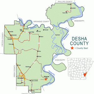
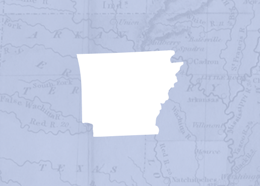
| Region: | Southeast |
| County Seat: | Arkansas City |
| Established: | December 12, 1838 |
| Parent Counties: | Arkansas, Chicot |
| Population: | 11,395 (2020 Census) |
| Area: | 741.21 square miles (2020 Census) |
| Historical Population as per the U.S. Census: | |||||||||
|
1810 |
1820 |
1830 |
1840 |
1850 |
1860 |
1870 |
1880 |
1890 |
1900 |
|
– |
– |
– |
1,598 |
2,911 |
6,459 |
6,125 |
8,973 |
10,324 |
11,511 |
|
1910 |
1920 |
1930 |
1940 |
1950 |
1960 |
1970 |
1980 |
1990 |
2000 |
|
15,274 |
20,297 |
21,814 |
27,160 |
25,155 |
20,770 |
18,761 |
19,760 |
16,798 |
15,341 |
|
2010 |
2020 |
|
|
|
|
|
|
|
|
|
13,008 |
11,395 |
|
|
|
|
|
|
|
|
| Population Characteristics as per the 2020 U.S. Census: | ||
| White |
4,845 |
42.5% |
| African American |
5,398 |
47.4% |
| American Indian |
47 |
0.4% |
| Asian |
61 |
0.5% |
| Native Hawaiian or Other Pacific Islander |
4 |
0.0% |
| Some Other Race |
527 |
4.6% |
| Two or More Races |
513 |
4.5% |
| Hispanic Origin (may be of any race) |
773 |
6.8% |
| Population Density |
15.4 people per square mile |
|
| Median Household Income (2019) |
$31,893 |
|
| Per Capita Income (2015–2019) |
$19,235 |
|
| Percent of Population below Poverty Line (2019) |
29.1% |
|
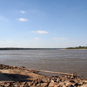
Hardwood forests, alluvial soil, and flooding rivers marked the Native American territory that became Desha County. Lying at the confluence of the Arkansas, White, and Mississippi rivers, fertile land with abundant game provided sustenance for the Quapaw. Today, Delta soil and ample water make Desha County a leading agricultural producer.
European Exploration and Settlement
Explorers Hernando de Soto; Father Jacques Marquette; Louis Joliet; René-Robert Cavelier, Sieur de La Salle; and Henri de Tonti visited area Indian tribes. Marquette and Joliet stopped in 1673 at the Indian village of Mitchagama, in the vicinity of the Arkansas River mouth. La Salle, visiting Indians in 1682, set up a cross in the same area. Frenchman Francis D’Armond erected a trading post on the Mississippi River banks just north of the White River after he was given a land grant of 500 acres in 1766.
Louisiana Purchase through Early Statehood
The site was later acquired by General William Montgomery, who built a hotel/casino, mercantile store, and warehouses called Montgomery’s Point. The trading post, founded in 1810, was a regular docking point for steamboats unloading freight and passengers going up the White and Arkansas rivers. About 1820, Frederick Notrebe built warehouses at the mouth of the Arkansas River and named the area—originally called “Mouth of Arkansas”—Napoleon in 1837. Two sites for Arkansas Post also were located in Desha County: Post No. 2 on Big Island in 1738 and Post No. 4 near the site of Napoleon.
A duel between Henry Wharton Conway and Robert Crittenden was fought in the present-day boundaries of the county in 1827. Conway, the territorial delegate to the U.S. House of Representatives, was wounded in the duel and died several days later.
Created by legislative act on December 12, 1838, Desha County was detached from Arkansas and Chicot counties. State representative Stephen Ryan led legislative efforts after south Arkansas County citizens filed petitions declaring their area isolated by the Arkansas and White rivers. The county was named for Captain Benjamin Desha, a War of 1812 hero and federally appointed receiver of public monies in the Arkansas Territory.
Justices of the peace met at William Sexton’s house, Wellington Landing, to form a county court. On March 4, 1839, they elected county officers, including John Morris as judge, George Watson Jr. as circuit and county clerk, A. C. Jamison as sheriff, Sexton as treasurer, and Gardner Cooper as surveyor. J. Smith was state senator. The Sexton house was the temporary county seat until 1841, when commissioners chose Bellville (later Red Fork). Napoleon was designated county seat in 1843. A federal $55,000 U.S. Marine hospital was built there in 1855.
Civil War through Reconstruction
The 1860 census reported that 2,655 white citizens lived in Desha County and 3,784 people were held in bondage. Twenty free people of color lived in the county, the second-highest number in the state, after Washington County. The dependence of the county’s economy on slave labor made secession popular among its citizens.
Military action began in the county even before Arkansas seceded from the Union with the capture of Federal munitions at Napoleon in early 1861. Other military actions followed in May 1863 at Napoleon and a skirmish at White River Station.
Its location at the confluence of the Mississippi and Arkansas rivers made Napoleon subject to flooding. During the Civil War, a Federal flotilla tied up there, and troops set fire to the town. Later, a Federal naval commander, in an effort to avert Confederate fire, ordered a canal built through narrow land separating the rivers. The doomed Napoleon crumbled into river currents. By 1869, the three-story hospital had disappeared.
During the war, county records were moved by wagon to Richland Township and later to Clarksville, Texas. Some records were never recovered.
Following the war, citizens signed the Amnesty Oath (loyalty to the Union and U.S. Constitution), attested to by records remaining in county possession. The western portions of Desha County were detached to form Lincoln County in 1871.
Post Reconstruction through Early Twentieth Century
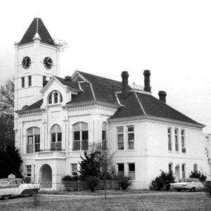
The courthouse was moved to Watson in 1874 and to Arkansas City in 1881. A permanent courthouse costing $23,269 was completed in 1900.
Elected as the county’s first African-American legislator, R. C. Weddington was a representative in the seventeenth legislative session in 1891. He moved from Red Lick, Mississippi, to Arkansas City to become principal of the grade school in 1887.
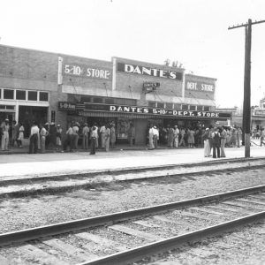
Steamboats provided major transportation until railroads developed the county interior. Arkansas City was a regular port of call, and excursion boats continued to stop there into the 1930s.
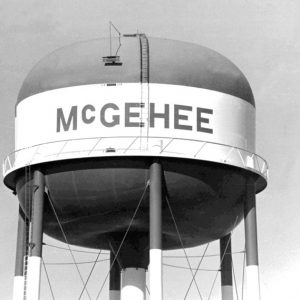
The first railroad to be chartered in Arkansas was the Mississippi, Ouachita and Red River. A portion ran from Eunice (Chicot County) on the Mississippi River to Watson and Halley, but the route was abandoned in 1878. The Little Rock, Mississippi River and Texas Railroad laid the first rail through Dumas and McGehee; was acquired by the St. Louis, Iron Mountain and Southern Railway in the 1870s; and is now the present Union Pacific route.
The principal cities of Dumas and McGehee were incorporated in 1904 and 1906, respectively. Also incorporated were Arkansas City, Watson, Mitchellville, Pickens, and Reed.
State Senator X. O. Pindall, an Arkansas City attorney, became Senate pro tem and ascended to gubernatorial leadership after Governor John Little became disabled. Pindall was acting governor from 1907 to 1909.
At least ten men were lynched in the county in the late nineteenth and early twentieth centuries. Lynched in 1877, Henry Jackson was accused of killing a justice of the peace. Two lynchings took place in 1884, with Abe Livingston and Mat Orton killed that year. Julius Mosely was lynched for allegedly raping his stepdaughter in 1892. Luke Washington, Richard Washington, and Henry C. Robinson were killed together in 1894. Additional lynchings took place in 1907, 1911, and 1921.
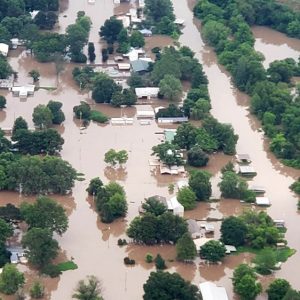
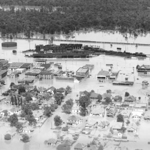
Desha County’s greatest tragedy came in the spring of 1927, when a flood inundated 478,000 acres after levee breaks occurred on the Arkansas and Mississippi rivers. Many of the county’s 26,684 citizens were forced to flee to hill counties or to live on second floors, in tent cities, and in boxcars on the levee. Damage in Desha County from the Flood of 1927 exceeded $2 million, then an enormous sum. Flood waters did not recede for more than a month, and most farmers had to forego planting. The multi-storied Greystone Hotel in McGehee was a haven for refugees, who rode in boats to the stairway landing. Among those who came to Desha County to assess the damage was the national relief administrator, Herbert Hoover, who later became president of the United States.
The Drought of 1930–31 and the Great Depression, with unemployment over thirty percent, added to economic woes. Barter systems, home gardens for subsistence, and men riding rail cars in search of work were common. In 1930, the U.S. government shipped 20,000 head of cattle from Oklahoma and Texas to Desha County to graze along lands near rivers. The cattle, branded ERA for Emergency Relief Association, later were shipped to Fort Smith (Sebastian County) for butchering and canning, destined as relief supplies. A National Youth Administration (NYA) camp to train youth was built on twenty acres one mile north of Dumas in 1935 and later became the site for the town of Mitchellville. With U.S. Highway 65 as the only paved roadway, the Works Progress Administration (WPA) funded the first concrete streets for Dumas.
World War II through the Faubus Era
World War II started county out-migration, with thousands joining the armed forces and taking defense jobs. War heroes included Lieutenant Roy Rushing of McGehee, a naval air ace. Seventy-eight from Desha County died in action.
When President Franklin Roosevelt ordered the relocation of Japanese Americans from the West Coast in 1942, a 17,000-acre compound was built at Rohwer near McGehee to house more than 8,400 internees. Desha citizens were disgruntled. They distrusted the Japanese because of the bombing of Pearl Harbor and also complained that the U.S. government fed the internees a better diet than locals could afford. Rohwer Relocation Center became the county’s largest city until it was closed in 1945. George Takei and Nami Shingu were among the internees at the camp. Rohwer’s cemetery is now a National Historic Landmark.
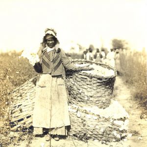
Farm mechanization altered the county economy, ending sharecropping. Cotton has reigned as the principal crop, but in the 1940s, rice and soybeans were added. For more than fifty years, Missouri Pacific Railroad was a major employer in McGehee until roundhouse shops were closed in 1954, and employment continued to dwindle. In the early 1970s, Potlatch, Inc., built a $150 million paper mill at Cypress Bend. Dumas attracted light industry beginning in the 1950s. Agriculture remains the primary economic engine for Desha, which is in the top five in cotton production among Arkansas counties.
Modern Era
Replacing small ferries was the 1969 completion of the Arkansas River Bridge connecting Desha and Arkansas counties. The construction of McClellan-Kerr Arkansas River Navigation System provided another asset to the area. Highway 65 has four lanes, and airports serve Dumas and McGehee. Union Pacific Railroad operates freight service.
Great Rivers Vocational Technical School, established at McGehee in 1975, is now affiliated with the University of Arkansas at Monticello (UAM). County schools began with “freedom of choice” and eventually proceeded to full integration without violence. Small schools were consolidated into Dumas and McGehee districts.
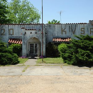
Two weekly newspapers serve the county. The Dumas Clarion is the successor to the Desha County Democrat founded by Ed Lucas in 1897. The McGehee-Dermott County Times-News followed the McGehee Times, which had been established in 1925 as successor to the Desha News begun by Jack Bernhardt in 1910. Radio station KVSA began broadcasting June 29, 1953.
McGehee-Desha County Hospital was opened in 1966. Delta Memorial Hospital, formerly Desha County Hospital (built in 1948), moved into a $14 million facility in 2006.
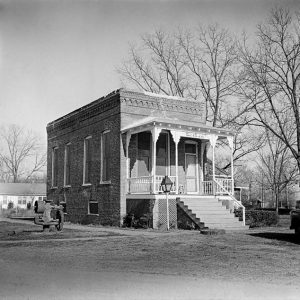
Two electoral efforts to move the county seat to McGehee failed, but court districts for Arkansas City and McGehee were formed in 1953, with a court building erected at McGehee in 1955. Completed in 2005 were a $1.8 million restoration of the historic courthouse at Arkansas City and a $2.2 million renovation of a vacant school as a courthouse annex.
Desha County residents are hoping that the proposed Interstate 69 and its Mississippi River crossing from Bolivar County, Mississippi, to a point one mile north of Arkansas City will stem population outflow. The interstate, an international route linking Mexico and Canada, would provide south Arkansas’s first east-west interstate and bring an estimated 24,000 vehicles daily through Desha County.
Chambers of Commerce in McGehee and Dumas now join in prioritizing educational enhancement and technology training to improve the economy. A geo-tourism effort is promoting hunting and fishing opportunities, and a Delta Heritage Initiative is focusing on historical and cultural tourism.
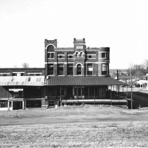
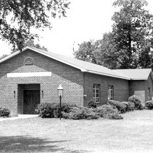
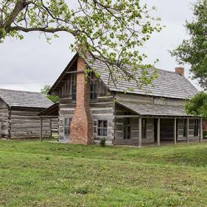
Multiple properties in the county are listed on the National Register of Historic Places, including the Hubert and Ionia Furr House, the Xenophon Overton Pindall Law Office, and Temple Meir Chayim.
For additional information:
Biographical and Historical Memoirs of Southeast Arkansas. Chicago: Goodspeed Publishing Company, 1890.
Bolsterli, Margaret Jones. During Wind and Rain: The Jones Family Farm in the Arkansas Delta, 1848–2006. Fayetteville: University of Arkansas Press, 2008.
Images from the Past: A Pictorial History of Desha County, Arkansas and Southeast Arkansas Delta. Marceline, MO: Heritage House, 1992.
Jackson, Nannie Stillwell. Vinegar Pie and Chicken Bread: A Woman’s Diary of Life in the Rural South, 1890–1891. Fayetteville: University of Arkansas Press, 1982.
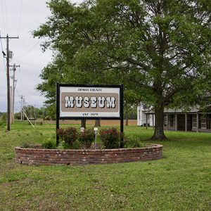
Programs of the Desha County Historical Society. McGehee: Desha County Historical Society (1974–).
Whayne, Jeannie M., and Willard B. Gatewood Jr., eds. The Arkansas Delta: Land of Paradox. Fayetteville: University of Arkansas Press, 1993.
Charlotte Tillar Schexnayder
Dumas, Arkansas
Revised 2022, David Sesser, Henderson State University


Comments
No comments on this entry yet.