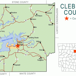
 Cleburne County Map
 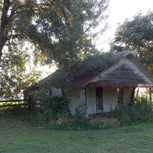 Prim Grocery Store
 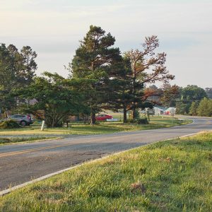 Prim Street Scene
501-918-3025
calsfoundation@cals.org
calsfoundation@cals.org
Prim is an unincorporated community located at the junction of Arkansas Highway 225 (Sunny Slope Road) and Highway 263 (Prim Road), nine miles north-northeast of the resort area of Greers Ferry (Cleburne County) and ten miles north-northwest of Heber Springs (Cleburne County), the county seat. Devil’s Fork, a tributary of the Little Red River, is at Prim, and Turkey Creek is to the north.
The Osage once lived in the area. In 1812, the year the Missouri Territory was carved from the Louisiana Territory, John Benedict and his wife, Rebecca Standlee Benedict, came from Kentucky—along with Rebecca’s three brothers—to settle in Arkansas. They cleared thirty acres of land and built two cabins on Little Red River below Devil’s Fork. The mother of the Standlee siblings was said to have been a Cherokee from North Carolina.
John Lindsey Lafferty, son of Izard County pioneer John Lafferty, bought most of the land in 1823 and became an important political figure in the area, helping organize Van Buren County in 1833. John Lindsey Lafferty continued to be a political force in the region over the next thirty years as county judge and state legislator.
By 1829, farmers had settled in what would become Prim. Only gradually did the region increase in population. The l840 census listed sixty families in the area that makes up most of present-day Cleburne County.
A pioneering family of Prim was the Everett family from Missouri, who moved to Arkansas during the Civil War. The family first made its home at Shiloh (Cleburne County), south of what would become Prim. Francis Monroe Everett, son of a German immigrant, married Martha Alice Hipp in 1888. Francis and Martha Everett moved with their family to what became known as Everett Ridge (today part of Prim), where the couple bought two log cabins in exchange for a pair of oxen and a wagon. Everett Cemetery is located on Everett Ridge.
The two cabins were most likely the first dwellings built in the Prim area. From her analysis of the one cabin still in existence, Dr. Linda Moss of the Black River Technical College in Pocahontas (Randolph County) stated that the cabins were built about 1829. There was a well, and there were outbuildings, including a potato house for drying, a storm cellar, and a corn crib. What is now known as the Everett-Short cabin was relocated to the Widner-Magers Farm Historic District north of Dell (Mississippi County) on April 16, 2010, donated by Dave and Shirley Short of Prim, the granddaughter of Francis and Martha Everett. Short’s father had used the cabin for a barn, and the building was in disrepair when the Short family decided to donate it to the Widner-Magers Farm.
The Prim Post Office was established in 1892 and is still active. The first postmaster was George Washington Prim, whose name was used for the community. Born in Tennessee, he first moved to Arkansas with his family in the 1850s, settling in Union Township of Independence County. He fought for the Confederacy during the Civil War, serving in the Second Arkansas Cavalry Regiment. After his return home, he married Malinda Catherine Painter. By the 1880 census, George and Malinda Prim were residing in what is now Mount Pleasant (Izard County). Before the post office was established, the census records used the name California (the name of the township) for the Prim community.
By 1915, the population of Prim had grown enough to support a baseball team, which was managed by James J. Hipp. The names of the players represent a cross-section of the families who settled in Prim—Lewellen, Dillard, Powell, Sloan, Allen, Hines, Stubbs, Evans, and Finch.
Prim is called the “home of the round rocks” due to geological formations in the area—large, spherical sandstone boulders commonly ranging in diameter from one foot to four feet. When the first settlers arrived, these rocks were viewed as impediments to farming, so most were relocated away from the plowed fields and stacked in piles. Denizens of the region have used them for decoration along driveways, near home entrances, and in front yards. Geologist Tom Freeman in 1964 was the first to perform a scientific study of the rocks. Studies are ongoing to provide a better understanding of their formation, distribution, and economic potential as decorative stones.
Prim is a popular rustic resort area today, featuring fishing, hunting, camping, and boating. Such getaway cabins as Longbow Resort (founded in 1992) appeal to those wanting to get back to nature. Prim has several businesses, including a convenience store/gas station, a grocery store, a pharmacy, a trucking company, an auto repair shop, a bus station, a photography shop, and restaurants. There are two Holiness churches in Prim and two Baptist churches in nearby Woodrow (Cleburne County). There are also campgrounds and a marina.
For additional information:
Barger, Carl J. Cleburne County and Its People. 2 Vols. Bloomington, IN: AuthorHouse, 2008.
Berry, Evalena. Time and the River: A Centennial History of Cleburne County. Little Rock: Rose Publishing Co., 1982.
Blevins, Brooks. Hill Folks: A History of Arkansas Ozarkers and Their Image. Chapel Hill: University of North Carolina Press, 2002.
Hanson, William D., and J. Michael Howard. “Spherical Boulders in North-Central Arkansas.” Arkansas Geological Commission Miscellaneous Publication 22. https://www.geology.arkansas.gov/docs/pdf/publication/miscellaneous_pubs/MP-22-Prim-Boulders.pdf (accessed October 19, 2020).
Kenneth Rorie
Van Buren, Arkansas


Comments
No comments on this entry yet.