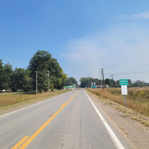
 Entering Hughes
 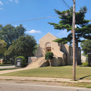 Hughes Church
 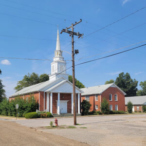 Hughes Church
 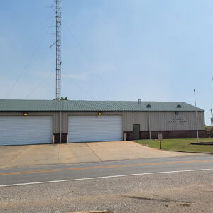 Hughes Fire Department
 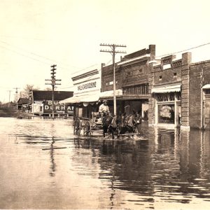 Hughes Flood
 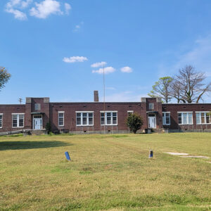 Hughes High School
 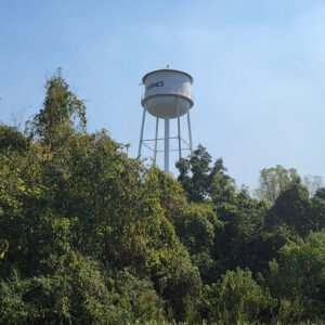 Hughes Municipal Water Tower
 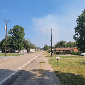 Hughes Street Scene
 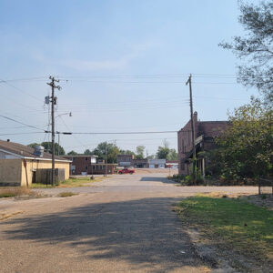 Hughes Street Scene
 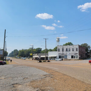 Hughes Street Scene
 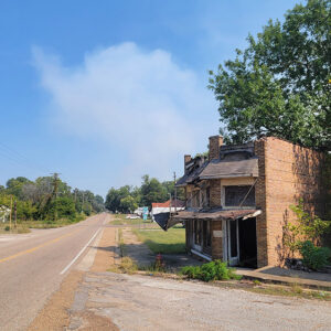 Hughes Street Scene
 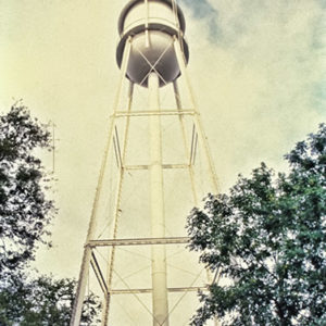 Hughes Water Tower
 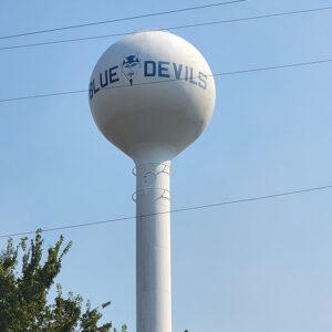 Hughes Water Tower
 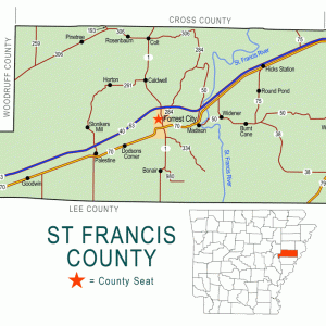 St. Francis County Map
501-918-3025
calsfoundation@cals.org
calsfoundation@cals.org
| Latitude and Longitude: | 34º56’57″N 090º28’17″W |
| Elevation: | 205 feet |
| Area: | 2.26 square miles (2020 Census) |
| Population: | 1,056 (2020 Census) |
| Incorporation Date: | June 12, 1916 |
Historical Population as per the U.S. Census:
|
1810 |
1820 |
1830 |
1840 |
1850 |
1860 |
1870 |
1880 |
1890 |
1900 |
|
– |
– |
– |
– |
– |
– |
– |
– |
– |
– |
|
1910 |
1920 |
1930 |
1940 |
1950 |
1960 |
1970 |
1980 |
1990 |
2000 |
|
451 |
815 |
1,004 |
1,686 |
1,960 |
1,872 |
– |
1,919 |
1,810 |
1,867 |
|
2010 |
2020 |
|
|||||||
|
1,441 |
1,056 |
|
Hughes is the second-largest town in St. Francis County. Located halfway between Mud Lake (St. Francis County) and Greasy Corner (St. Francis County), Hughes is part of Arkansas’s Delta region, near the Mississippi River, and a center of agricultural production.
Like most of the Arkansas Delta, the area that is now Hughes was populated by Native American tribes long before it was seen by European explorers and settlers. While St. Francis County does not have Indian Mounds as impressive as those at Parkin (Cross County) or the Toltec Mounds, archaeologists have studied significant structures and remains in the area since the nineteenth century.
In 1836, with the earlier opening of the Military Road in east Arkansas, white people settled the area. According to historians, farmers who were named Hughes lived near the present-day town in the early 1800s, including John J. Hughes, who farmed 1,000 acres, and Elijah C. Hughes, who farmed 2,000 acres. But the settlement was formally named for the family of Robert Hughes—no relation to John or Elijah—a native of Senatobia, Mississippi, who never moved to the town but who bought a farm in the area in 1907.
During the Civil War, there was troop movement through the area, but there were no battles, and by the late nineteenth century, the area around present-day Hughes was prime farmland that featured several large farms and plantations employing African-American laborers and sharecroppers. The primary crops of the region were cotton and corn. Additionally, crops such as strawberries, grapes, raspberries, and sweet potatoes were grown in the area during the nineteenth century.
The arrival of steamboats on the Mississippi River in the nineteenth century provided greater opportunity for these crops to be marketed, since the community was five miles west of the Mississippi River levee. Farmers of the area reaped the benefits of steamboat trade and travel at first, until the river moved away from the settlement in the late nineteenth and early twentieth centuries. Peters Island, less than five miles south of Hughes, had been in the Mississippi River (and is still part of the state of Mississippi), but today what was the main channel of the river is an oxbow lake named Midway Lake, doubling the distance between the river and Hughes.
In 1916, Hughes was incorporated as a result of the railroad. The Missouri-Pacific Railroad arrived in east Arkansas to survey a cutoff between Marianna (Lee County) and Memphis, Tennessee. The Marianna Cut-Off was located at Hughes, and the town’s population grew. Hughes was surveyed into lots and sold to settlers, who called the cutoff the “mud line” as it ran through town, separating the white from the black community. Throughout the twentieth century, the black population of Hughes outnumbered the white population, although most of the property was possessed by a few white families. By replacing the river traffic opportunities that had been lost, the railroad made it possible for Hughes to be the trading center of a rich agricultural area.
At this time, other large landowners donated land for business enterprises. A hotel and school were built on donated land, and by the 1920s, Hughes had stores, a postmaster, and permanent homes. The first brick building was built in 1916, and the first auto agency, the Hughes Motor Company, was founded by the Rolfe family in 1924. John J. Hughes organized the Bank of Hughes around 1919, but it failed in 1923, perhaps because of the rivalry of J. O. E. Beck, A. L. Waring, and Bert C. Pouncey. Their rival bank, Planter’s National, opened in 1920 and is still in business. There was even a tourist court where visitors to east Arkansas could stop and camp for a dollar a day.
Various religious denominations can be found in Hughes. The Methodists began with missionary work in 1907 and built their first brick church in 1918. The Baptists and Presbyterians built churches in Hughes by the 1920s. Today, Hughes is home to roughly a dozen Baptist congregations, two Methodist congregations, a Church of God in Christ, and a Kingdom Hall of the Jehovah’s Witnesses.
The Flood of 1927 devastated the Delta region, and Hughes was not spared its effects. The Red Cross cared for 4,000 refugees in Hughes who had been displaced by flood waters. Three years later, drought and the beginning of the Great Depression led to significant poverty and desperate need. Red Cross representatives visiting the workers of the farms near Hughes on Christmas Day found that few of the farm workers had sufficient food even to mark the holiday: of thirty-seven families visited, only six had received rations. None had coffee or butter, two had milk, and one had sugar.
In 1944, a prisoner of war branch work camp was established near Hughes. Housing approximately 250 prisoners from Germany, it provided workers for the area farms to replace those workers then serving in the American armed forces.
The heart of Hughes is its school complex, which was organized in 1920 through the sale of bonds. By 1954, there were two campuses—one for white students and one for black students. The campuses were integrated by the 1970s under the leadership of Superintendent Roy Stobaugh. The school district is the second largest in the county. In April 2015, the state Board of Education ordered the district’s consolidation with West Memphis (Crittenden County); the district filed a lawsuit later that month challenging the decision.
Agriculture plays a large part in the county’s history. By the twentieth century, harvests near Hughes included cotton, soybeans, corn, rice, fruit, and timber. Agriculture is still at the forefront of the Hughes economy with the harvesting of large soybean crops and mechanized farming. Because Hughes is less than thirty miles from Memphis, many residents travel to the larger city for weekend entertainment. The Hughes Water Tower is listed on the National Register of Historical Places, and Eddie Reed, a cancer researcher inducted into the Arkansas Black Hall of Fame, was raised on a farm near Hughes.
For additional information:
Biographical and Historical Memoirs of Eastern Arkansas: Arkansas, Crittenden, Cross, Lee, Monroe, Phillips, Prairie, St. Francis, White, and Woodruff Counties. Chicago: Goodspeed Publishing Company, 1890.
Chowning, Robert W. History of St. Francis County, Arkansas, 1954: A Narrative Historical Edition Preserving the Record of the Growth and Development of St. Francis County, Arkansas, and Chronicling the Genealogical and Memorial Records of its Prominent Families and Personages. Forrest City, AR: Times-Herald Publishing Company, 1954.
Lea Flowers Baker
Little Rock Central High School National Historic Site
Staff of the CALS Encyclopedia of Arkansas


My hometown.