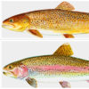
 Salmonids
 World War II through the Faubus Era, 1941 through 1967
501-918-3025
calsfoundation@cals.org
calsfoundation@cals.org
Although Table Rock Lake lies mostly in the Ozark Mountains of Missouri, it plays an important role in water resource development for the White River basin, most of which lies in Arkansas. Its dam and reservoir are part of a flood-control system designed to reduce flooding in Arkansas’s Delta and the Mississippi drainage. Its hydroelectric power supplies electricity that the Southwest Power Administration sells to municipalities and rural cooperatives across northern Arkansas, southern Missouri, and several adjoining states. Recreational development resulting from the lake contributes to the economies of both Missouri and Arkansas.
Table Rock Dam is located at river mile 528.8 on the White River about eight miles southwest of Branson, Missouri. The lake extends westerly from the dam before turning south to Beaver Dam in Arkansas at river mile 609.0. Table Rock was the third U.S. Army Corps of Engineers multi-purpose, high-head dam project to be built on the White River, following the construction of Norfork and Bull Shoals dams. Table Rock and Beaver reservoirs are supplemental flood-control projects to Bull Shoals Reservoir, the downstream control point for releases from Beaver and Table Rock. At the top of its flood pool, Table Rock Lake has a shoreline of about 850 miles and extends over 52,300 surface acres in Taney, Stone, and Barry counties in Missouri. In Arkansas, this shoreline includes the White River from Beaver Dam to the Missouri line and the Kings River and Long Creek arms in Carroll and Boone counties, respectively.
Congress authorized Table Rock Dam in the Flood Control Act of 1941, but construction was delayed by World War II, the Korean War, and the building of Bull Shoals Dam. The Little Rock District of the Corps of Engineers began work in October 1954. The project’s name comes from a large rock outcrop in Missouri, a well-known tourist landmark in the early 1900s. The “Table Rock” is a scenic overlook above Lake Taneycomo on State Highway 165 about three miles east of Table Rock Dam.
A combination concrete gravity dam and earthen embankment, the dam’s concrete section is 1,602 feet long and contains 1.23 million cubic yards of concrete. A 531-foot-long spillway section has ten crest gates for control of overflow. The earthen embankment section of the dam is 4,821 feet long and contains 3.32 million cubic yards of fill. The dam was completed in August 1958, and power production was online in May 1959 with two generating units. Two additional generating units were completed in April and June 1961. Overall construction cost was approximately $65.42 million. An auxiliary spillway to the dam with eight more crest gates was constructed in 2005 after the Corps determined spillway capacity was not sufficient during a worst-case flood event. Congress approved construction of the new auxiliary spillway at a cost of approximately $65 million.
The Corps maintains fourteen campground facilities around the lake, with one of those parks in Arkansas (Cricket Creek) on the Long Creek Arm. It also has lease agreements with fifteen commercial marinas, which generate $36 million annually in tourist revenue.
The Branson area now sees 5.5 million visitors per year and boasts 100 resorts and many outdoor-related tourism businesses, which complement other area attractions. The cold water below the dam supplies Shepherd of the Hills Trout Hatchery, operated by the Missouri Department of Conservation, and provides for a tailwater trout fishery in upper Lake Taneycomo. (Lake Taneycomo was built in 1913, and a fishing tourism industry arose around Branson in the decades thereafter, especially after promoter Jim Owen’s float trips from Forsyth, Missouri, to the Baxter County city of Cotter were featured in the June 23, 1941, edition of Life magazine.) This hatchery also brings dollars to the economy of northern Arkansas. A Class A (regional) visitor center at the Corps project office adjacent to the dam, the $10.8 million Dewey Short Visitor Center, opened on April 27, 2012, and highlights the White River system and its impact upon both Missouri and Arkansas.
Table Rock powerhouse remotely controls powerhouse generation at Beaver Dam. Database systems are being upgraded, and the Table Rock facility will eventually control power plants at Bull Shoals, Norfork, and Greers Ferry dams as well. No water districts utilize water from the reservoir; however, this is expected to change in years to come. The Missouri Department of Conservation does draw a water allocation for the fish hatchery located below the dam.
Floods in 2008 and 2011 established a record lake level and record spillway releases. Part of the skin of the earthen embankment near the concrete portion of the dam gave way after flooding in the spring of 2011 but was immediately repaired at a cost of approximately $250,000 to prevent further erosion to the dam. While the flooding caused damage to the Missouri communities of Branson, Hollister, and Forsyth, the Corps asserts that the lakes and levees on the White River system have prevented, over the life of the projects as of 2011, more than $1 billion in flood losses. From October 2010 through June 2011, flood damage prevented by the White River projects was estimated at $100 million, double what was prevented in the entire previous year.
For additional information:
Clay, Floyd M. A History of the Little Rock District, U.S. Army Corps of Engineers, 1881–1979. 2nd ed. Little Rock: Dept. of the Army, Corps of Engineers, Little Rock District, 1979.
Rathbun, Mary Yeater. Castle on the Rock, 1881–1985: The History of the Little Rock District, U.S. Army Corps of Engineers. Little Rock: U.S. Army Engineer District, Little Rock, 1990.
“Table Rock Lake.” U.S. Army Corps of Engineers, Little Rock District. https://www.swl.usace.army.mil/Missions/Recreation/Lakes/Table-Rock-Lake/ (accessed February 5, 2024).
Scott Branyan
Rogers, Arkansas


Comments
No comments on this entry yet.