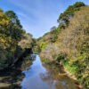
 Antoine River
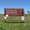 Arkansas System of Natural Areas
 Endemic Biota
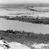 Geography and Geology
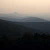 Ouachita National Recreation Trail
 Silver Mining
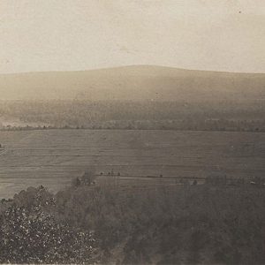 Charleston Area
  Daisy State Park
 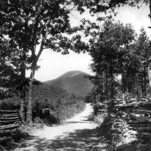 Eagle Mountain
 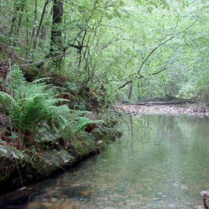 Gap Creek Natural Area
 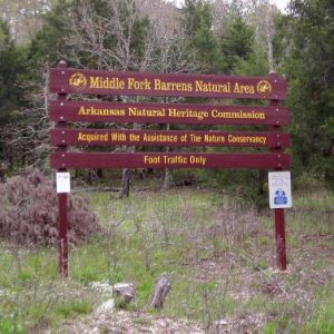 Middle Fork Barrens Natural Area
 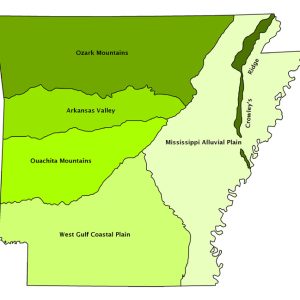 Natural Divisions Map
 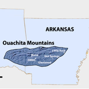 Ouachita Mountains Biological Station
  Ouachita Mountains Road
  Saline River
501-918-3025
calsfoundation@cals.org
calsfoundation@cals.org
The Ouachita Mountains, one of the six natural divisions of Arkansas, are generally characterized as folded ridges and valleys composed of Paleozoic rocks. They are unusual in North America in that the ridges are generally aligned east to west, unlike the Rocky Mountains or Appalachian Mountains, where the ridges usually run north to south. The most striking result of this orientation is that there is an extensive south-facing slope on each ridge that is exposed to the heat and light of the sun, as well as a north-facing slope that is protected from direct solar radiation and is consequently cooler and moister. The dry south-facing slopes are often covered with pine forests or woodlands, or even drier oak woodlands, while the moister north-facing slopes are covered with diverse hardwood forests. This results in distinct east-to-west bands of vegetation that can be seen from an airplane or by satellite. The bands usually shift repeatedly from pine forest to hardwoods and back, moving from north to south. This is particularly apparent in the winter when the green color of evergreen pines contrasts dramatically with the brown of the leafless deciduous hardwoods.
Alternating layers of sandstone and shale are the dominant rocks underlying the Ouachitas. They are usually tilted, with erosion-resistant layers of sandstone forming the crest and one slope of a ridge. Rocks of other types are less extensive than in the Ozark Mountains, where limestone and dolomite underlie large areas.
Hot Springs (Garland County) is the largest city in the Ouachita Mountains, and the western part of Little Rock (Pulaski County) is in this natural division. Much of the Ouachitas is still forested, and a substantial portion is within the boundaries of the Ouachita National Forest, which covers almost half the total area.
Fourche Mountains
Distinctive subdivisions of the Ouachitas share the general characteristics of the natural division as a whole but differ from each other in sometimes subtle, but important, ways. The northernmost subdivision is known as the Fourche Mountains, in many ways the most characteristic of the Ouachitas subdivisions. The ridges of the Fourche Mountains are often very long; the most prominent of these extends from near Waldron (Scott County) to near Searcy (White County), with only a few breaks. It is known by several names, including Dutch Creek Mountain, Danville Mountain, Ola Mountain, Perry Mountain, Tom’s Mountain, and Cadron Ridge. Cadron Ridge, even though it is a part of the same fault and ridge system as these other named mountains, is on the other side of the Arkansas River. It is the notable ridge crossed by Highway 65 just northeast of its intersection with Interstate 40 at Conway (Faulkner County). It illustrates the remarkable fact that the Arkansas River actually cuts through the eastern portion of the Ouachita Mountains. This can also be seen in Little Rock, where the ridges that make up the Heights neighborhood and Cammack Village (Pulaski County) continue to the opposite side of the Arkansas River at Big Rock and, from there, eastward to the Park Hill and Lakewood neighborhoods of North Little Rock (Pulaski County). Indeed, the “Little Rock” itself, named “La Petit Roche” by the earliest French explorers, is an outcrop of shale typical of the Fourche Mountains.
As the highest mountains in the Ouachitas, Rich Mountain and Blackfork Mountain are typical Fourche Mountain ridges. Since they are very tall and extend in an east-west direction, they actually affect the climate of western Arkansas. Moist south winds from the Gulf of Mexico are forced to rise as they cross these ridges, a process known as orographic lifting. In doing so, the air is cooled, and the moisture condenses as clouds, fog, or rain. Therefore, these mountains have higher rainfall than the surrounding areas of lower topography. In particular, the much lower elevations of the Arkansas River Valley to the north are drier than they would be otherwise, since they lie in the “rain shadow” of these mountains. In contrast, forest communities of the upper north-facing slopes of the mountains may be lush and moist, while forests right on the ridge tops may be stunted by frost, fog, and wind, with trees often no higher than twenty feet tall. In 1819, British traveler Thomas Nuttall crossed these ridges and commented on the stunted forest.
Small streams of the Fourche Mountains plunge rapidly down the slopes of the ridges and then join large streams and rivers that run the length of the valleys between the ridges. The Fourche La Fave River is by far the largest, but others, such as Maumelle River, are substantial as well. South Fourche River cuts across a major ridge just before it enters the Fourche La Fave. In doing so, it abandoned a channel that it formerly occupied high on the mountainside. This channel is now a unique wetland fed by local drainage and is protected as the South Fourche Botanical Area of the Ouachita National Forest.
Rolling valleys of the Fourche Mountains subdivision are wide, and have often been cleared for cropland or converted to pasture. Human population is dispersed through the rural landscape, and towns are generally small, such as Needmore (Scott County), Aplin (Perry County), and Houston (Perry County). The largest cities are Perryville (Perry County) and Plainview (Yell County).
Central Ouachita Mountains
The Central Ouachita Mountains region, sometimes called the Novaculite Uplift, is the most diverse subdivision of the Ouachitas. It stretches from near Oklahoma to Little Rock and is widest (north to south) near the middle, west of Hot Springs, narrowing both to the east and west. Although high ridges are typical in the Central Ouachitas, they are neither as long nor as consistently east-west in orientation as the ridges of the Fourche Mountains. They also tend to be clustered into distinct mountain ranges, such as the Cross Mountains, the Cossatot Mountains, or the aptly named Zigzag Mountains near Hot Springs. The perimeter of the subdivision is bounded by outcrops of novaculite, a silica-based rock that is very hard and flint-like. The Ouachitas are also world-renowned for the quality and quantity of their crystal, formed as silica precipitated out of solution in hot water seeping through fissures in the surrounding rock.
Outcrops of novaculite, high on the Central Ouachita ridges, form glades or rocky openings dominated by grasses, flowers, and shrubs. Such glades can also occur on outcrops of sandstone or shale, which formed from sand (sandstone) or clay (shale), compressed and sometimes cemented by iron in the seawater they were deposited in hundreds of millions of years ago.
Rugged mountain ranges are usually forested, and much of their area is included in the Ouachita National Forest, while wide basins, particularly the one along the Ouachita River, have been cleared for cropland and pasture. The Ouachita rises within and drains the Central Ouachitas. The largest cities of the Central Ouachitas subdivision are Hot Springs and Mena (Polk County), and they are the largest cities of the Ouachita Mountains as a whole. Other smaller cities and towns include Mount Ida (Montgomery County), Glenwood (Pike County), Jessieville (Garland County), and Caddo Gap (Montgomery County). The western portion of Little Rock is in the subdivision. While several of these are in the basins, part of Hot Springs is sited within the mountains because of the proximity of the hot springs.
Athens Plateau
The Athens Plateau is the southernmost subdivision of the Ouachita Mountains. Although its topography is characterized by east-west ridges like most of the Ouachitas, the maximum elevations are under 1,000 feet. Despite the name, it is not a flat-topped plateau like those of the Ozarks. Rather, it has been proposed that the entire set of ridges and valleys was lowered and raised as a unit after the ridges had formed. According to that scenario, the region was lowered below sea level, and it rose again as a plain with the valleys filled with sediment, with a north-to-south gradient.
Streams such as the Cossatot River and Little Missouri River ran from north to south and crossed the ridges in their paths. At each crossing, they created a steep rapids or waterfall and emptied the valleys of their sediments. As a result, these streams have a much different character than those of the Ozarks, making them very challenging for white-water canoes and kayaks. The most notable waterfalls are typically at the final ridge crossing before the streams leave the Athens Plateau and enter the Coastal Plain. Because of the waterfalls, this boundary has sometimes been referred to as the “Fall Line.” It has proven to be a prime location for dams that impound reservoirs built by the U.S. Army Corps of Engineers, and today every major stream has been dammed to create lakes, such as Lake Greeson in Pike County and De Gray Lake in Clark County.
Cities of the Athens Plateau—such as Bismarck (Hot Spring County), Wickes (Polk County), and Amity (Clark County)—are generally small, with fewer than 1,000 residents. However, larger cities are located along the boundaries of the subdivision, including Arkadelphia (Clark County), Murfreesboro (Pike County), De Queen (Sevier County), and Glenwood. Most of these cities owe much of their economy to the timber produced from within the Athens Plateau. The subdivision is still dominantly forested, with much of it owned by the timber industry and managed intensively for timber production.
Contrast with the Ozark Mountains
The Ouachita Mountains Natural Division is, along with the Ozark Mountains Natural Division, one of the two mountainous regions of the state. The Ouachitas are characterized by ridges and valleys oriented in generally an east-west direction, while the Ozarks are characterized by flat-topped plateaus. Streams of the Ouachitas generally run along the wide valleys created by the folding processes that created the mountains, while streams of the Ozarks found their way along subtle cracks and topographic low areas. In the process, they created their own valleys that are more dendritic, or tree-branched, than the streams of the Ouachitas. The rocks of the Ouachitas are even more dominated by sandstone than those of the Ozarks, and pine forest is more dominant, generally on the south-facing slopes of the ridges. As a result of the greater prominence of economically valuable pine in the Ouachitas, the timber industry is more important there than in the Ozarks.
For additional information:
Berry, Trey, Pam Beasley, and Jeanne Clements, eds. The Forgotten Expedition: The Louisiana Purchase Journals of Dunbar and Hunter, 1804–1805. Baton Rouge: Louisiana State University Press, 2006.
Foti, Thomas. The Natural Divisions of Arkansas, A Classroom Guide. Little Rock: Arkansas Ecology Center, 1978.
Foti, Thomas, and Gerald Hanson. Arkansas and the Land. Fayetteville: University of Arkansas Press, 1992.
Nuttall, Thomas. A Journal of Travels into the Arkansas Territory During the Year 1819. Edited by Savoie Lottinville. Norman: University of Oklahoma, 1980.
Smith, Kenneth L. Sawmill: The Story of Cutting the Last Great Virgin Forest East of the Rockies. Fayetteville: University of Arkansas Press, 1986.
Trubitt, Mary Beth. Ouachita Mountains Archeology. Fayetteville: Arkansas Archeological Survey, 2019.
Thomas Foti
Arkansas Natural Heritage Commission


This is a wonderfully written article about a unique geologic region. It is so full of details. I believe I saw this part of the country last year on a flight from North Carolina and somehow deduced we were over Arkansas. When I saw the magnificent long, long ridges extending north and south, I wondered about the formation of this unique topography. After reading this, I have a much better idea now, and that I really did see something unique from the air.