 Arkansas System of Natural Areas
 Back-to-the-Land Movement
 Beaver Dam and Lake
 Endemic Biota
 Environment
 Funeral Customs, Traditional (Ozark Mountains)
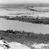 Geography and Geology
 North Fork River
 Ozark English
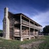 Ozark Vernacular Architecture
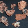 Rocks and Minerals
 Salmonids
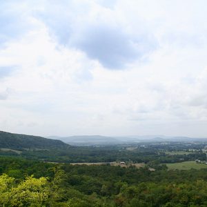 Boston Mountains
 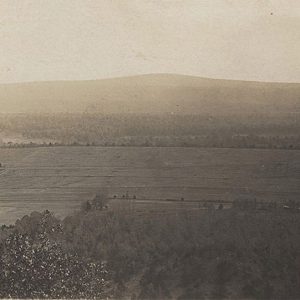 Charleston Area
 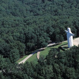 Christ of the Ozarks
 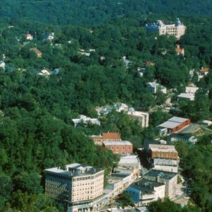 Eureka Springs Aerial View
 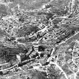 Eureka Springs Aerial View
 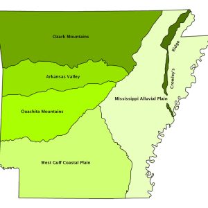 Natural Divisions Map
  Ozark Plateau Map
  Syllamo Mountain Bike Trail
 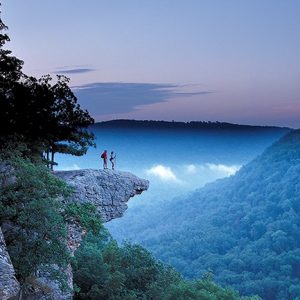 Whitaker Point
501-918-3025
calsfoundation@cals.org
calsfoundation@cals.org
The Ozark Mountains (a.k.a. the Ozark Plateau or Plateaus), representing one of the six natural divisions of Arkansas, are generally characterized as uplifted level plateaus composed of Paleozoic rocks. Streams have cut valleys into these plateaus, and, in some cases, the plateau surface is only visible as the flat tops of the mountains at similar elevations. The three distinct plateaus differ in topography, geology, vegetation, as well as inhabitants’ land use, history, and culture.
Boston Plateau
At up to 2,600 feet, the Boston Plateau, usually referred to as the Boston Mountains because of its ruggedness, is the highest of the Ozark Mountains. It extends as a belt across the southernmost Ozarks, generally parallel to and to the north of Interstate 40. Typical rock types are sandstone and shale. Although the elevation of the mountains is similar, the highest are in and near Newton County. The elevation there causes higher precipitation and lower temperatures than elsewhere in the Ozarks. Streams are generally small, and the headwaters of many of the well-known rivers of the Ozarks occur in the Boston Mountains, including the White, Buffalo, Kings, Mulberry, Big Piney, and Little Red rivers.
In most areas of the Boston Mountains, oak and hickory forests predominate, while warm, south-facing slopes on sandstone have extensive areas dominated by shortleaf pines. The cool, moist conditions of protected ravines, particularly in the highest mountains, support forests with beech or sugar maple that are of limited extent elsewhere in the Ozarks.
The ruggedness of the Boston Plateau has limited people’s ability to develop the region for agriculture, transportation, urbanization, or other uses. Croplands and pastures are concentrated in wider valleys or on level mountaintops. Towns are few and generally small, including Mountainburg (Crawford County), Deer (Newton County), and Shirley (Van Buren County). Clinton (Van Buren County), located in the wide valley of the Little Red River, is the largest city within the region. Roads typically are narrow, winding, and steep. The Butterfield Overland Mail Company route once crossed the region from Fayetteville (Washington County) to Fort Smith (Sebastian County), but this segment was notoriously difficult. The first-hand account of the initial journey by a correspondent to the New York Herald described it as “the much-dreaded Ozark range, including the Boston Mountains. I had thought before we reached this point that the rough roads of Missouri and Arkansas could not be equalled [sic]; but here Arkansas fairly beats itself.”
The Boston Mountains probably best typify the view of the Ozarks as rugged and beautiful but with little potential for economic development. Poor transportation and limited economy fostered the isolated, self-sufficient mountaineer lifestyle often associated with the Ozarks.
Much of the Boston Mountain region is forested today, with a large part of the area in the Ozark National Forest. Highways, such as Hwy. 23 in Franklin and Madison counties and Hwy. 7 in Pope and Newton counties, still follow their traditional winding routes. They are, however, renowned for their scenic vistas. Only Hwy. 65 in Van Buren and Searcy counties has been substantially widened and straightened. Interstate 49, from Interstate 40 in Crawford County to Washington and Benton counties, stands alone as a modern expressway crossing the region on an entirely new and direct alignment.
Springfield Plateau
The Springfield Plateau, adjacent to and north of the Boston Plateau, is usually abruptly lower. In many areas, the plateau surface, at an elevation of about 1,800 feet, forms extensive plains. Hilly areas occur where rivers and their tributaries cut into the plateau surface, most notably in the vicinity of the White River. Also, as streams like the Buffalo National River cut through the plateau down to the level of the White River, they sometimes carve spectacular bluffs.
The Springfield Plateau is underlain by limestone and chert, a flint-like rock. Since limestone is easily dissolved by water, cave and solution (karst) features are prominent. Surface water may drain directly into channels in limestone, where it can move rapidly and without filtration to the surface as a spring, at a location that is unpredictable without extensive testing. Therefore, water pollution problems are of particular concern in this region. In addition, both caves and the small streams fed by springs known as spring runs support aquatic species vulnerable to extinction.
South-facing, cherty slopes are occupied by shortleaf pine and hardwood forests, while hills and mountains underlain by limestone are often occupied by hardwood forests. Rocky, open glades with exposed limestone or chert are extensive and common. Prairies on level plateau surfaces with thin soils were extensive, but almost all have been converted to pasture, cities, and other developed areas. The most extensive prairies extended from Fayetteville to Rogers (Benton County), and also near Harrison (Boone County). These areas have experienced considerable urban growth.
With its extensive, fairly level areas, often blanketed with prairie that was easy to till, the Springfield Plateau was much easier to develop for transportation, agriculture, and urban centers than the Boston Mountains. Because it combines the scenery and quality of life of the Ozark Mountains with relatively level topography that can be readily developed, the Springfield Plateau has become a growth center, of significance not only in Arkansas but regionally and nationally as well. That growth has occurred in spite of barriers to transportation that have now been addressed by an interstate highway and a regional airport.
Salem Plateau
The Salem Plateau, north and east of the Springfield Plateau, is separated from it by an abrupt drop. The abrupt change in elevation is apparent at Eureka Springs (Carroll County), where its location on the boundary of the two plateaus gives it its mountainous character. Like the Springfield Plateau, the Salem Plateau, at an elevation of about 1,500 feet, often forms extensive plains, as at Berryville (Carroll County). Several distinct areas of hills have been cut into the plateau by rivers, most prominently along the White River and its tributaries. Other extensive hills have been cut by the Spring and Strawberry rivers. The Salem Plateau is often underlain by dolomite or dolostone, similar to limestone. Although dolostone is not dissolved by water as readily as limestone, caves are present, as well as large springs such as the one at Mammoth Spring (Fulton County).
The plateau surface and level hilltops have rocky soil originally covered with oak forests, open oak woodlands, and open rocky glades. Large areas were described in the nineteenth century as “barrens,” implying exposed rock and thin soil, with limited herbaceous and woody plant cover. Near Berryville were several prairies that surrounded low hills with forested sides and prairie on the tops, known as “bald knobs.”
The Salem Plateau had few areas easily adapted to agriculture, such as areas of deep alluvial soil or prairie. However, beginning in the late nineteenth century and extending through the twentieth century, recreational development became increasingly important. In the late nineteenth century, Eureka Springs developed along the Missouri and North Arkansas Railroad as a tourist destination known for “healing springs.” Although the railroad eventually failed, Eureka Springs has remained a tourist destination into the twenty-first century.
Bull Shoals and Norfork lakes, created by U.S. Army Corps of Engineers’ dams on the White River and its tributary Norfork River, became significant outdoor recreation attractions. (The same may be said for Beaver Lake in the Springfield Plateau.) The once sleepy little community of Mountain Home (Baxter County), located between the two reservoirs with easy access to both, has become the largest city in the region. Cold water released from the reservoirs into rivers below the dams damaged the native aquatic ecosystem, and, as mitigation, the Corps built hatcheries to stock trout as an alternative. This has also become a major outdoor recreation attraction, and White River trout fishing has become world famous. Flippin (Marion County), Cotter (Baxter County), and, to some extent, Calico Rock (Izard County) have benefited from recreational use of the White River. Hardy (Sharp County) and Mammoth Spring have become thriving communities in large part based on tourism associated with the Spring River and the Mammoth Spring at its source. Nearby Cherokee Village (Sharp County), also one of the largest communities in the region, is a retirement/recreation center.
The most extensive land use and most important agricultural endeavor in the region is beef cattle pasturage. As with the Springfield Plateau, commercial timber production is limited, although small hardwood lumber mills are common, and charcoal is produced from hardwood in Yellville (Marion County).
For additional information:
Blevins, Brooks. A History of the Ozarks. 3 vols. Champaign: University of Illinois Press, 2018–2020.
———. Up South in the Ozarks: Dispatches from the Margins. Fayetteville: University of Arkansas Press, 2022.
Foti, Thomas, and Gerald Hansen. Arkansas and the Land. Fayetteville: University of Arkansas Press, 1992.
Kersen, Thomas. Where Misfits Fit: Counterculture and Influence in the Ozarks. Jackson: University Press of Mississippi, 2021.
Rafferty, Milton D. The Ozarks, Land and Life. Norman: University of Oklahoma Press, 1980.
Smith, Kenneth L. Buffalo River Handbook. Little Rock: Ozark Society Foundation, 2004.
Woods, A. J., et al. “Ecoregions of Arkansas.” Reston, VA: U.S. Geological Survey, 2004.
Thomas Foti
Arkansas Natural Heritage Commission


Excellent introduction to the geography of the beautiful natural state of Arkansas and all those who desire to learn more and help promote, maintain, and preserve Arkansas’s attributes.